Perry-Castañeda Library
Map Collection
Nebraska Maps
State Maps
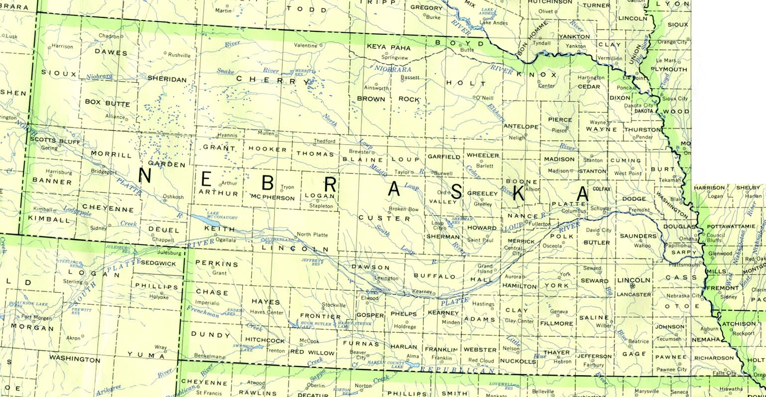
- Nebraska (base map) JPEG format (231K) County boundaries and names, county seats, rivers. Original scale 1:2,500,000 U.S. Geological Survey, 1972 limited update 1990
- Nebraska (outline map) JPEG format (94K) County boundaries and names. U.S. Bureau of the Census, 1990
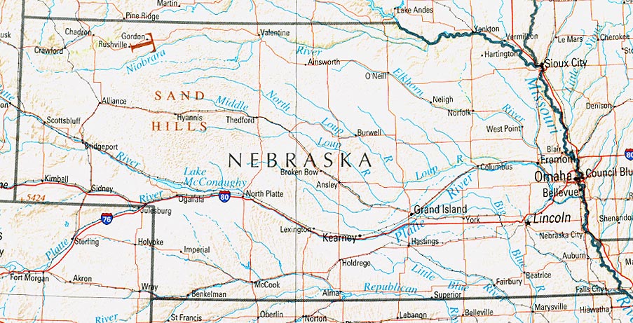
- Nebraska (reference map) JPEG format (190K) Shaded relief map with state boundaries, forest cover, place names, major highways. Portion of "The National Atlas of the United States of America. General Reference", compiled by U.S. Geological Survey 2001, printed 2002
- Nebraska (reference map) PDF format (193K) Shaded relief map with state boundaries, forest cover, place names, major highways. Portion of "The National Atlas of the United States of America. General Reference", compiled by U.S. Geological Survey 2001, printed 2002
- Nebraska - Federal Lands and Indian Reservations PDF format (502K) The National Atlas of the United States of America, U.S. Geological Survey, 2003
Historical City Maps
- Lincoln 1901 "Skimming Stations of the Beatrice Creamery Co. of Lincoln, Neb." From Report of the Industrial Commission on the Distribution of Farm Products. Volume VI of the Commission's Reports. House of Representatives, 1901. (508K)
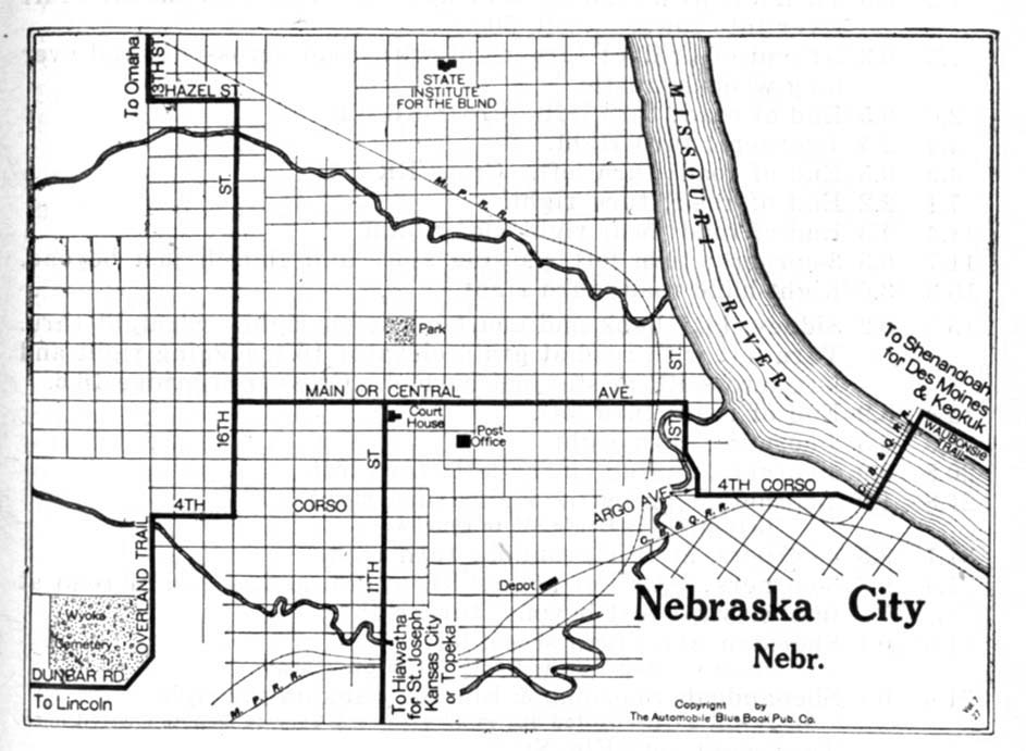
- Nebraska City 1920 Automobile Blue Book, 1920, Vol. 5 (128K)
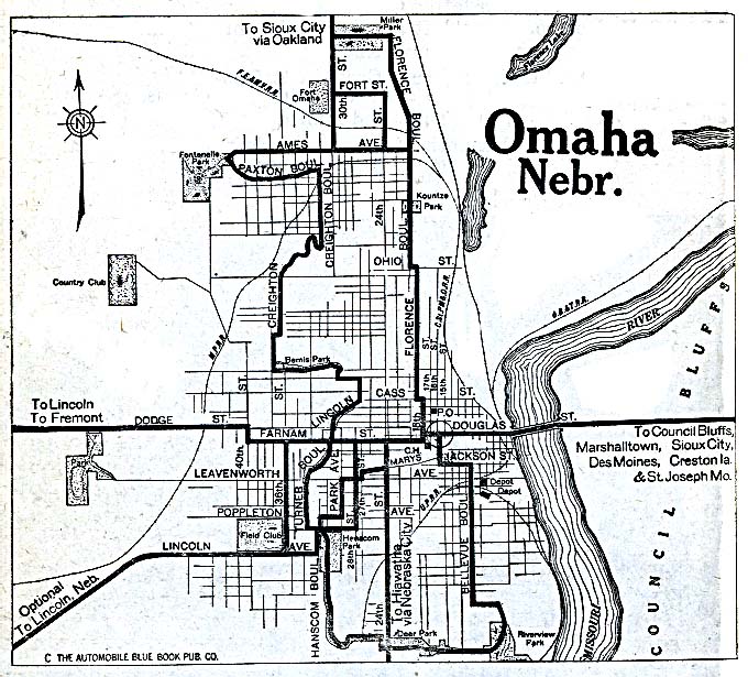
- Omaha 1920 Automobile Blue Book (162K)
Historical Topographic Maps
- Nebraska Historical Topographic Maps (U.S. Geological Survey)
- Pre-1945 historical maps, scales include 1:62,500, 1:125,000.
Maps of National Parks, Monuments, and Historic Sites
The following maps were produced by the U.S. National Park Service unless otherwise noted.
- Agate Fossil Beds National Monument (Park Map) 1996 (65K) (PDF Format)
- Chimney Rock National Historic Site (Park Map) 1999 (65K) (PDF Format)
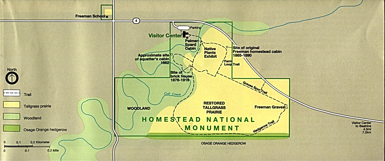
- Homestead National Monument of America (Park Map) 1995 (187K)
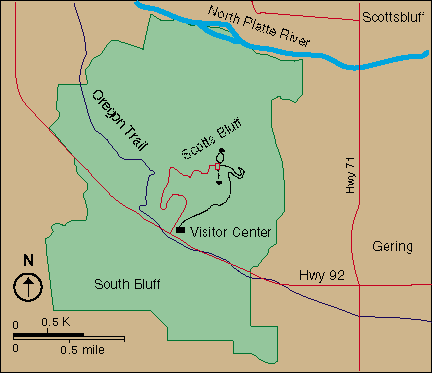
- Scotts Bluff National Monument (Area Map) (65K)
Maps on Other Web Sites