Perry-Castañeda Library
Map Collection
Maine Maps
State and Regional Maps
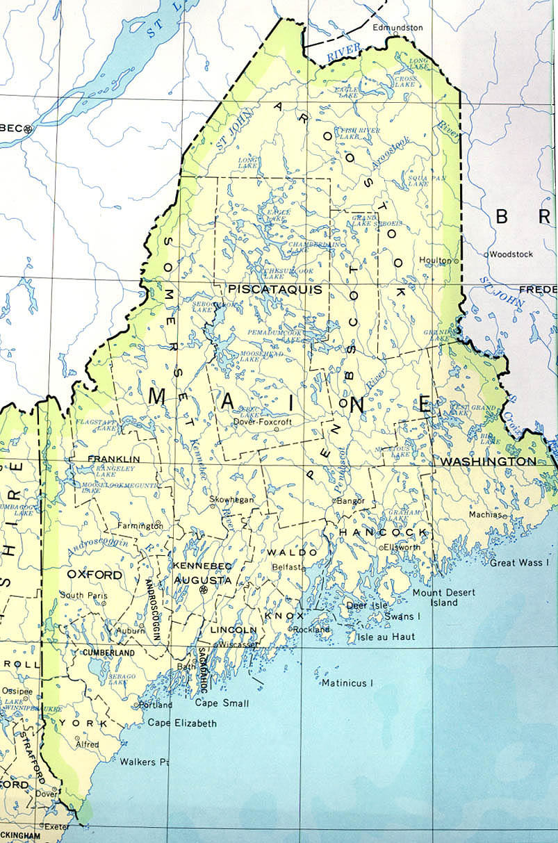
- Maine (base map) JPEG format (261K) County boundaries and names, county seats, rivers. Original scale 1:2,500,000 U.S. Geological Survey, 1972 limited update 1990
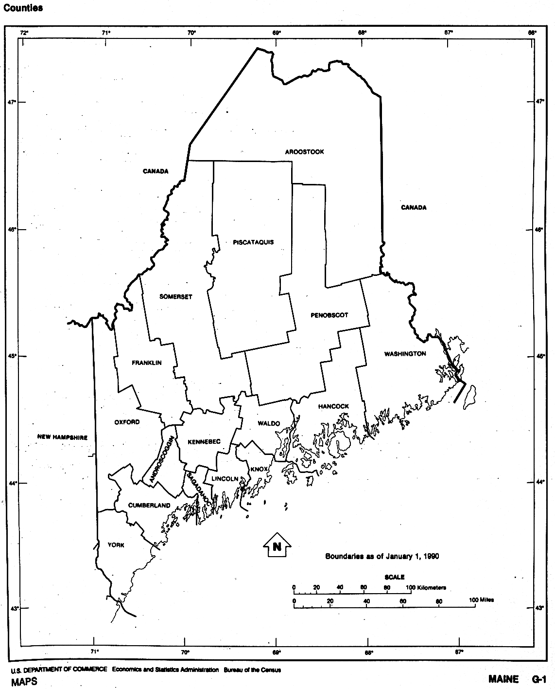
- Maine (outline map) JPEG format (72K) County boundaries and names. U.S. Bureau of the Census, 1990
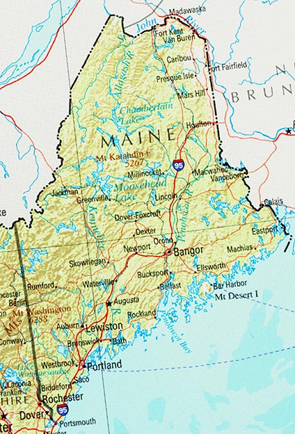
- Maine (reference map) JPEG format (134K) Shaded relief map with state boundaries, forest cover, place names, major highways. Portion of "The National Atlas of the United States of America. General Reference", compiled by U.S. Geological Survey 2001, printed 2002
- Maine (reference map) PDF format (136K) Shaded relief map with state boundaries, forest cover, place names, major highways. Portion of "The National Atlas of the United States of America. General Reference", compiled by U.S. Geological Survey 2001, printed 2002
- Maine - Federal Lands and Indian Reservations PDF format (808K) The National Atlas of the United States of America, U.S. Geological Survey, 2003 U.S.G.S. 1972 limited update 1990 (261K)
- New England (reference map) JPEG format (385K) Shaded relief map with state boundaries, forest cover, place names, major highways. Portion of "The National Atlas of the United States of America. General Reference", compiled by U.S. Geological Survey 2001, printed 2002
- New England (reference map) PDF format (388K) Shaded relief map with state boundaries, forest cover, place names, major highways. Portion of "The National Atlas of the United States of America. General Reference", compiled by U.S. Geological Survey 2001, printed 2002
City Maps
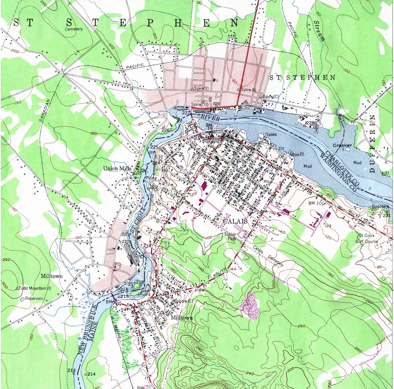
- Calais, Maine and St. Stephen, New Brunswick (topographic) original scale 1:24,000 U.S.G.S. 1949, photorevised 1977 (553K)
Historical Topographic Maps
- Maine Historical Topographic Maps (U.S. Geological Survey)
- Pre-1945 Maps, Scales 1:125,000 and 1:62,500
Maps of National Parks, Monuments, and Historic Sites
The following maps were produced by the U.S. National Park Service unless otherwise noted.
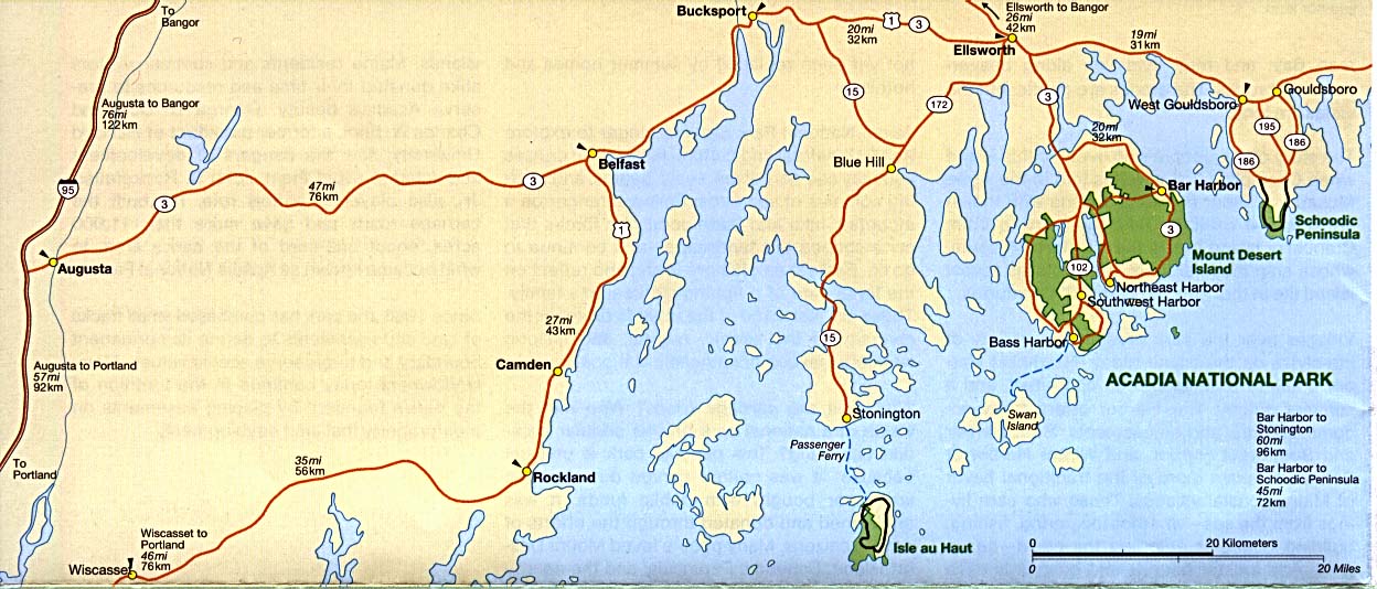
- Acadia National Park (Area Map) 1995 (159K)
- Acadia National Park (Park and Detail Maps) 1997 (1.1 MB) (PDF Format)
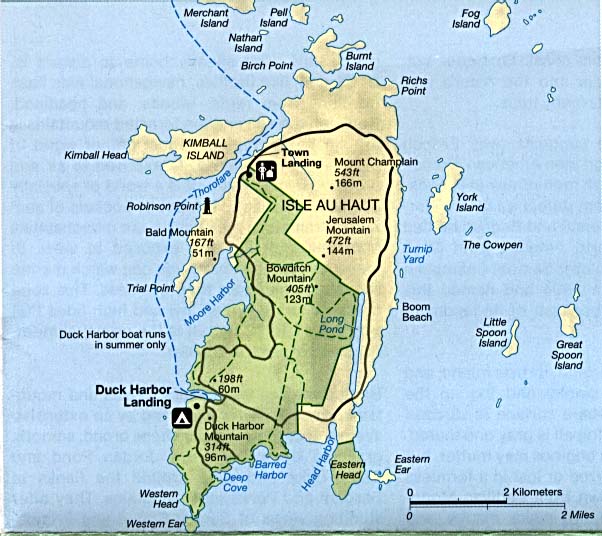
- Acadia National Park - Isle au Haut (Detail Map) 1995 (74K)
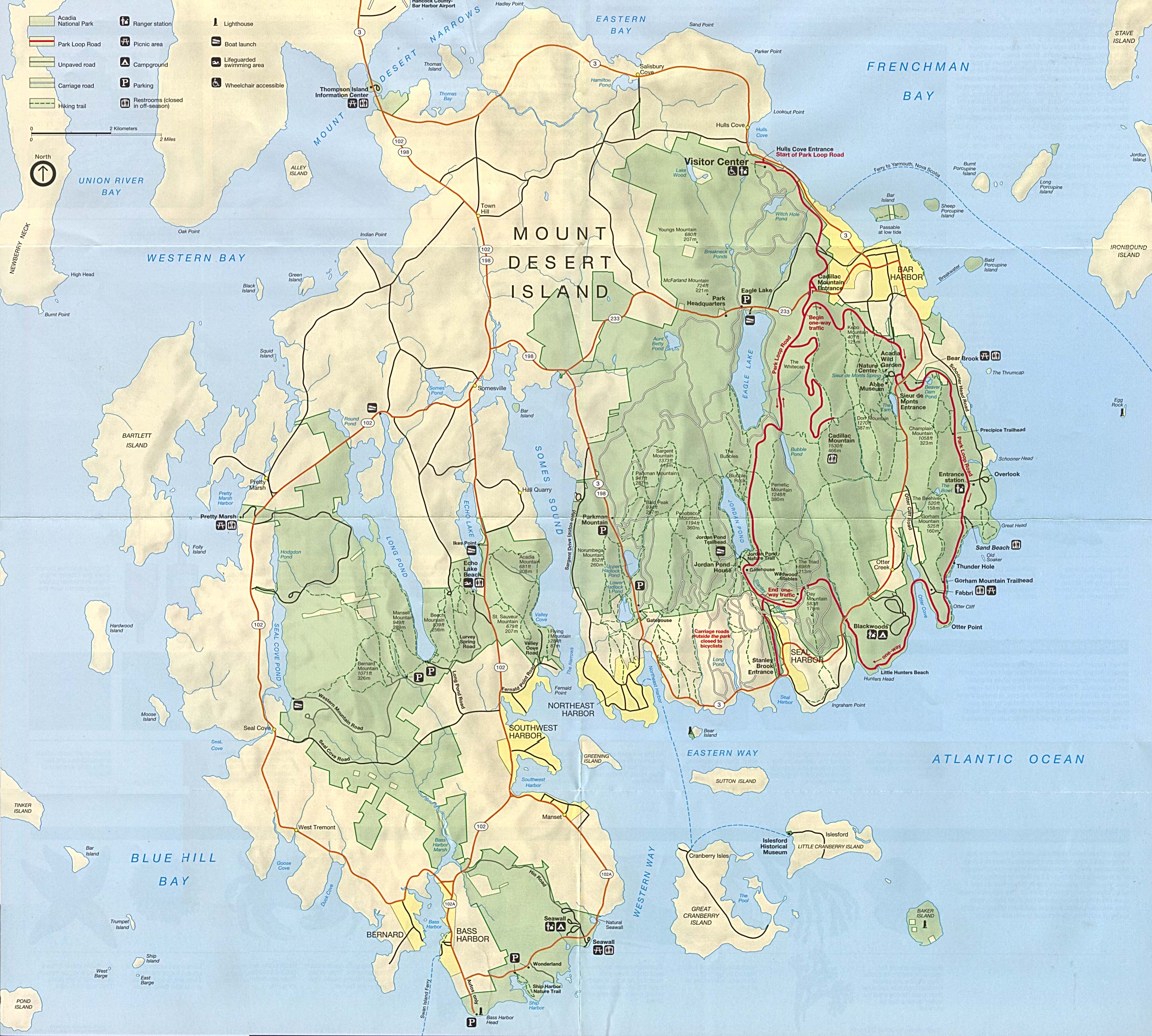
- Acadia National Park - Mount Desert Island (Detail Map) 1995 (870K)
- Acadia National Park - Schoodic Peninsula (Detail Map) 1995 (71K)
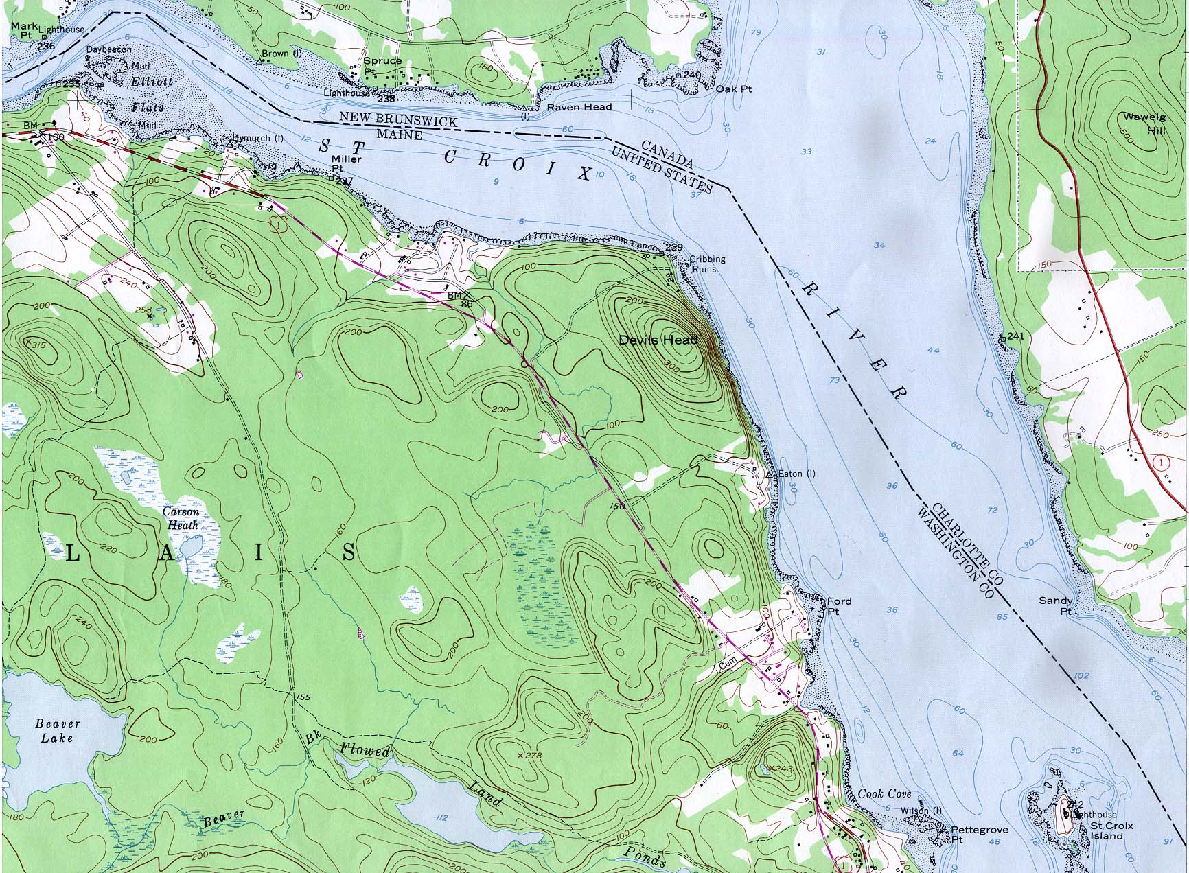
- St. Croix River from Mark Point Lighthouse to St. Croix Island (topographic) [St. Croix Island International Historic Site] Portion of Devil's Head, Maine sheet, original scale 1:24,000 U.S.G.S. 1949, photorevised 1977 (497K)
Maps on Other Web Sites