Perry-Castañeda Library
Map Collection
Kansas Maps
State Maps
- Kansas (base map) JPEG format (191K) County boundaries and names, county seats, rivers. Original scale 1:2,500,000 U.S. Geological Survey, 1972 limited update 1990
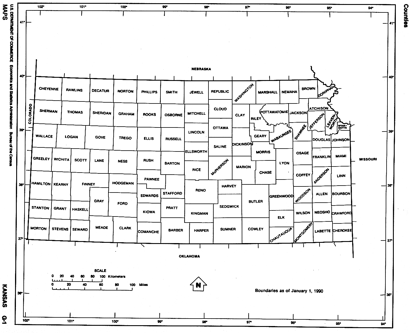
- Kansas (outline map) JPEG format (89K) County boundaries and names. U.S. Bureau of the Census, 1990
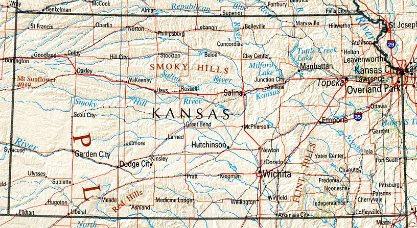
- Kansas (reference map) JPEG format (223K) Shaded relief map with state boundaries, forest cover, place names, major highways. Portion of "The National Atlas of the United States of America. General Reference", compiled by U.S. Geological Survey 2001, printed 2002
- Kansas (reference map) PDF format (225K) Shaded relief map with state boundaries, forest cover, place names, major highways. Portion of "The National Atlas of the United States of America. General Reference", compiled by U.S. Geological Survey 2001, printed 2002
- Kansas - Federal Lands and Indian Reservations PDF format (535K) The National Atlas of the United States of America, U.S. Geological Survey, 2003
City Maps
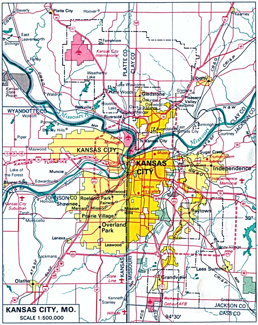
- Kansas City, Missouri and Kansas U.S. National Atlas 1970 (282K)
Historical City Maps
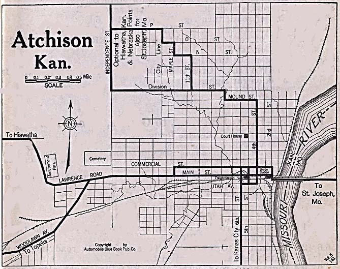
- Atchison 1920 Automobile Blue Book, 1920 (128K)
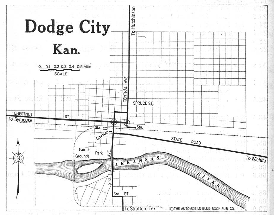
- Dodge City 1920 Automobile Blue Book, 1920, Vol. 7 (119K)
- Kansas City, Kansas and Missouri 1907 From The New Encyclopedic Atlas and Gazetteer of the World, Edited by Francis J. Reynolds, P.F. Collier & Son, New York, 1917 (139K)
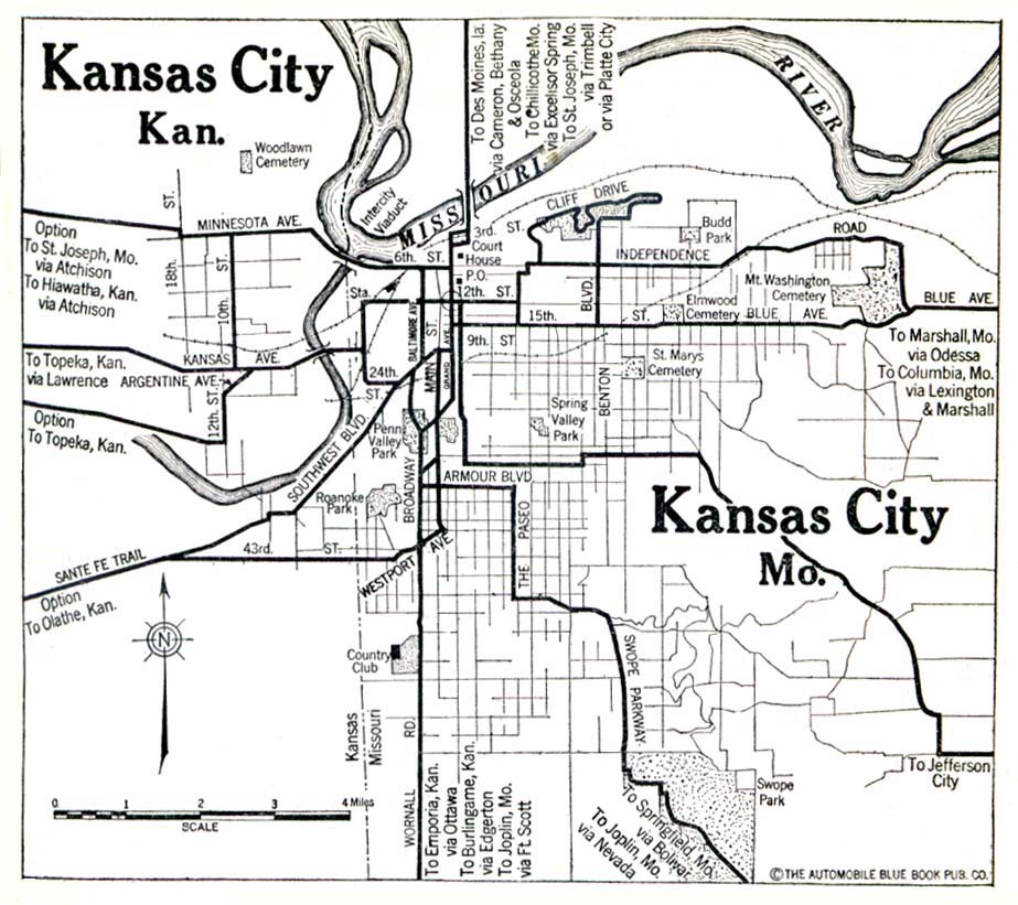
- Kansas City, Kansas and Missouri 1920 Automobile Blue Book, 1920 (139K)
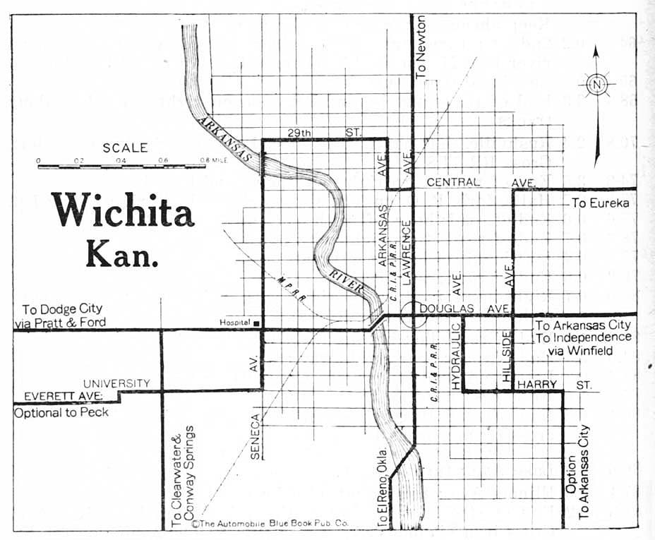
- Wichita 1920 Automobile Blue Book, 1920, Vol. 7 (117K)
Historical Topographic Maps
- Kansas Historical Topographic Maps (U.S. Geological Survey)
- Pre-1945 historical maps, scales include 1:62,500, 1:125,000.
Maps of National Parks, Monuments, and Historic Sites
The following maps were produced by the U.S. National Park Service unless otherwise noted.
- Fort Larned National Historic Site (Area Map) 1999 (65K) (PDF Format)
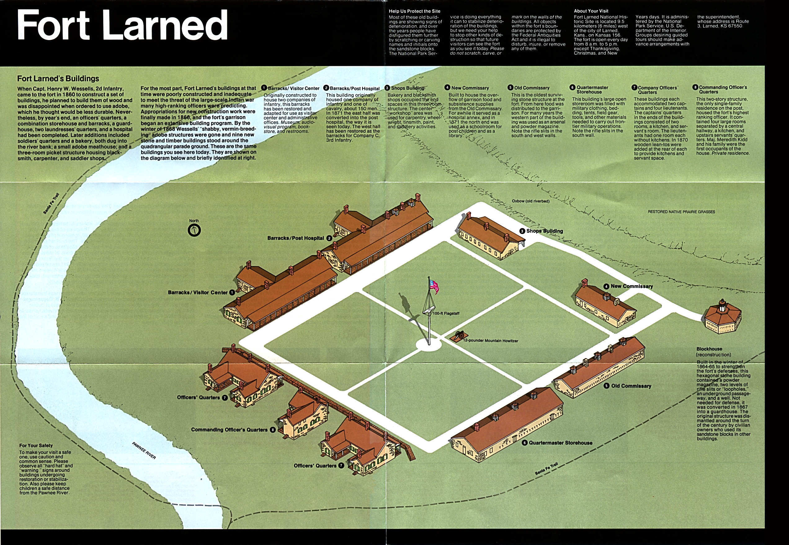
- Fort Larned National Historic Site (Schematic Map) 1994 (893K)
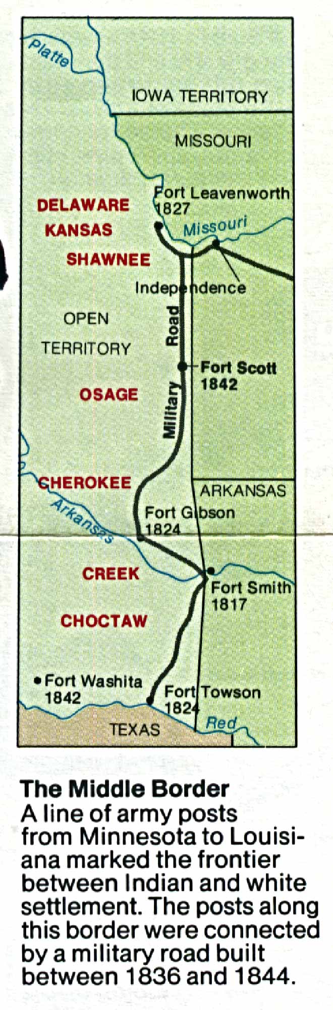
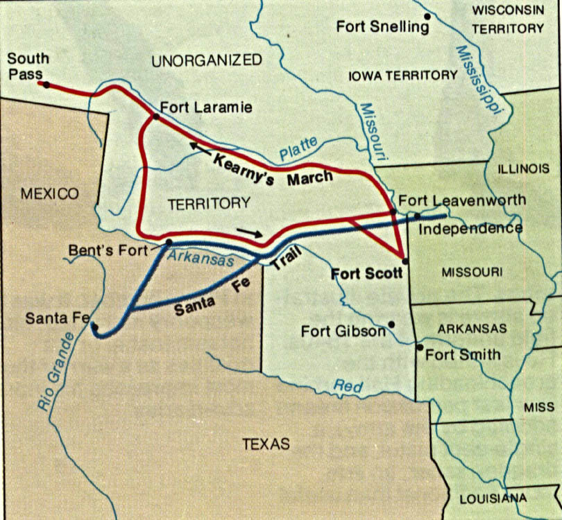
- Fort Scott National Historic Site (Area Map) 1993 (273K)
- Fort Scott National Historic Site (Battle Route Map) 1993 (187K)
- Fort Scott National Historic Site (Schematic) 1993 (390K)
Maps on Other Web Sites