Perry-Castañeda Library
Map Collection
Indonesia Maps
| Indonesia Country Maps | Indonesia City Maps | Topographic Maps | Indonesia Detailed Maps |
|---|
| Indonesia Historical Maps | Indonesia Thematic Maps | Other Sites: Country Maps | Other Sites: City Maps |
|---|
Also See: East Timor Maps Country Maps
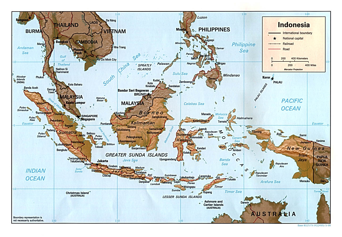
- Indonesia (Physiography) U.S. Central Intelligence Agency 2002 (243K) and pdf format (1.1MB)
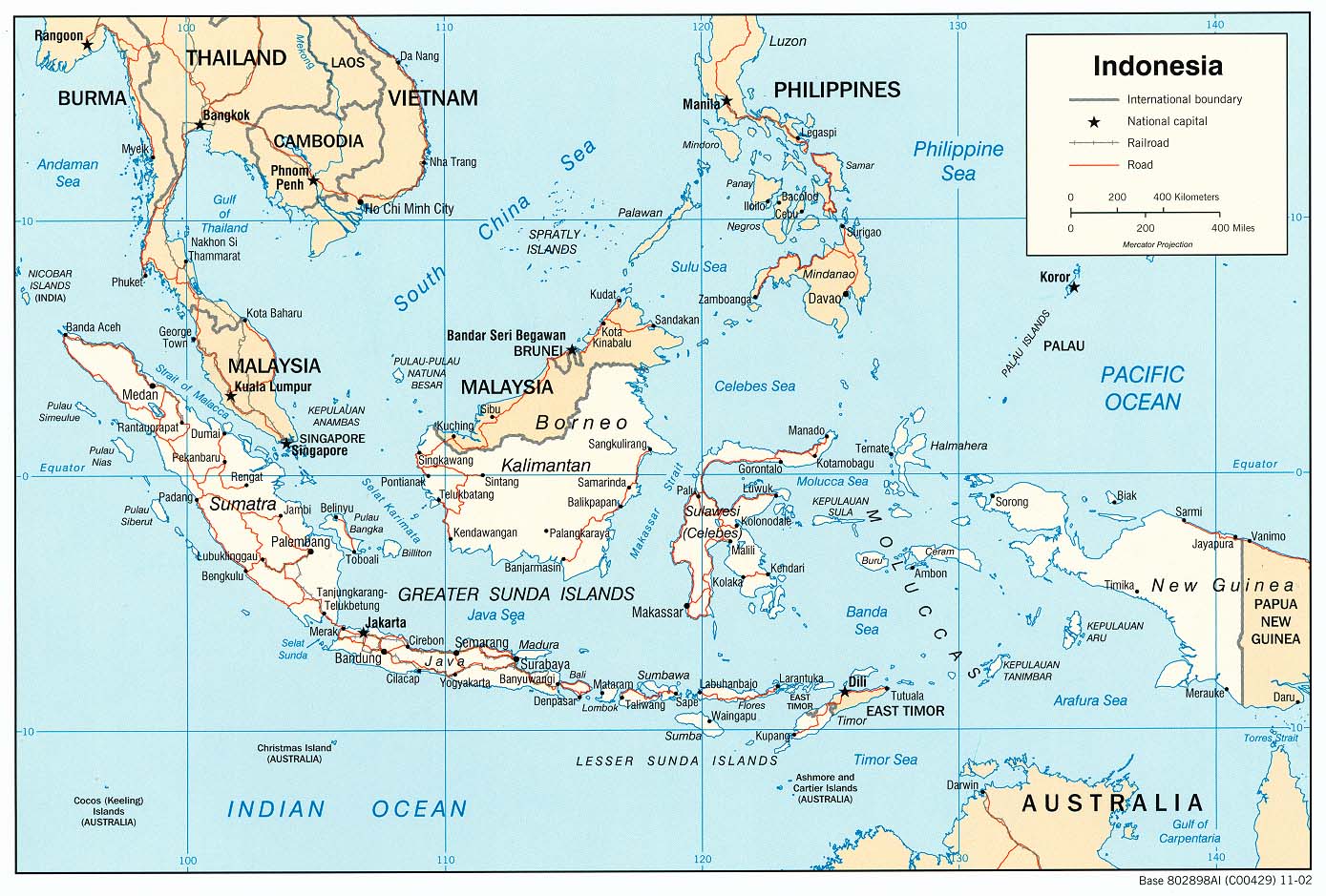
- Indonesia (Political) U.S. Central Intelligence Agency 2002 (243K) and pdf format (241K)
- Indonesia (Political) U.S. Central Intelligence Agency 1998 (269K) and pdf format (278K)
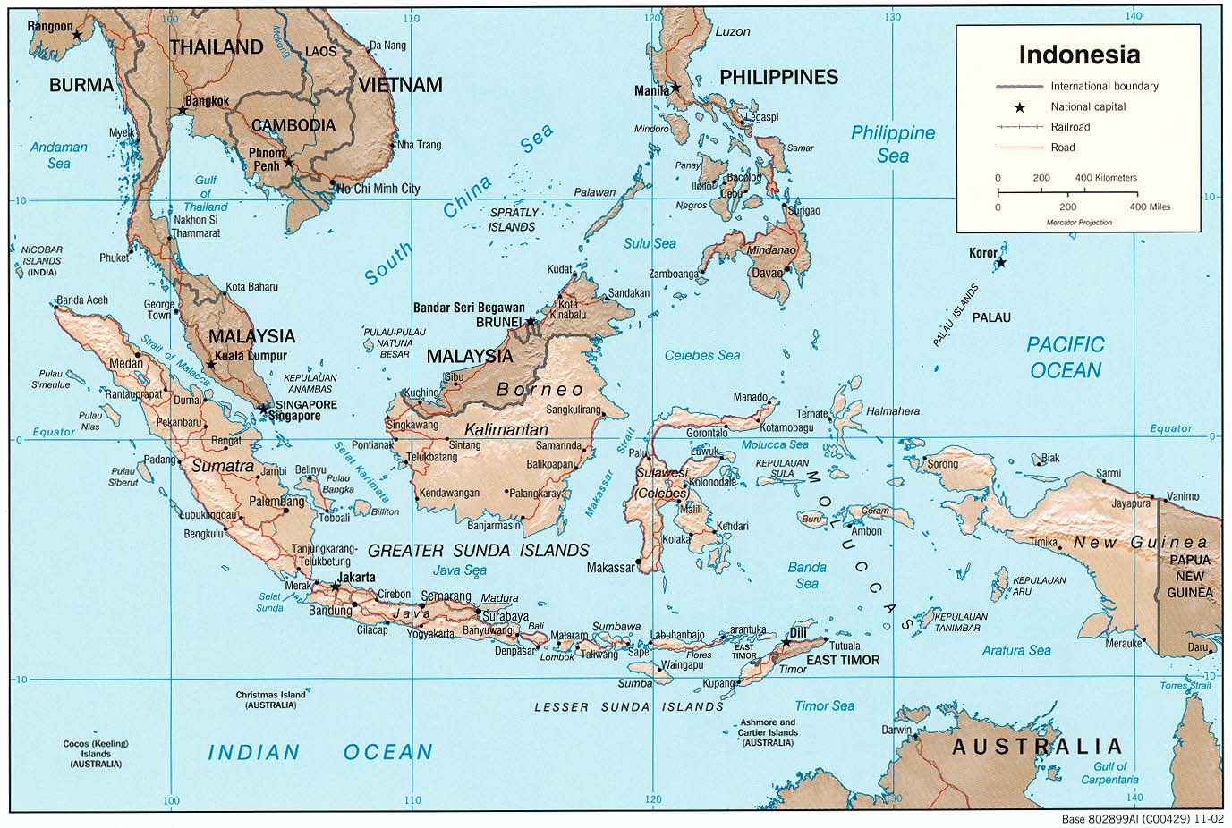
- Indonesia (Shaded Relief) U.S. Central Intelligence Agency 2002 (234K) and pdf format (232K)
- Indonesia (Shaded Relief) U.S. Central Intelligence Agency 1998 (274K) and pdf format (283K)
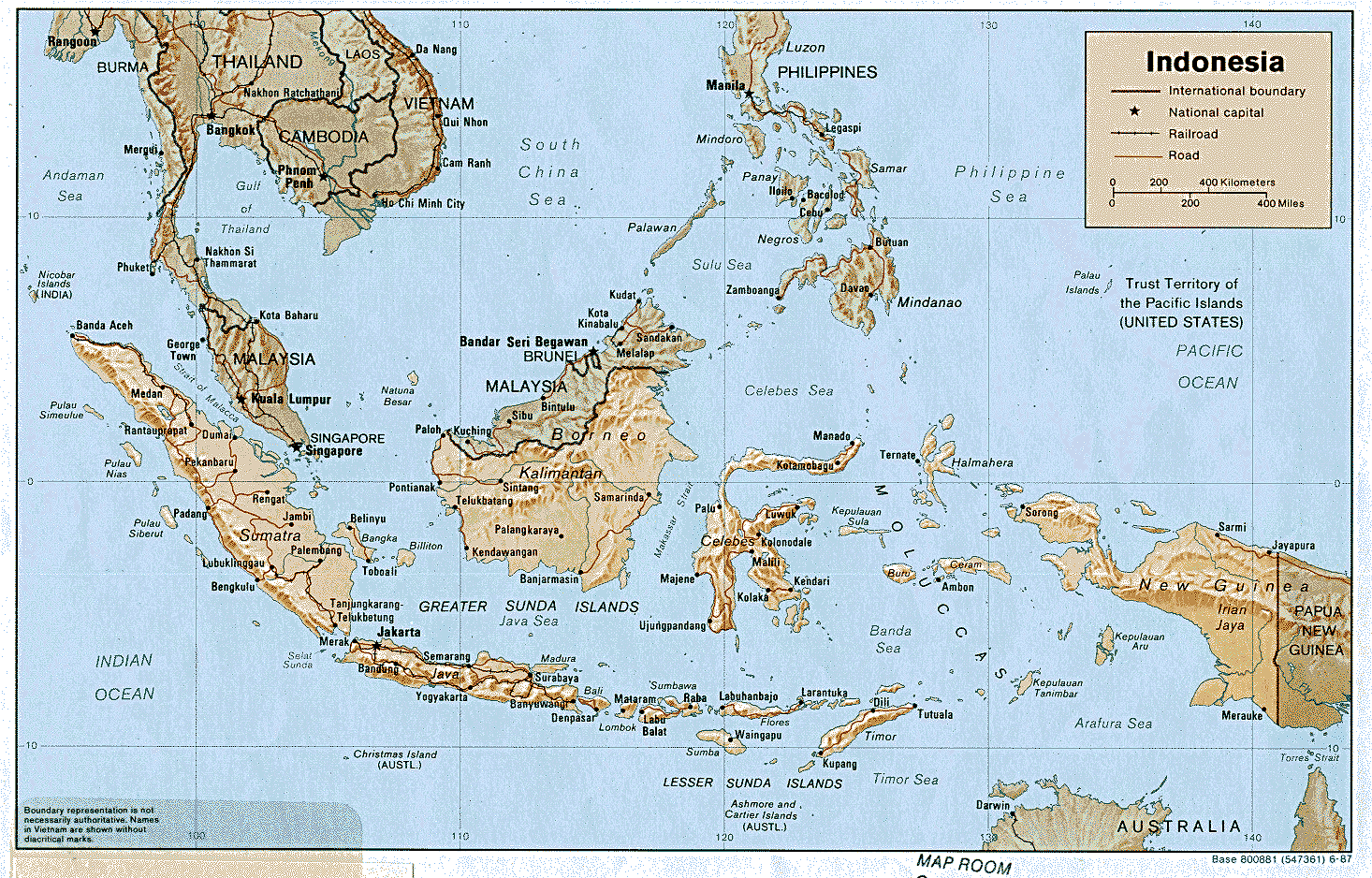
- Indonesia (Shaded Relief) U.S. Central Intelligence Agency 1987 (776K) and pdf format (750K)
- Indonesia (Small Map) U.S. Central Intelligence Agency 2016 (36.9K)
- Indonesia (Transportation) U.S. Central Intelligence Agency 2002 (243K) and pdf format (1.2MB)
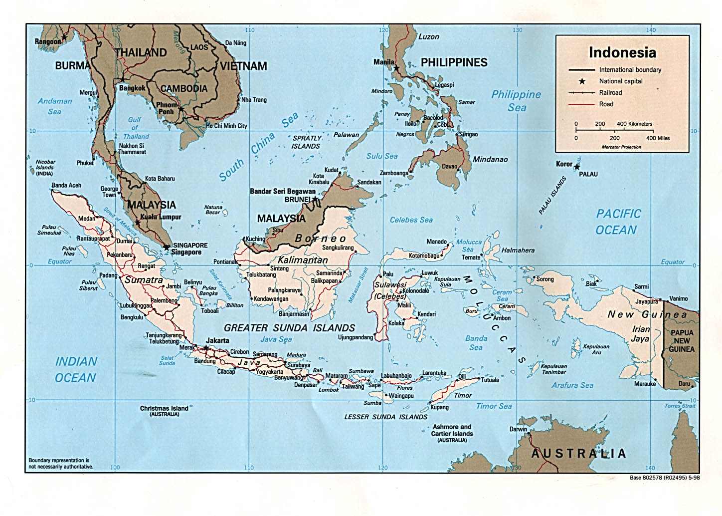
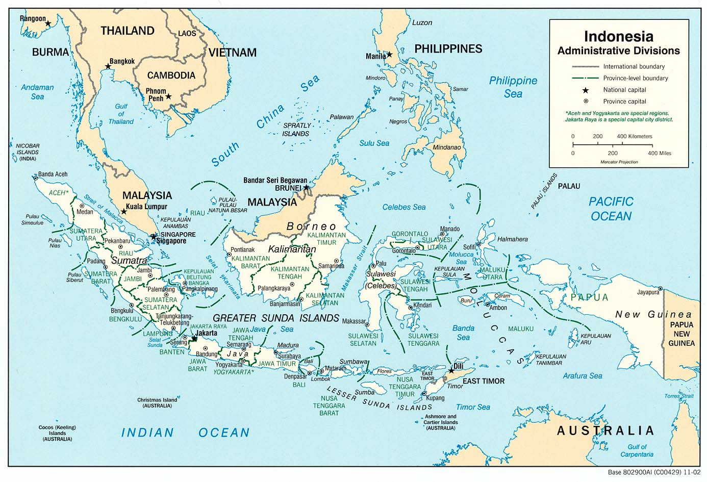
- Indonesia: Administrative Divisions (Political) U.S. Central Intelligence Agency 2002 (220K)and pdf format (228K)
- Indonesia: Administrative Divisions (Political) U.S. Central Intelligence Agency 1998 (387K) and pdf format (282K)
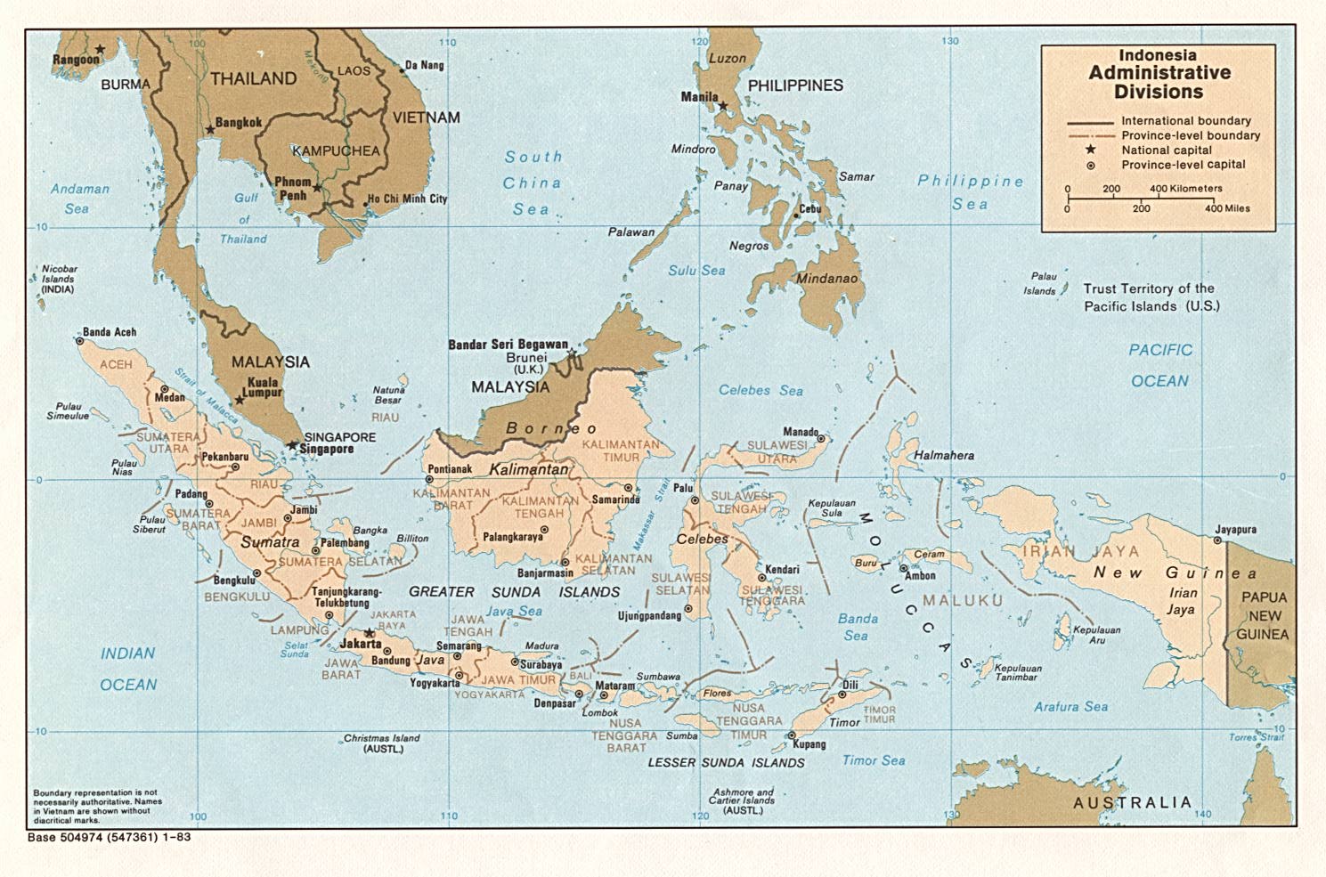
- Indonesia: Administrative Divisions (Political) U.S. Central Intelligence Agency 1983 (257K) and pdf format (260K)
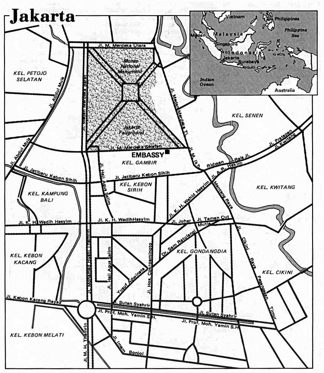
- Jakarta U.S. Department of State 1986 (105K)
- [Jakarta] Djakarta - South 1:50,000, Edition 1-AMS, Series T725. U.S. Army Map Service, 1959 (5.4MB)
- [Jakarta] Djakarta - North 1:50,000, Edition 1-AMS, Series T725. U.S. Army Map Service, 1959 (3.9MB)
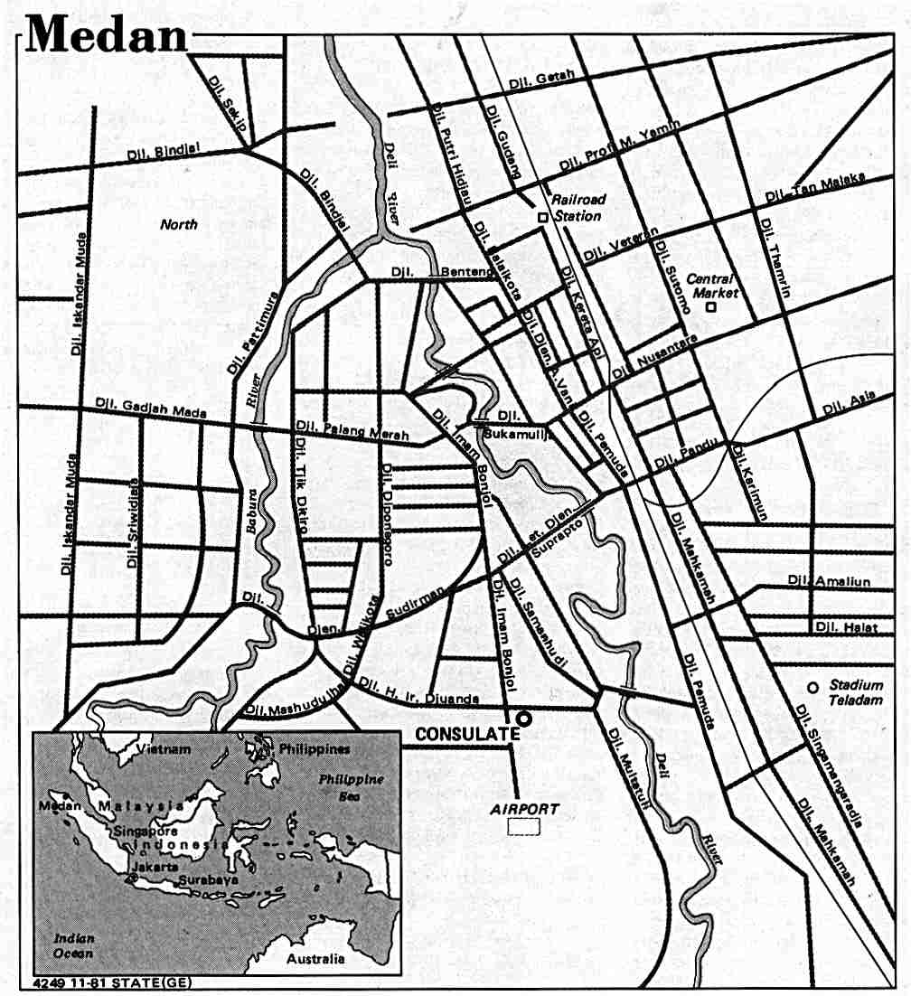
- Medan U.S. Department of State 1981 (96K)
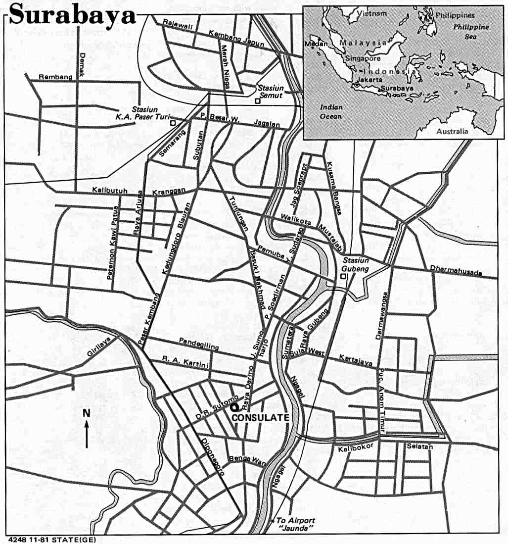
- Surabaya U.S. Department of State 1981 (94K)
![[Jakarta] Djakarta - South](world_cities/txu-oclc-436774040-djakarta_south-1959.jpg)
![[Jakarta] Djakarta - North](world_cities/txu-oclc-436776314-djakarta_north-1959.jpg)
- 1:1,000,000 - International Map of the World (Topographic Maps) U.S. Army Map Service, International Map of the World
- This series includes most of Indonesia
- 1:1,000,000 - Operational Navigation Chart Series (Aeronautical Charts) U.S. Defense Mapping Agency Aerospace Center.
- This series includes all of Indonesia Not for navigational use
- 1:500,000 - Tactical Pilotage Chart Series (Aeronautical Charts) U.S. Defense Mapping Agency Aerospace Center.
- This series covers most of Indonesia Not for navigational use
- 1:250,000 - Indonesia (Topographic Maps) U.S. Army Map Service, 1954-, Series T503
- This series covers most of Indonesia
- 1:250,000 - New Guinea (Topographic Maps) U.S. Army Map Service, 1964-, Series T504
- This series includes parts of West New Guinea
- 1:250,000 - Joint Operations Graphic Series (Aeronautical Charts), 1:250,000.
- This series covers parts of eastern Indonesia Not for navigational use
AMS Topographic Series from the World War II Era:
- 1:750,000 - Sumatra (Topographic Maps) Great Britain War Office, 1941, Series 4184
- 1:500,000 - New Guinea (Topographic Maps) U.S. Army Map Service, 1942, Series T401
- 1:250,000 - Lesser Sunda Islands (Topographic Maps) U.S. Army Map Service, 1942-1943, Series T551
- 1:250,000 - Sumatra (Topographic Maps) U.S. Army Map Service, 1943-, Series T511
- 1:200,000 - Borneo (Topographic Maps) U.S. Army Map Service, 1944-, Series T531
- 1:200,000 - Celebes (Topographic Maps) U.S. Army Map Service, 1942-1944, Series T541
- 1:100,000 - Ceram (Topographic Maps) U.S. Army Map Service, 1944, Series T663
- 1:100,000 - Java & Madura (Topographic Maps), U.S. Army Map Service, 1942-, Series 4201
- 1:100,000 - Molukken Islands (Topographic Maps) U.S. Army Map Service, 1942-, Series T662
- 1:100,000 - Southeastern Borneo (Topographic Maps) U.S. Army Map Service, 1944-, Series T631
- 1:50,000 - Amboina Archipelago (Topographic Maps) U.S. Army Map Service, 1943, Series T761
- 1:50,000 - Java & Madura (Topographic Maps), U.S. Army Map Service, 1942-, Series T722
- 1:50,000 - Southeastern Borneo (Topographic Maps) U.S. Army Map Service, 1942, Series T731
- This series includes most of Indonesia
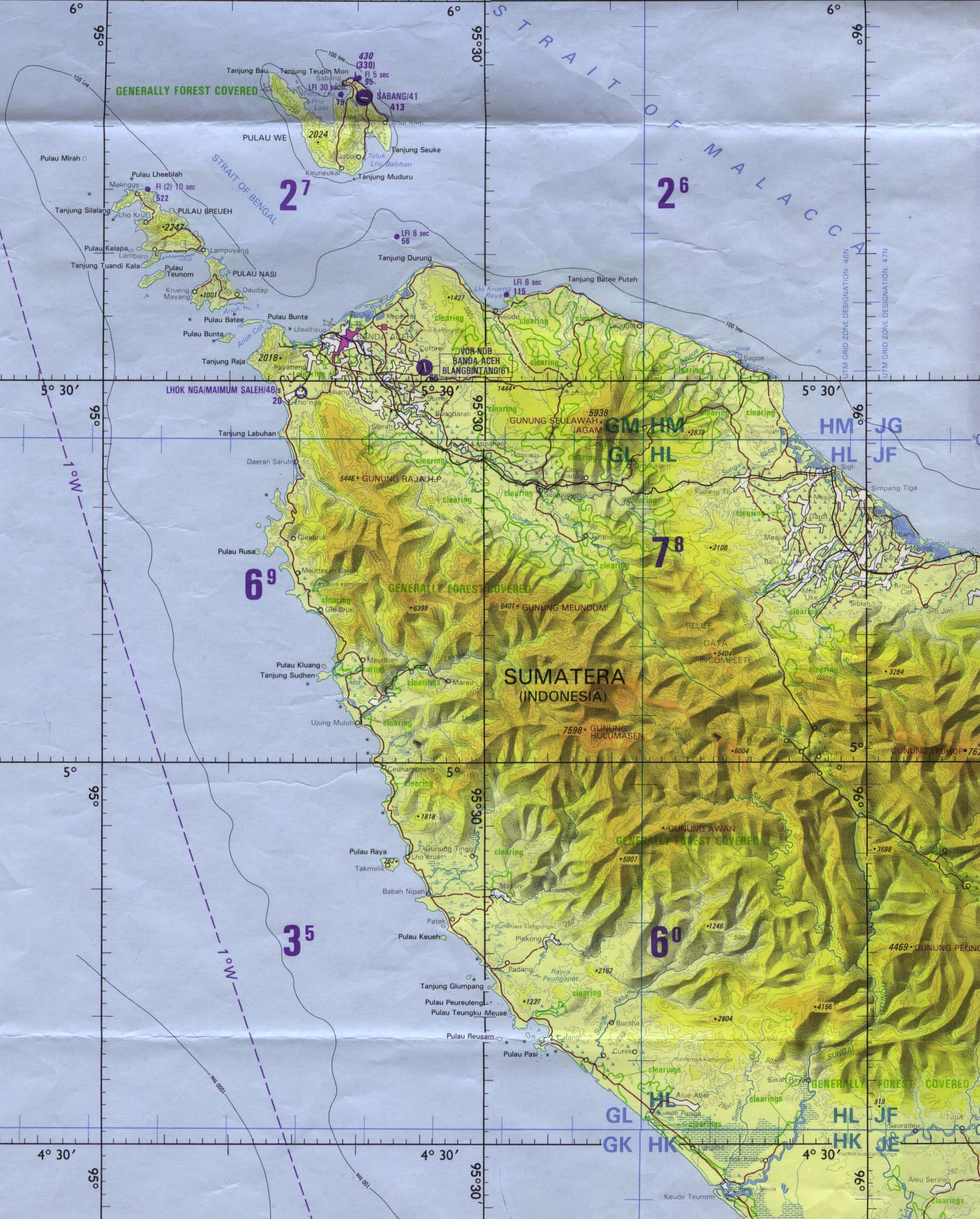
- Aceh Region (Tactical Pilotage Chart) original scale 1:500,000. Portion of Defense Mapping Agency TPC L-9B 1990 (419K) Not for navigational use
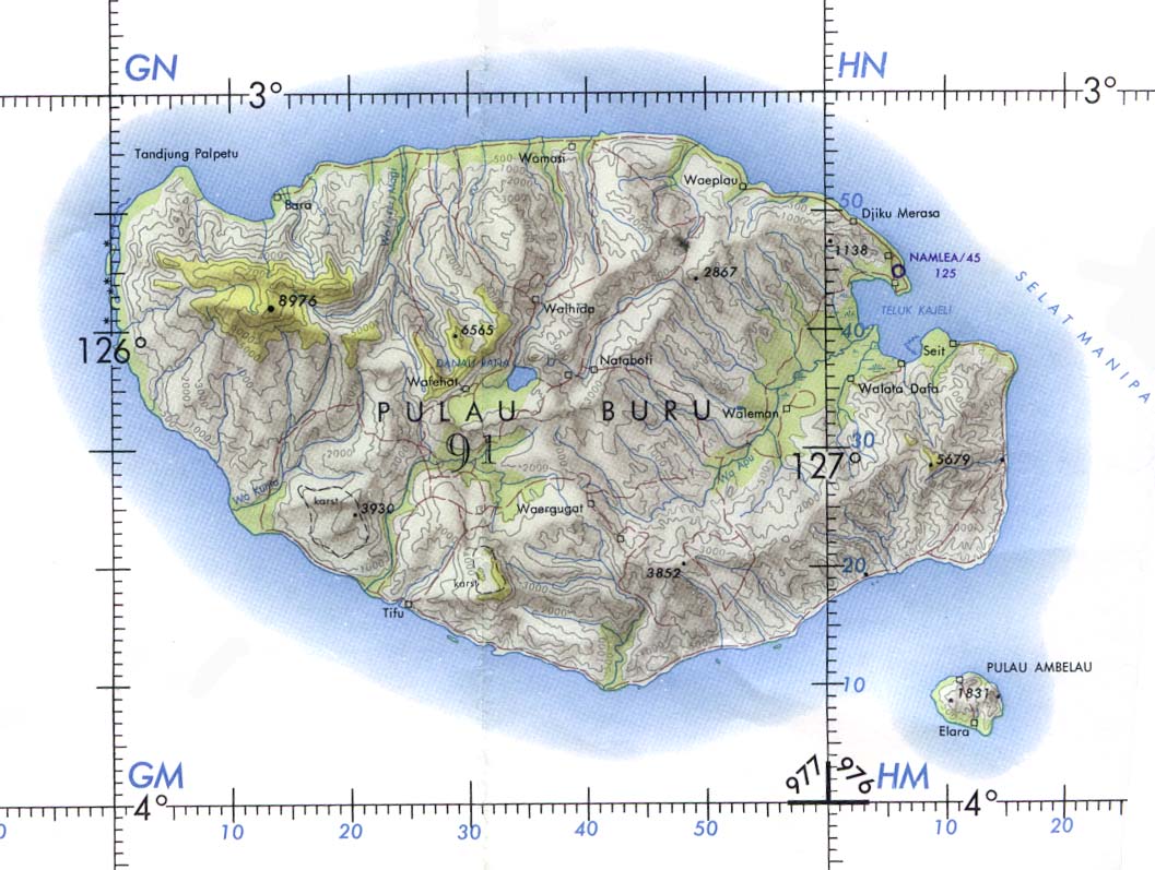
- Buru Island (Operational Navigation Chart) original scale 1:1,000,000. Portion of Defense Mapping Agency ONC M-12 1967 (152K) Not for navigational use
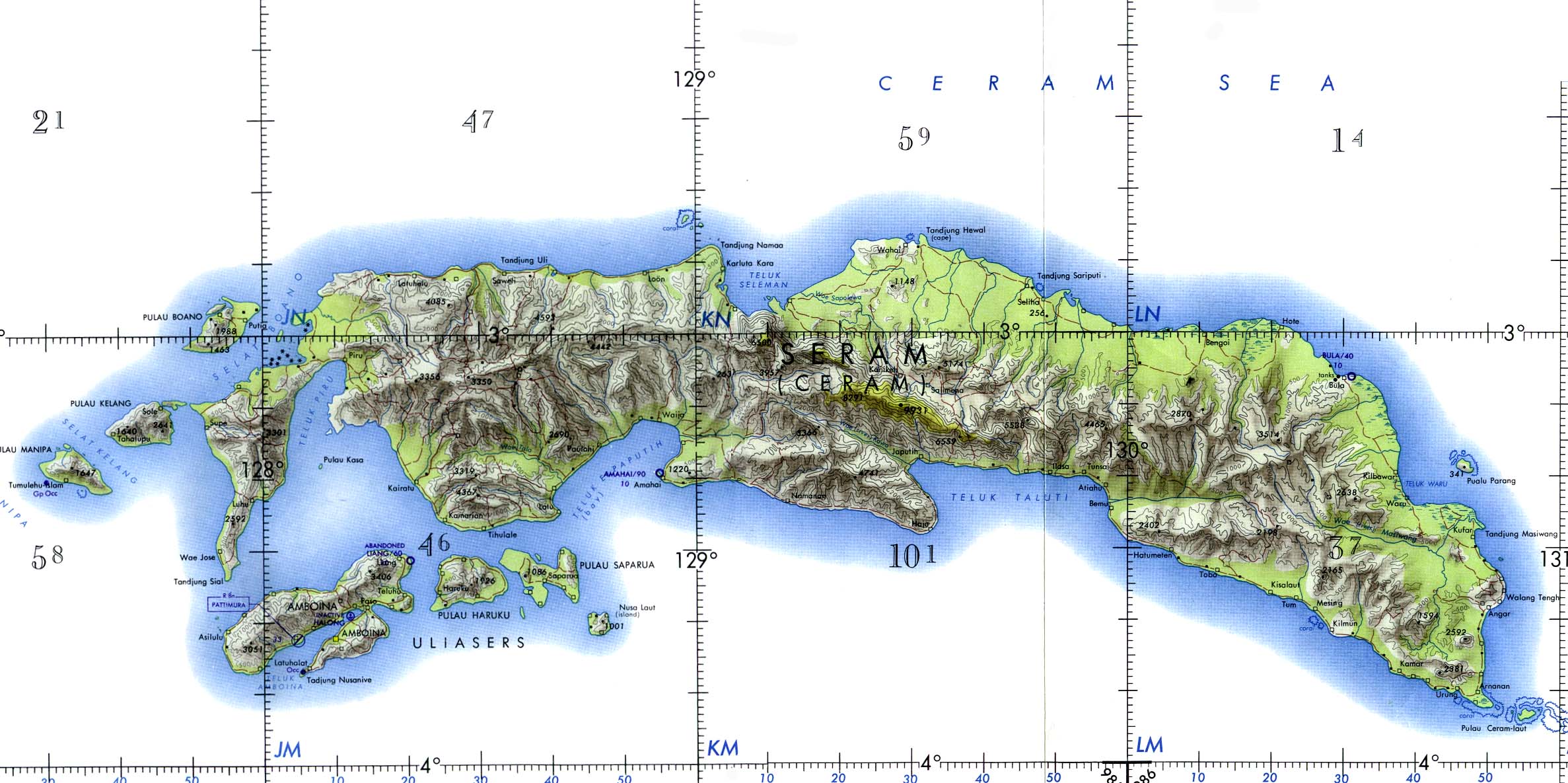
- Ceram and Ambon Islands (Operational Navigation Chart) original scale 1:1,000,000. Portion of Defense Mapping Agency ONC M-12 1967 (372K) Not for navigational use
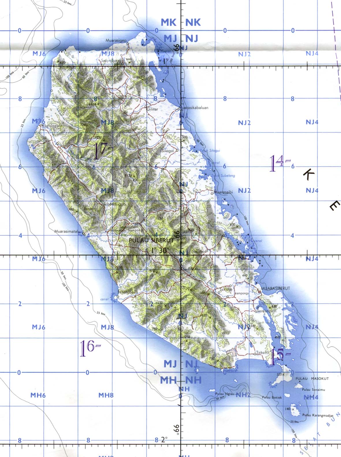
- Siberut Island (Tactical Pilotage Chart) original scale 1:500,000. Portion of Defense Mapping Agency TPC M-10A 1970 (224K) Not for navigational use
- South Central Kalimantan: Palangkaraja, Sampit, Semuda (Tactical Pilotage Chart) original scale 1:500,000. Portion of Defense Mapping Agency TPC M-11A 1974 (718K) Not for navigational use
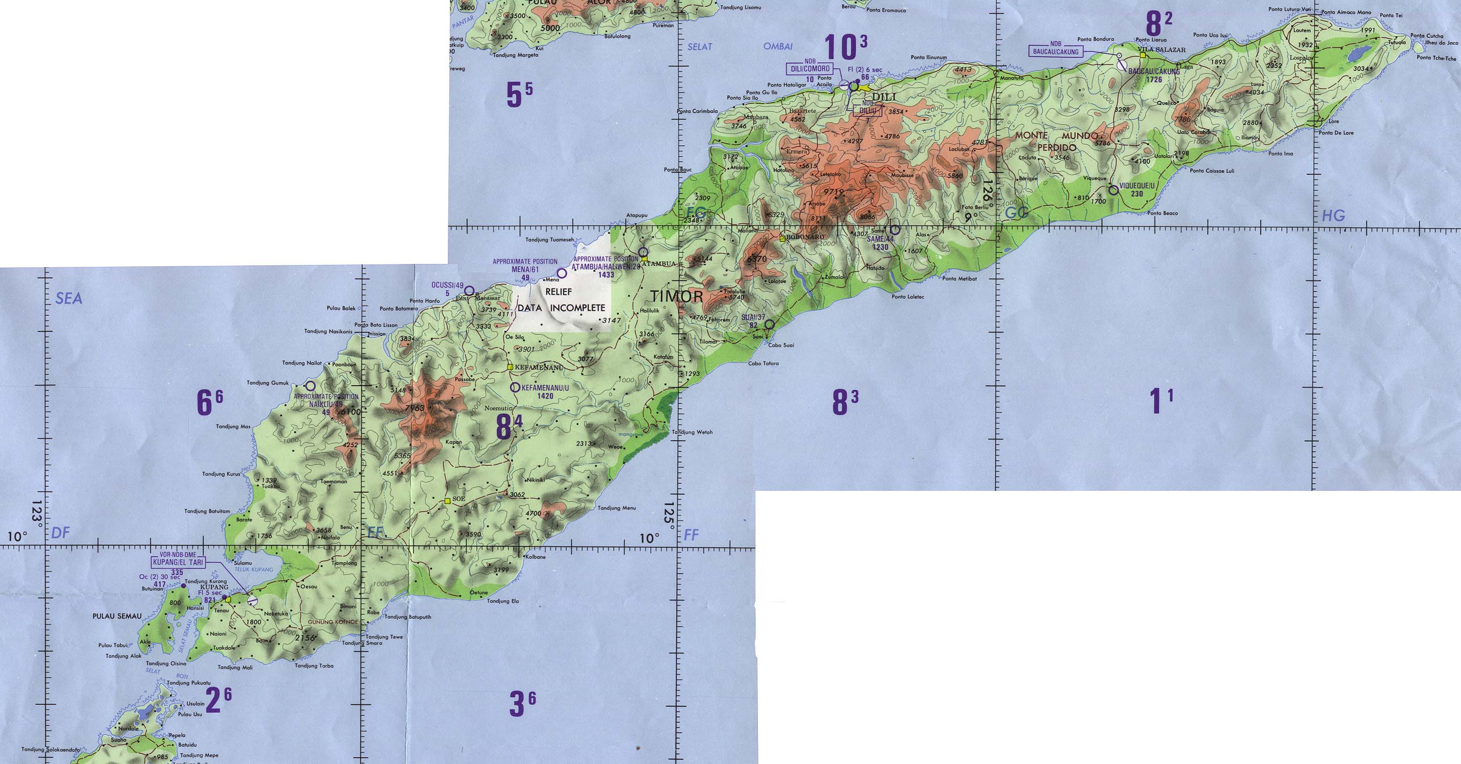
- Timor (Operational Navigation Chart) original scale 1:1,000,000. Portion of Defense Mapping Agency ONC N-13 1989 (500K) Not for navigational use
Note: Scroll to right and down to view entire map.
- [Ambon, Netherlands East Indies] Tan Toey Prisoners of War Camp 1943 "Sketch Map of Tan Toey Prisoners of War Camp, Amboina Island, Former camp of the Australian troops, built by the Netherlanders, now used by the Japanese as a prisoner-of-war camp..." from Allied Geographical Section, Southwest Pacific Area. Area Study of Ambon Island, Terrain Study No. 45, Map 13 dated March 13, 1943. (429K)
- Batavia [Jakarta] 1897 From Guide to the Dutch East Indies by Dr. J.F. van Bemmelen and G.B. Hoover, Luzac & Co, London 1897. (516K)
- Batavia [Jakarta] 1914 From "Indien: Handbuch Für Reisende" published by Verlag von Karl Baedeker, Leipzig, 1914. (1.4MB)
- Jakarta [Djakarta] Region 1954 original scale 1:250,000 Army Map Service, Corps of Engineers. Sheet SB 48-12, compiled 1954, printed 1958 (5.9MB)
- Buitenzorg [Bogor] 1914 From "Indien: Handbuch Für Reisende" published by Verlag von Karl Baedeker, Leipzig, 1914. (857K)
- Garoet [Garut] 1914 From "Indien: Handbuch Für Reisende" published by Verlag von Karl Baedeker, Leipzig, 1914. (1.3MB)
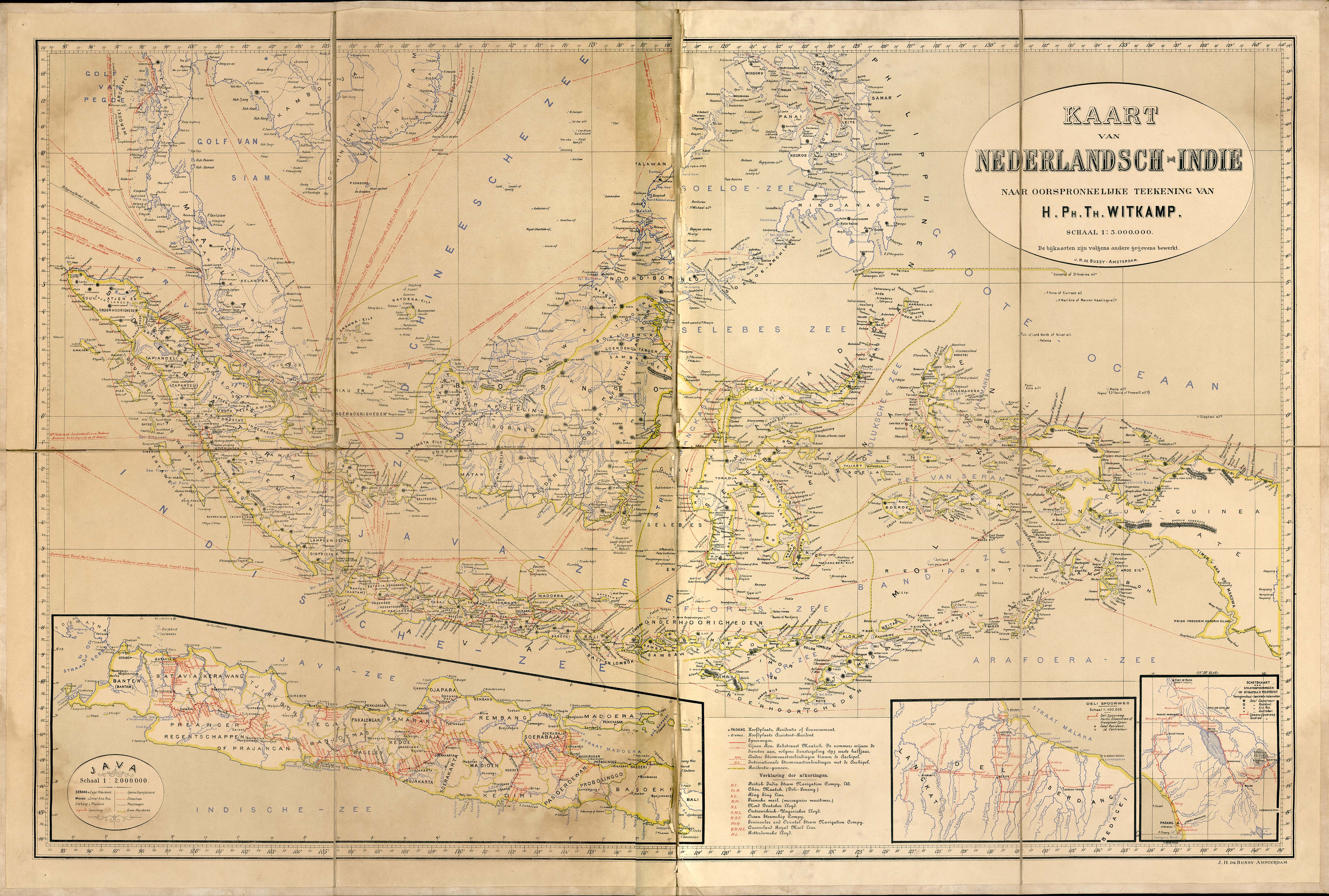
- Netherlands Indies circa 1893 "Kaart van Nederlandisch-Indie naar oorspronkelijke teekening van H. Ph. Th. Witkamp", J.H. deBussy, Amsterdam, ca. 1893. Original scale of main map 1:5,000,000 (3.3 MB)
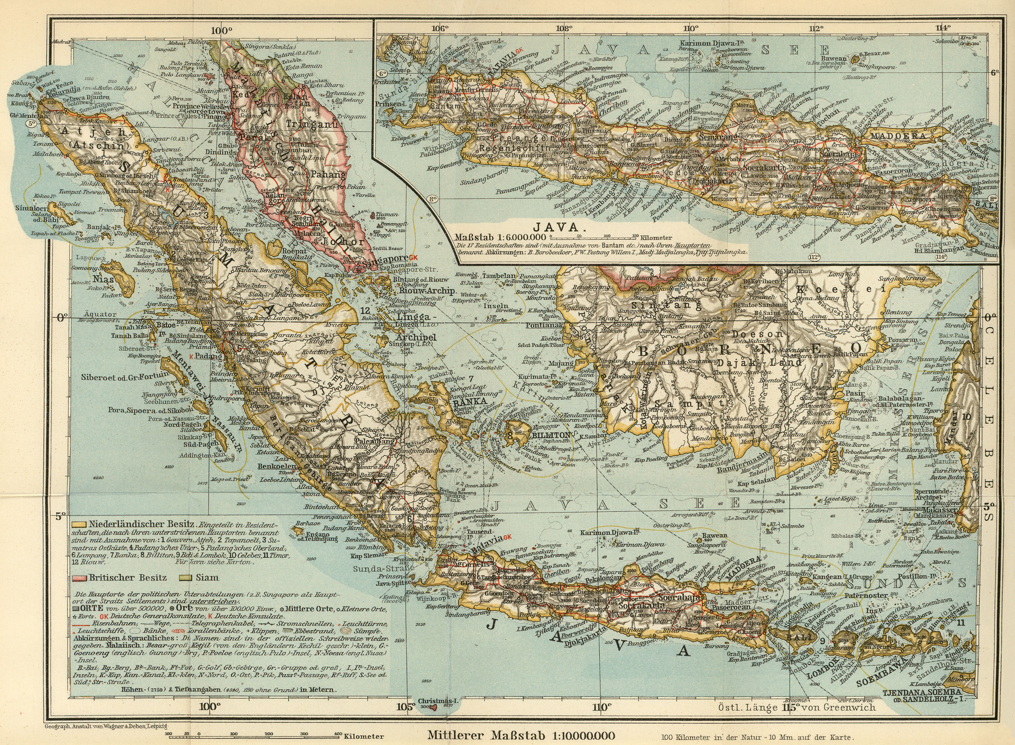
- Netherlands Indies 1914 Ubersichtskarte Malayische Halbinsel, Sumatra, Java 1:10,000,000 and Ubersichtskarte von Java 1:6,000,000 from "Indien: Handbuch Für Reisende" published by Verlag von Karl Baedeker, Leipzig, 1914. (3.0MB)
- Soerabaja [Surabaya] 1897 From Guide to the Dutch East Indies by Dr. J.F. van Bemmelen and G.B. Hoover, Luzac & Co, London 1897. (452K)
- Soerabaja [Surabaya] 1914 From "Indien: Handbuch Für Reisende" published by Verlag von Karl Baedeker, Leipzig, 1914. (1MB)
- Tanimbar Islands Terrain Study 1944 Allied Geographical Section, Southwest Pacific Area [includes maps and aerial photographs] (127MB)
- Tenggergebergte [Mount Bromo] 1914 From "Indien: Handbuch Für Reisende" published by Verlag von Karl Baedeker, Leipzig, 1914. (1.3MB)
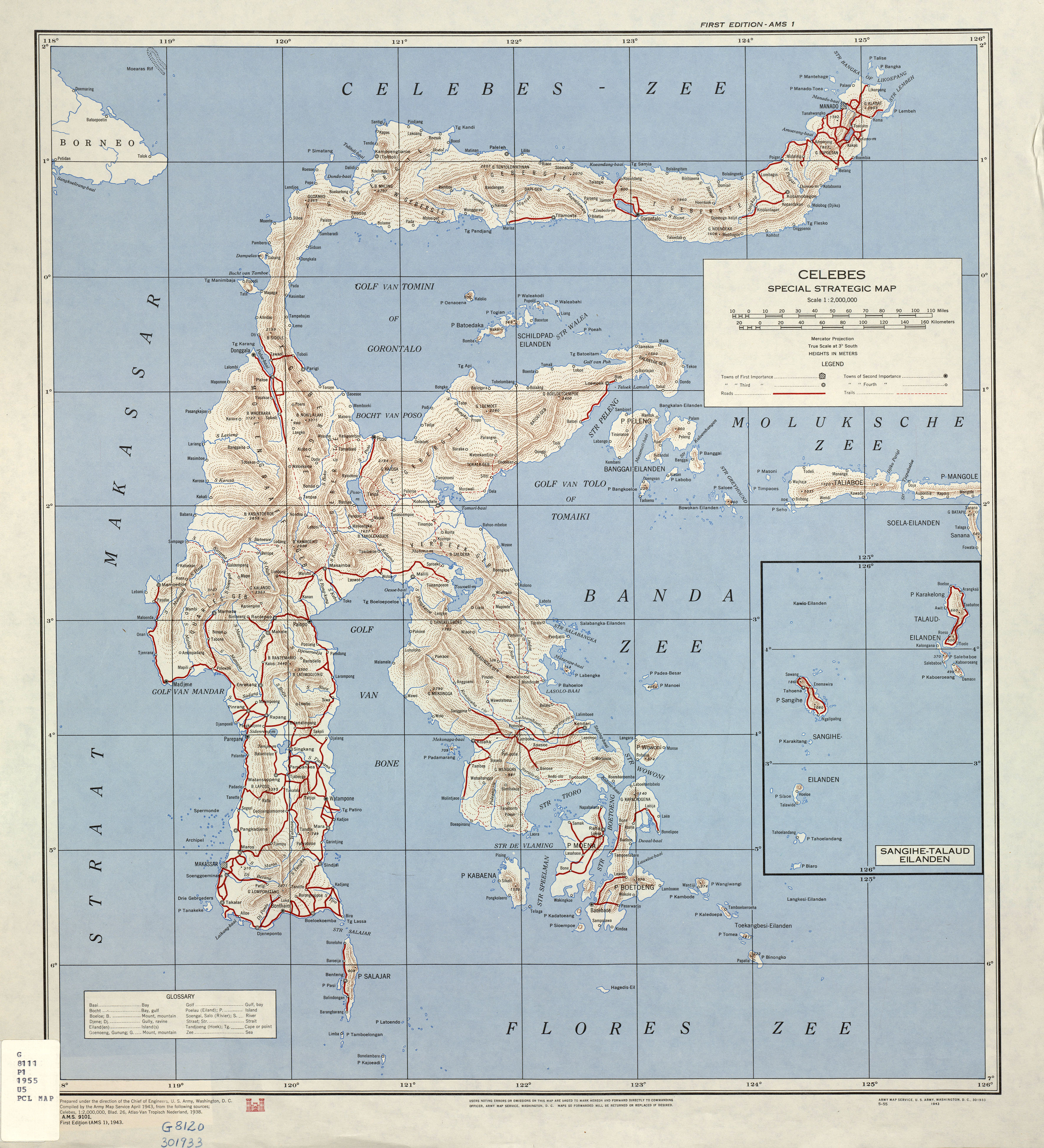
- Celebes 1943 Celebes Special Strategic Map. U.S. Army Map Service, 1:2,000,000, 1943 (5.3MB)
![[Ambon, Netherlands East Indies] Tan Toey Prisoners of War Camp 1943](historical/ambon_1943.jpg)
![Batavia [Jakarta] 1897](historical/batavia_1897.jpg)
![Batavia [Jakarta] 1914](historical/baedeker_indien_1914/txu-pclmaps-batavia_1914.jpg)
![Jakarta [Djakarta] Region 1954](middle_east_and_asia/djakarta_58.jpg)
![Buitenzorg [Bogor] 1914](historical/baedeker_indien_1914/txu-pclmaps-buitenzorg_1914.jpg)
![Garoet [Garut] 1914](historical/baedeker_indien_1914/txu-pclmaps-garoet_1914.jpg)
![Soerabaja [Surabaya] 1897](historical/soerabaja_1897.jpg)
![Soerabaja [Surabaya] 1914](historical/baedeker_indien_1914/txu-pclmaps-soerabaja_1914.jpg)
![Tenggergebergte [Mount Bromo] 1914](historical/baedeker_indien_1914/txu-pclmaps-tenggergebergte_1914.jpg)
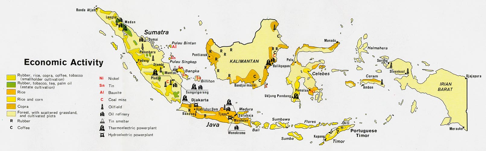
- Indonesia - Economic Activity from Map No. 500869 1972 (149K)
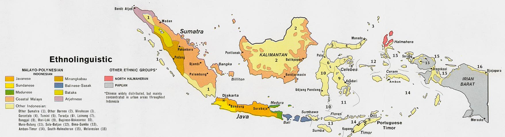
- Indonesia - Ethnolinguistic from Map No. 500869 1972 (144K)
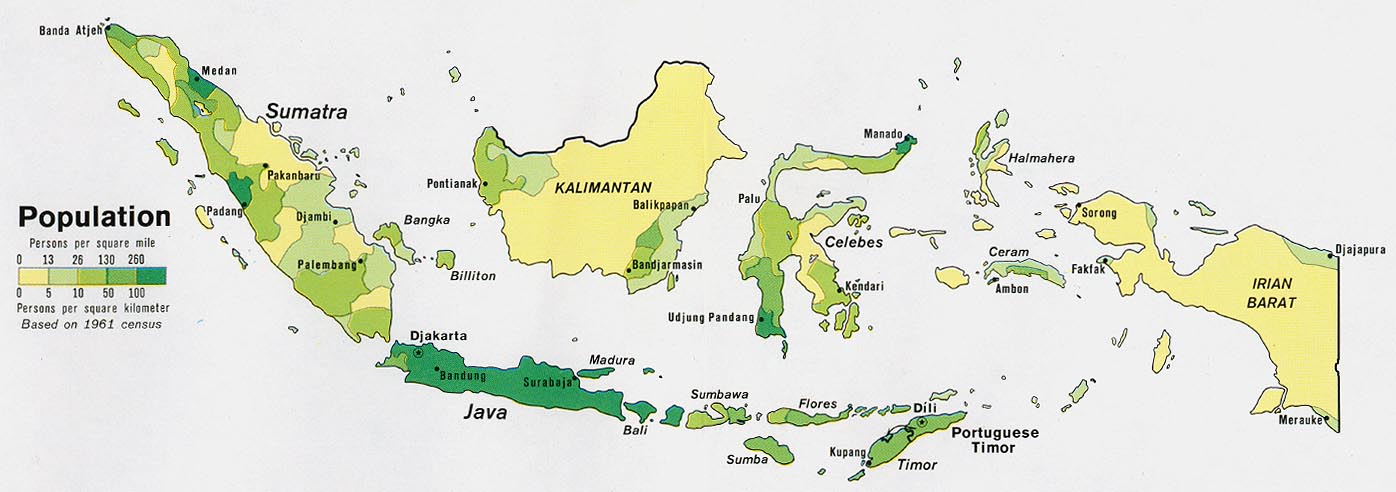
- Indonesia - Population from Map No. 500869 1972 (111K)
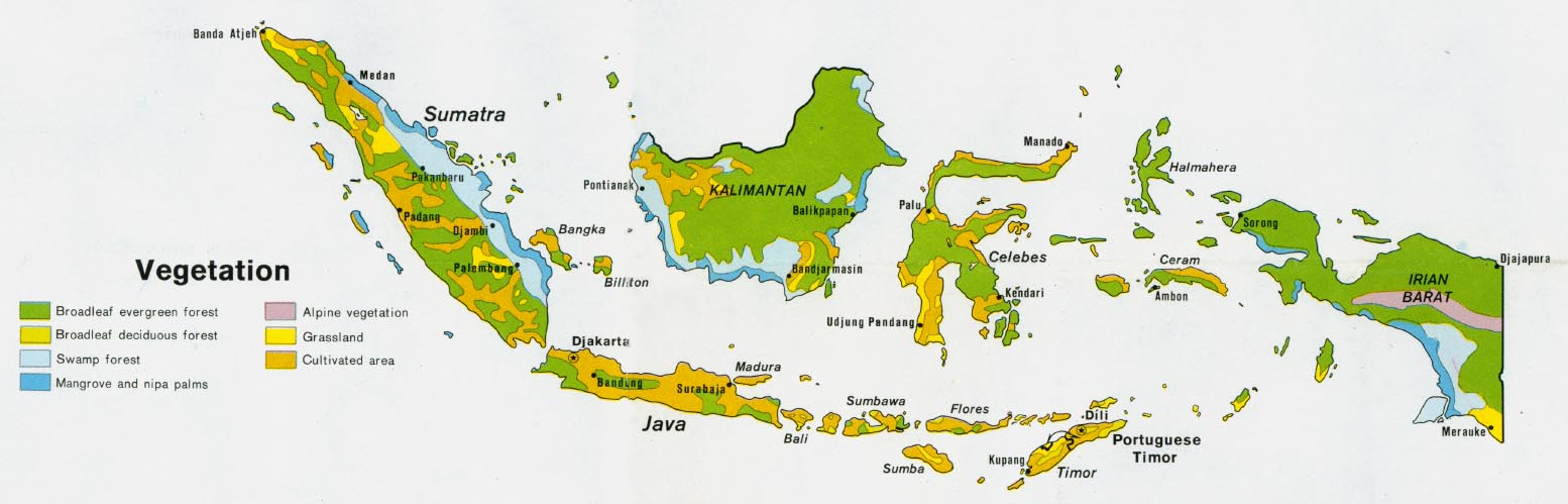
- Indonesia - Vegetation from Map No. 500869 1972 (112K)
Maps on Other Web Sites - Indonesia Country Maps
Updated 2/26/13
- Indonesia (Indonesian Parrot Project)
- Indonesia (Lonely Planet)
- Indonesia (United Nations) [pdf format]
- Indonesia - Clickable Atlas (AsiaMaya)
- Indonesia - Clickable Atlas (SEAsite Indonesia)
- Indonesia Earthquake, May 27, 2006 - Maps: Reuters AlertNet, ReliefWeb
- Indonesia Maps (Global Internal Displacement Project)
- Indonesia Maps (Peter Loud)
- Indonesia - Historical Maps 1850-1950 (KIT Library, Royal Tropical Institute)
- Indonesia - Language Maps (Ethnologue)
- Indonesia - Mineral Industry (USGS) and Map Key
- Indonesia - Surfing Maps (Wannasurf)
- Indonesia - Tsunami Maps (2004)
- Indonesia - Volcanoes Since 1900 (USGS)
- Aceh (Baliwww.com)
- Bali (Baliguide)
- Bali (Lonely Planet)
- Bali Bombings Map [October 12, 2002] (BBC News)
- Bali Bombings Map [October 1, 2005] (Sydney Morning Herald)
- Batam Island (Barunacs)
- Bintan Island (Republik-Indonesia.com)
- Java (Lonely Planet)
- Kai Islands (Alexis Su�rez/Web Archive)
- Kalimantan (AsiaMaya)
- Kalimantan - West (Peter Loud)
- Lombok (Lonely Planet)
- Lombok (Peter Loud)
- Spice Islands (Tim Severin)
- Sulawesi (Peter Loud)
- Sulawesi (Welt-atlas.de)
- Sumatra (Lonely Planet)
- Sumatra - Earthquake 2009 - Maps [2009] (MapAction)
- Timor - East (Democratic Republic of Timor-Leste) Maps (PCL Map Collection)
- Timor - West (Live.com)
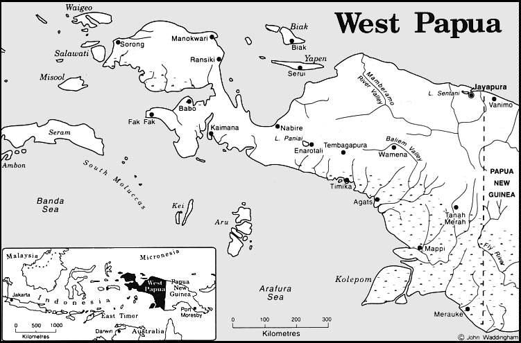
- West Papua (Alan Cline)
- [West Papua] Irian Jaya (AsiaMaya)
- [West Papua] Irian Jaya - Glaciers of Irian Jaya (USGS)
- [West Papua] Irian Jaya - Maps (PapuaWeb)
![Bali Bombings Map [October 1, 2005] (Sydney Morning Herald)](http://www.smh.com.au/ffxmedia/2005/10/02/03web_bali.jpg)
- Ambon City (IDP Project)
- Bandung (Asiatravel.com)
- Banjarmasin, Kalimantan (Google Maps)
- Bukittinggi, Sumatra (Green Map) [PDF]
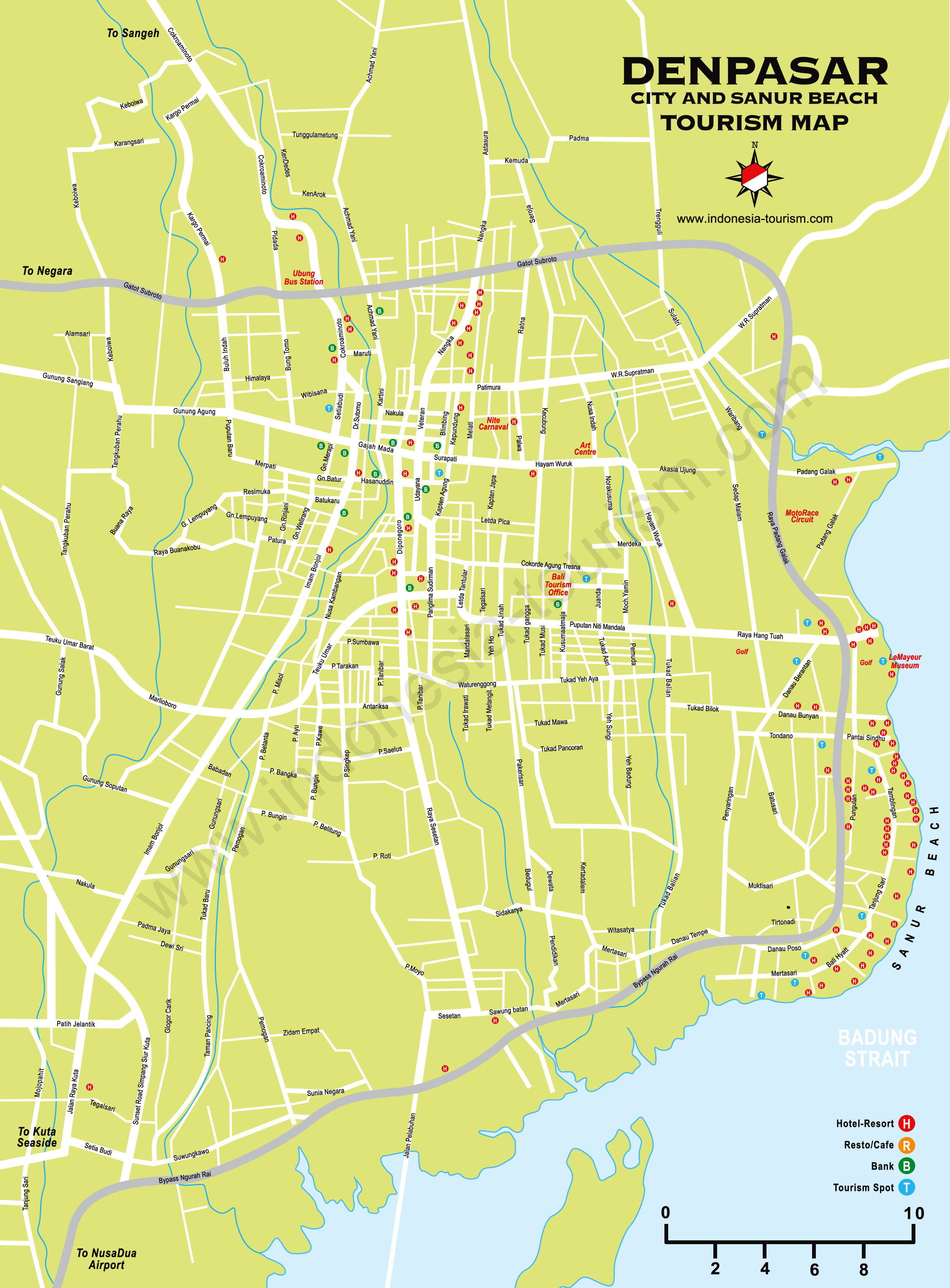
- Denpasar, Bali (Indonesia Tourism)
- Jakarta (Yahoo Travel)
- Jakarta [clickable] (Maps Jakarta)
- Jakarta - Central (Bing)
- Jakarta - City Center (Seasite)
- Jayapura [Satellite View] (Google Maps)
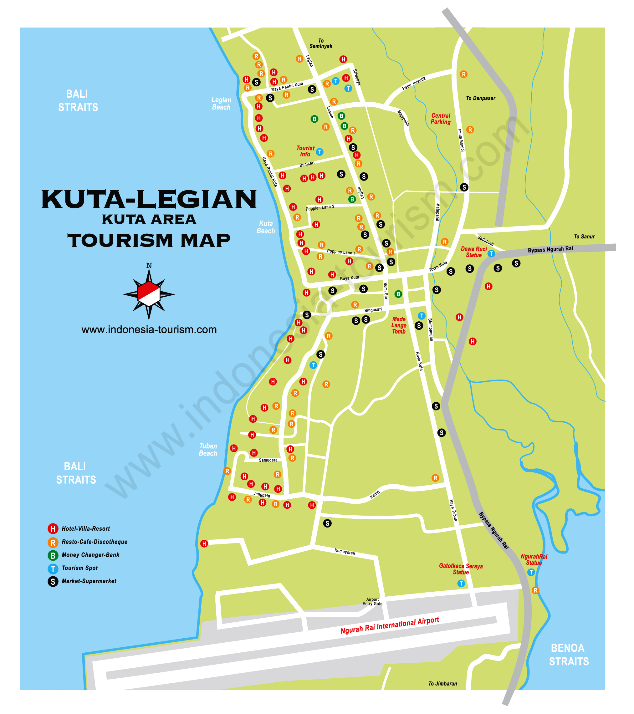
- Kuta, Bali (Indonesia Tourism)
- Malang Hill (EastJava)
- Nusa Dua, Bali (Plasa Bali)
- Surabaya (ABL Tours)
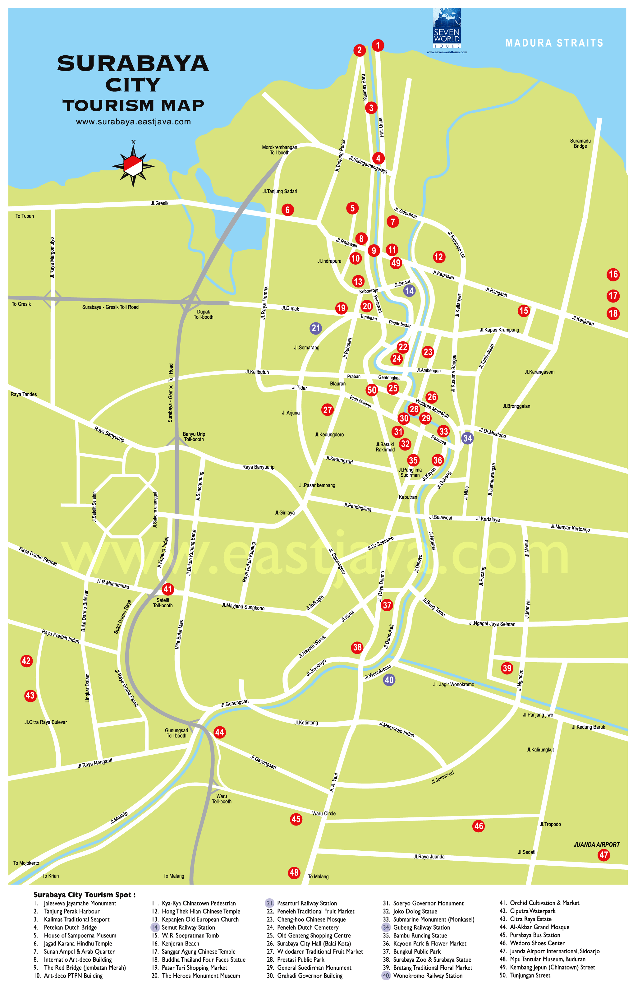
- Surabaya (EastJava)
- Ubud, Bali (Baliblog)
- Ujung Pandang (ABL Tours)
- Ujung Pandang (Magellan)
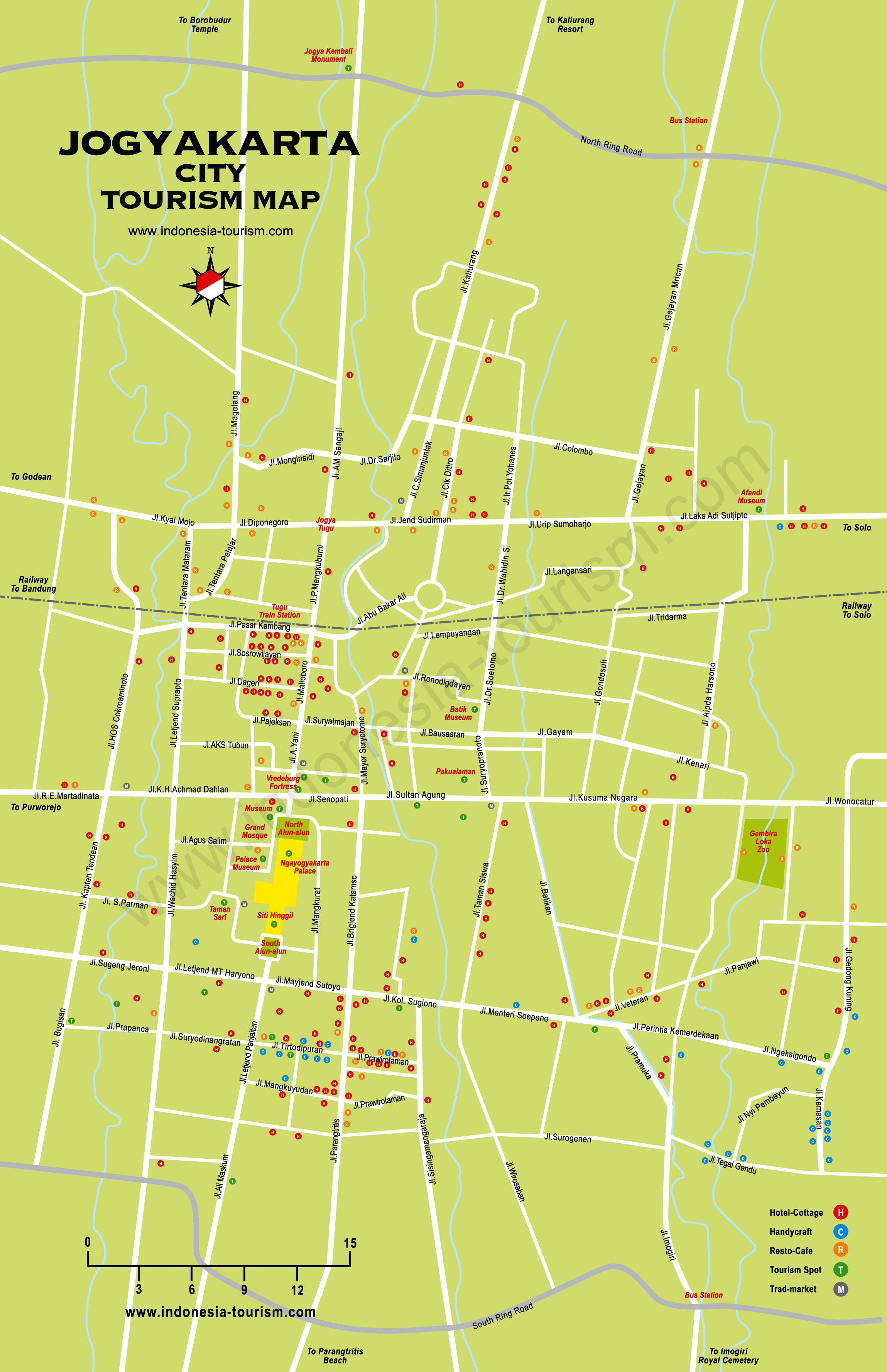
- Yogyakarta (ABL Tours)
- Yogyakarta (IndonesiaTourism.com)
- Yogyakarta (YogYes.com)
/6A5F249F618A72E38025709F00552647/$file/IDP%20locations%20Ambon%20City%20after%2025%20Ap%2004%20.jpg)