Perry-Castañeda Library
Map Collection
Illinois Maps
State Maps
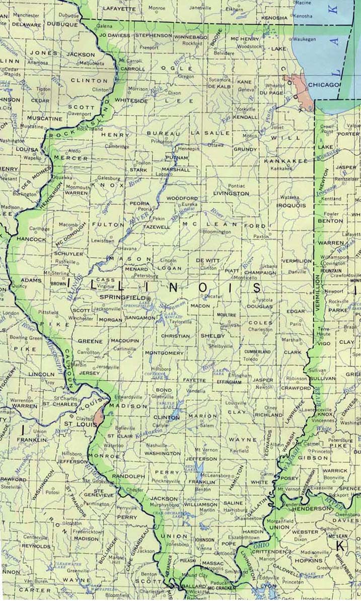
- Illinois (base map) JPEG format (243K) County boundaries and names, county seats, rivers. Original scale 1:2,500,000 U.S. Geological Survey, 1972 limited update 1990
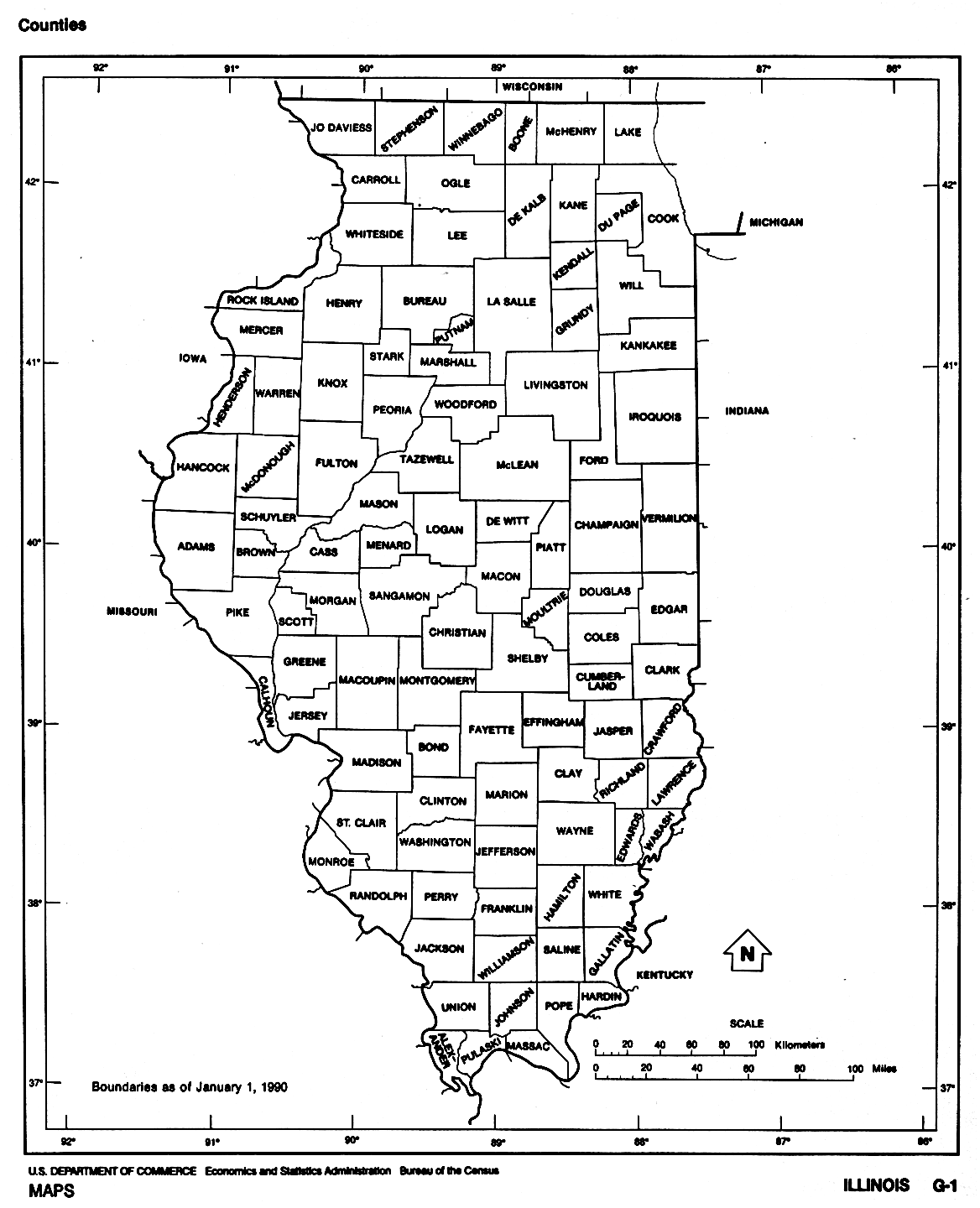
- Illinois (outline map) JPEG format (96K) County boundaries and names. U.S. Bureau of the Census, 1990
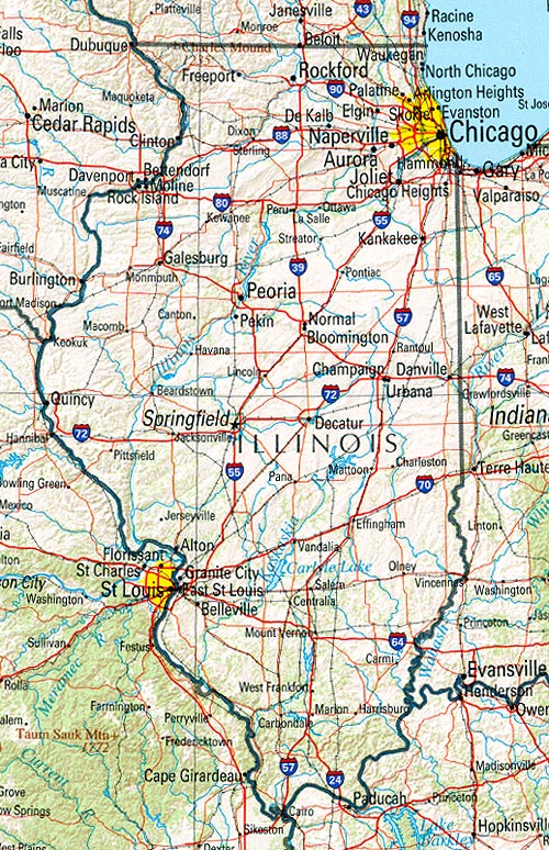
- Illinois (reference map) JPEG format (308K) Shaded relief map with state boundaries, forest cover, place names, major highways. Portion of "The National Atlas of the United States of America. General Reference", compiled by U.S. Geological Survey 2001, printed 2002
- Illinois (reference map) PDF format (248K) Shaded relief map with state boundaries, forest cover, place names, major highways. Portion of "The National Atlas of the United States of America. General Reference", compiled by U.S. Geological Survey 2001, printed 2002
- Illinois - Federal Lands and Indian Reservations PDF format (570K) The National Atlas of the United States of America, U.S. Geological Survey, 2003
Historical Topographic Maps
- Illinois Historical Topographic Maps (U.S. Geological Survey)
- Pre-1945 historical maps, scale 1:62,500 and special sheets
Historical City Maps
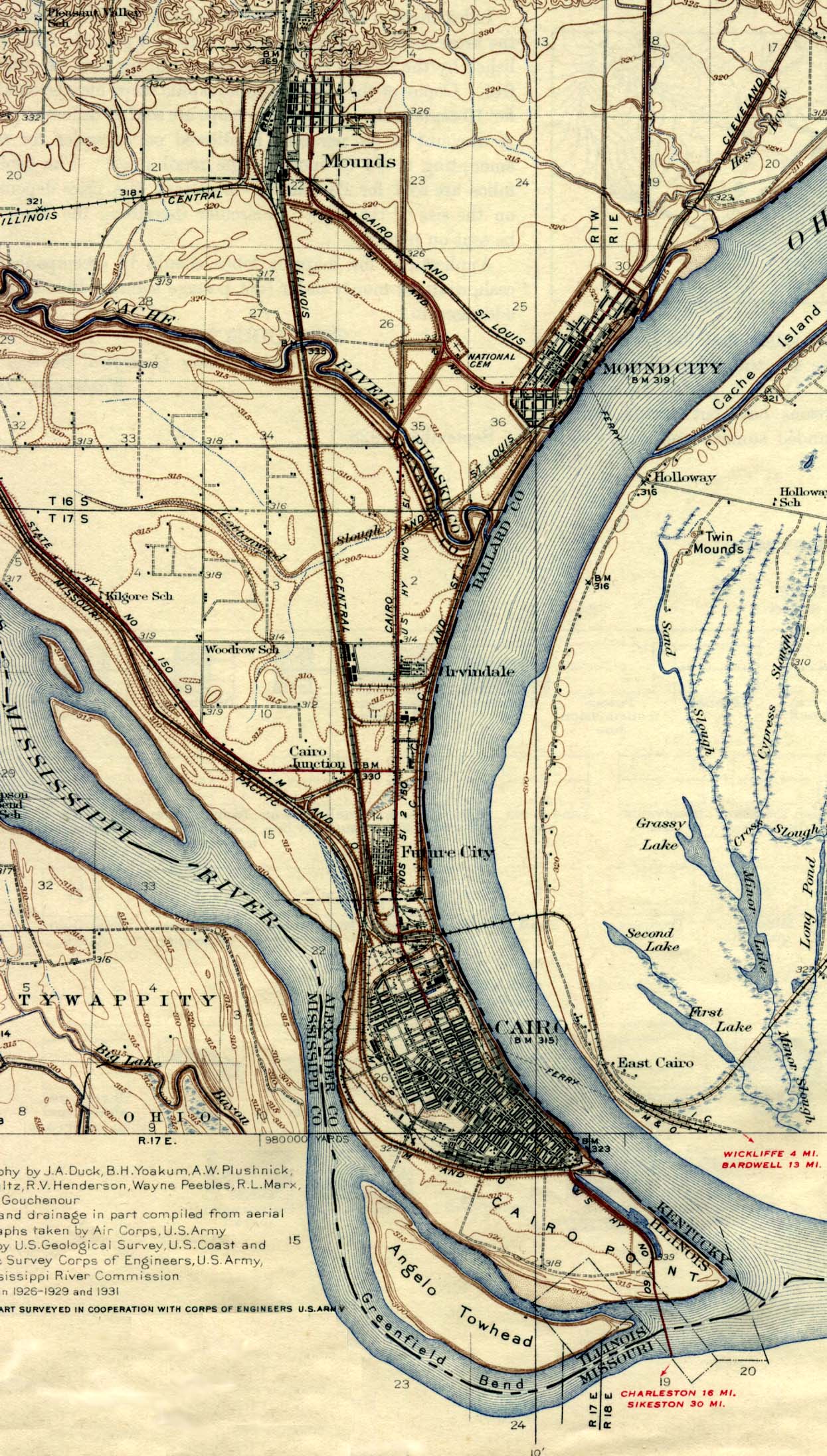
- Cairo 1945 U.S. Geological Survey (539K)
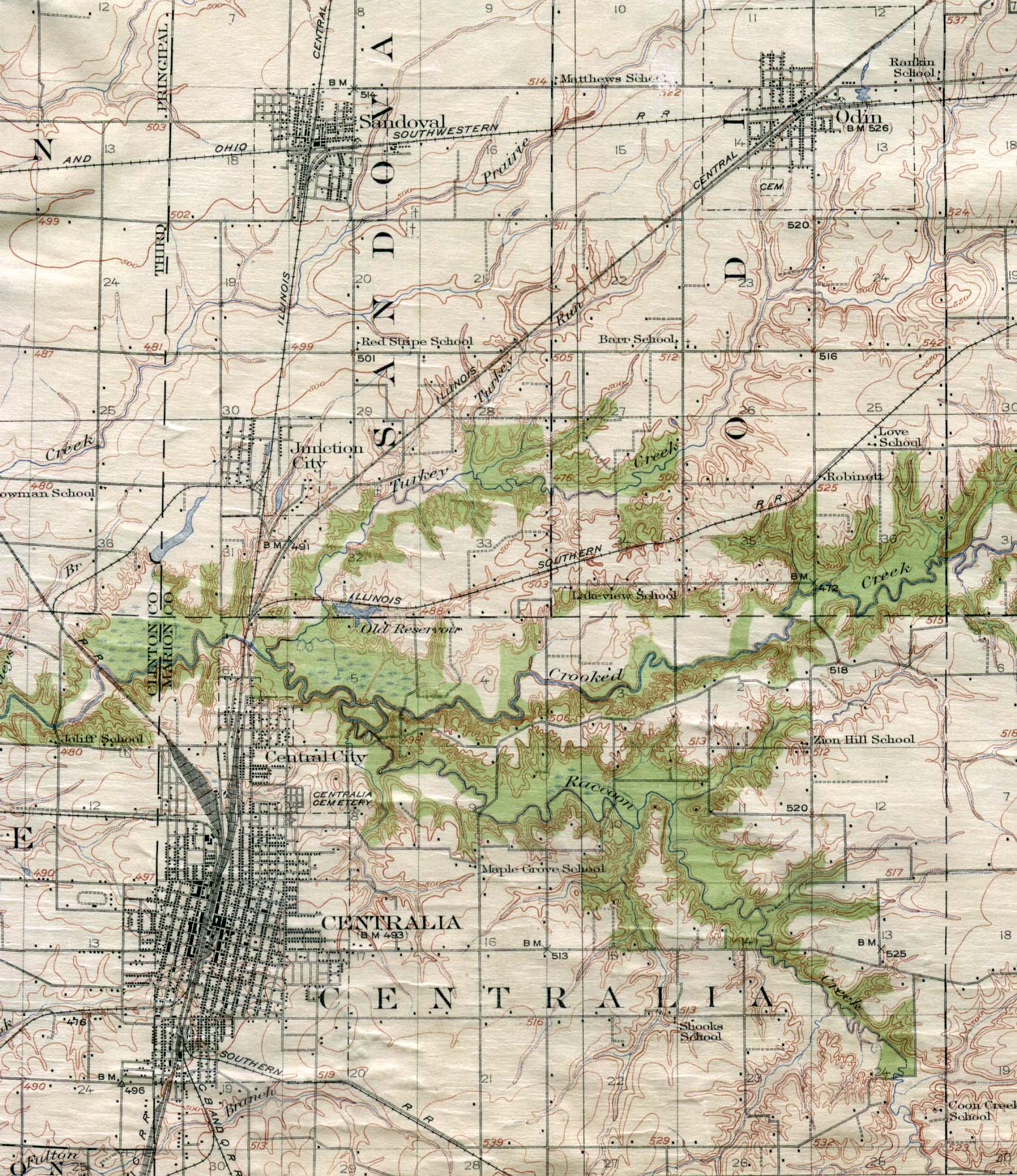
- Centralia 1914 U.S. Geological Survey (551K)
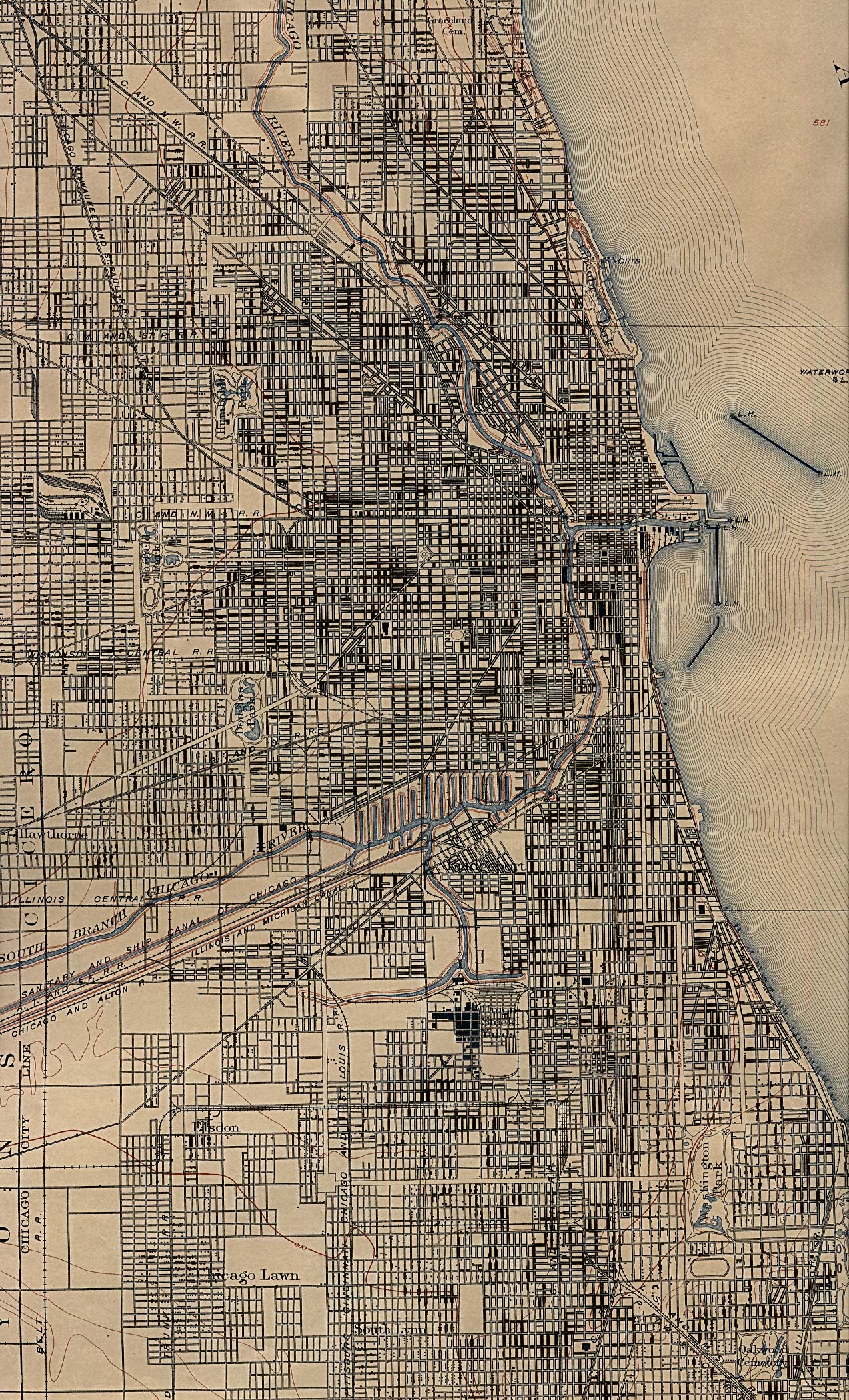
- Chicago 1901 U.S. Geological Survey (1,131K)
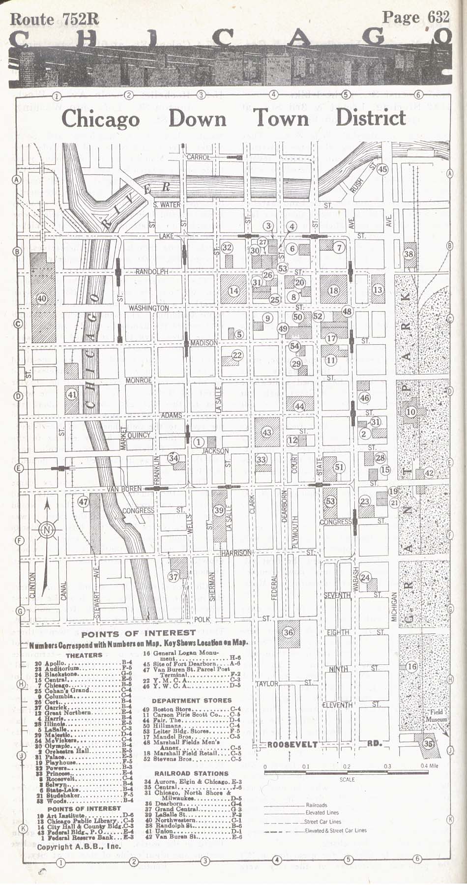
- Chicago - Downtown District 1917 Automobile Blue Book 1917, Volume 4 (280K)
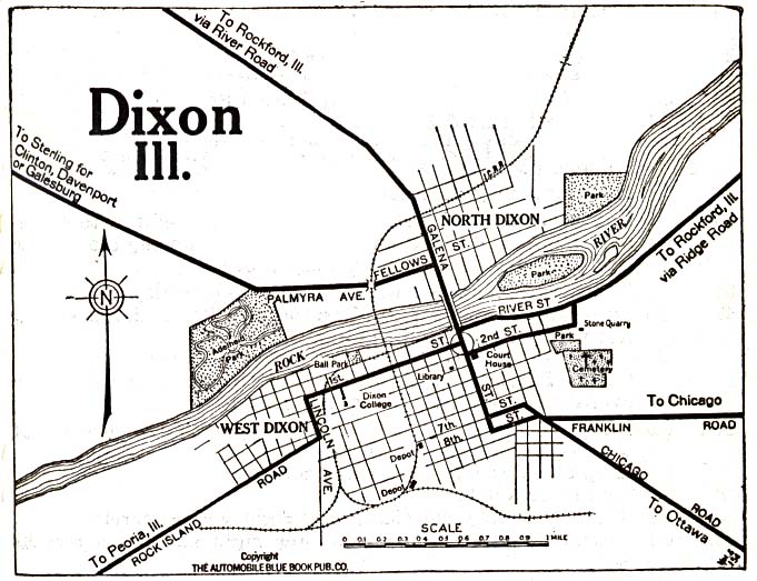
- Dixon 1919 Automobile Blue Book (117K)
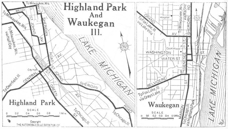
- Highland Park and Waukegan 1920 Automobile Blue Book, 1920, Vol. 5 (112K)
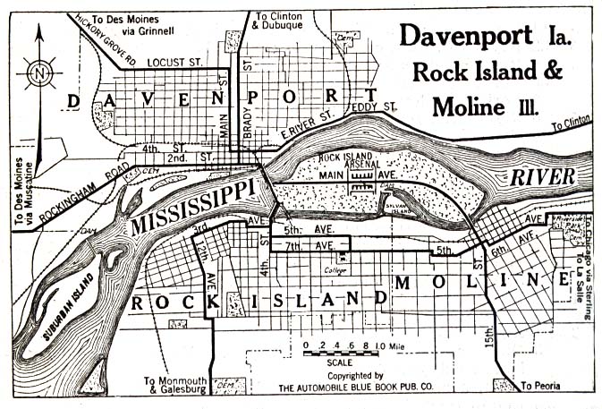
- Rock Island 1919 Automobile Blue Book (137K)
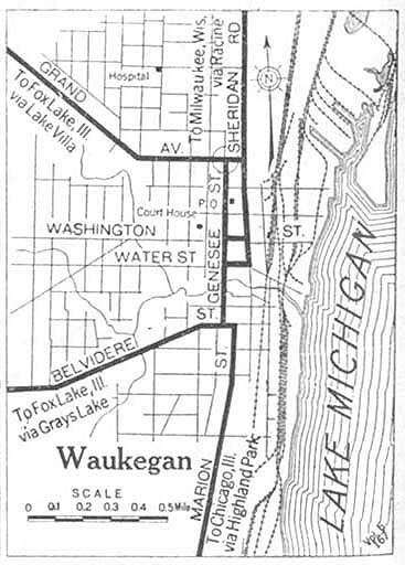
- Waukegan 1920 Automobile Blue Book, 1920, Vol. 5 (71K)
City Maps
- Chicago U.S. National Atlas 1970 (718K)
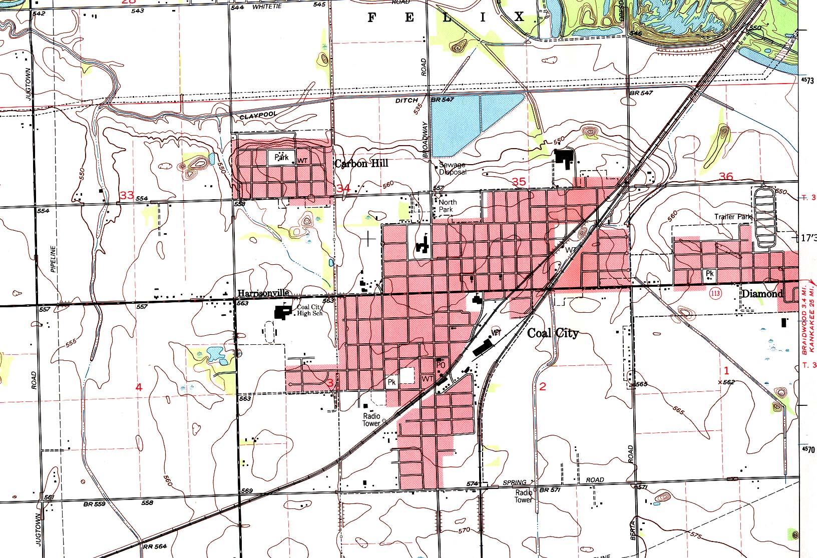
- Coal City (topographic) Original Scale 1:24,000 U.S.G.S. 1993 (516K)
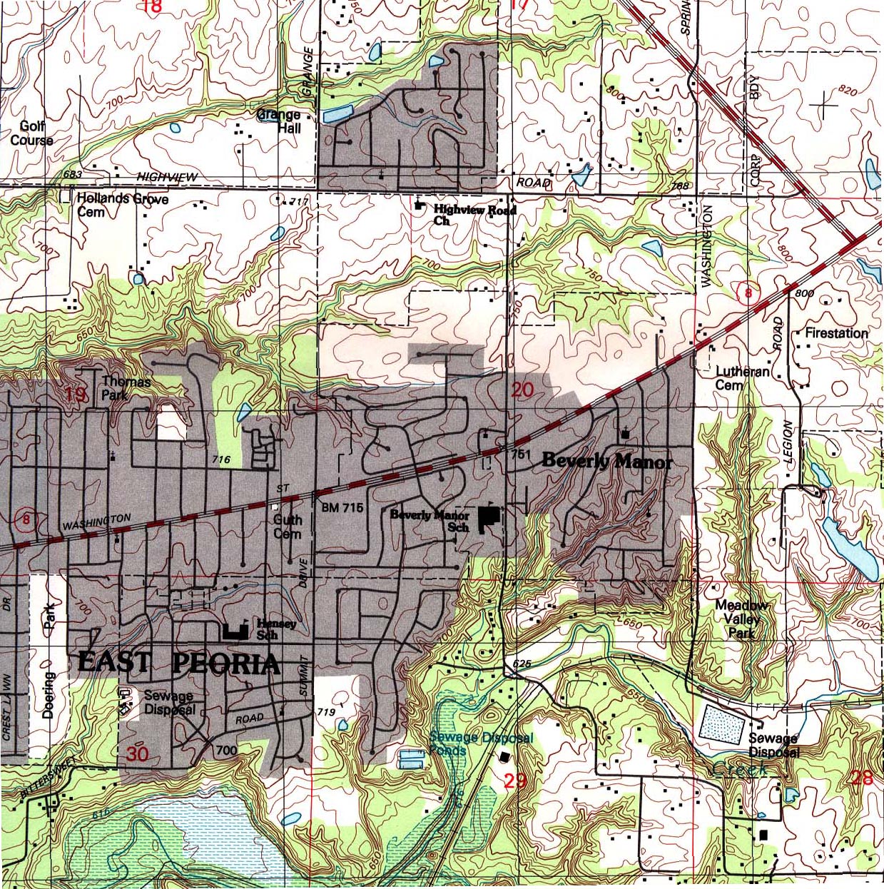
- East Peoria (topographic) Original Scale 1:24,000 U.S.G.S. 1995 (710K)
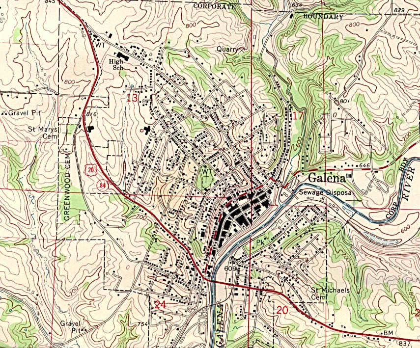
- Galena (topographic) original scale 1:24,000 U.S.G.S. 1968 (281K)
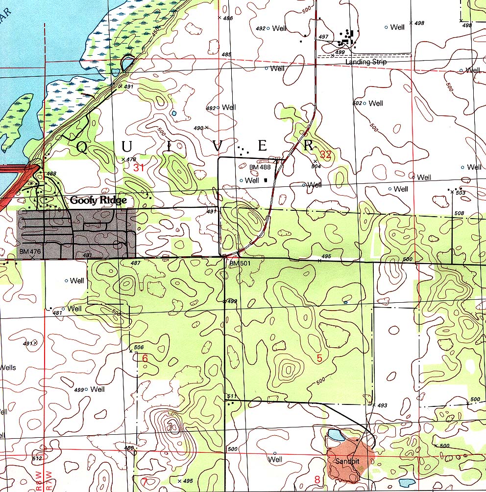
- Goofy Ridge (topographic) Original Scale 1:24,000 U.S.G.S. 1996 (452K)
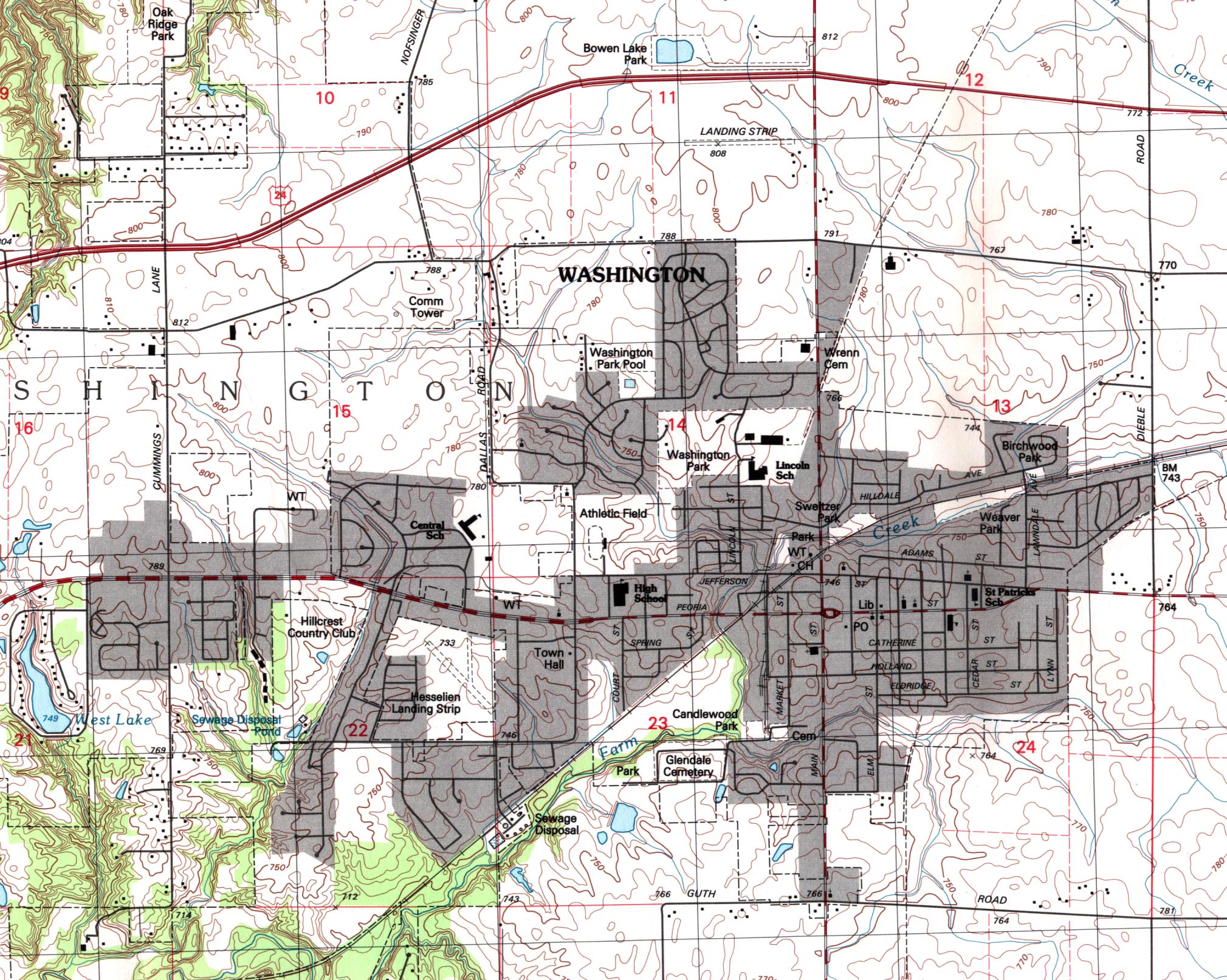
- Washington (topographic) Original Scale 1:24,000 U.S.G.S. 1995 (839K)
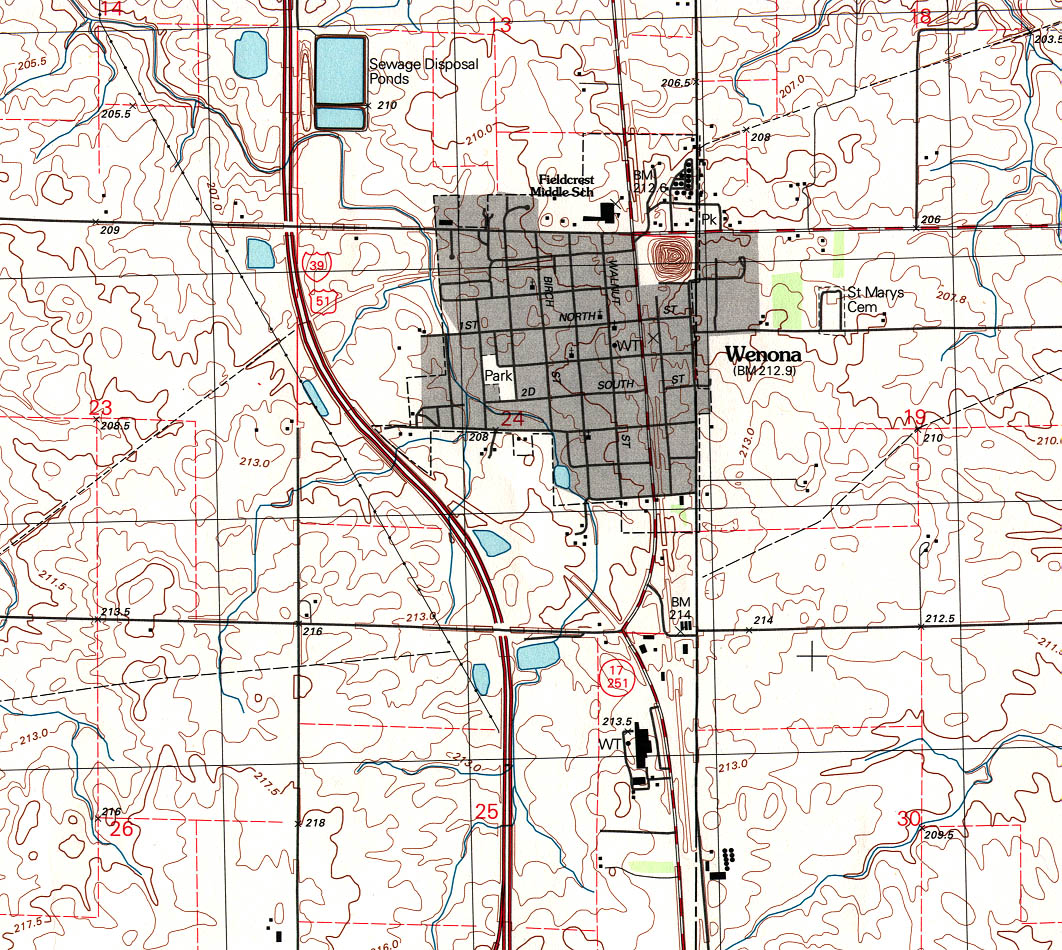
- Wenona (topographic) Original Scale 1:24,000 U.S.G.S. 1996 (516K)
- West Frankfort (topographic) Original Scale 1:24,000 U.S.G.S. 1963, photorevised 1978 (645K)
Maps on Other Web Sites