PCL Map Collection
>
Historical
Maps from the Journal of the Royal Geographical Society of London
Perry-Castañeda Library
Map Collection
Selected maps from
A Century of Population Growth
, from the First Census of the United States 1790-1900, Washington: Bureau of the Census 1909
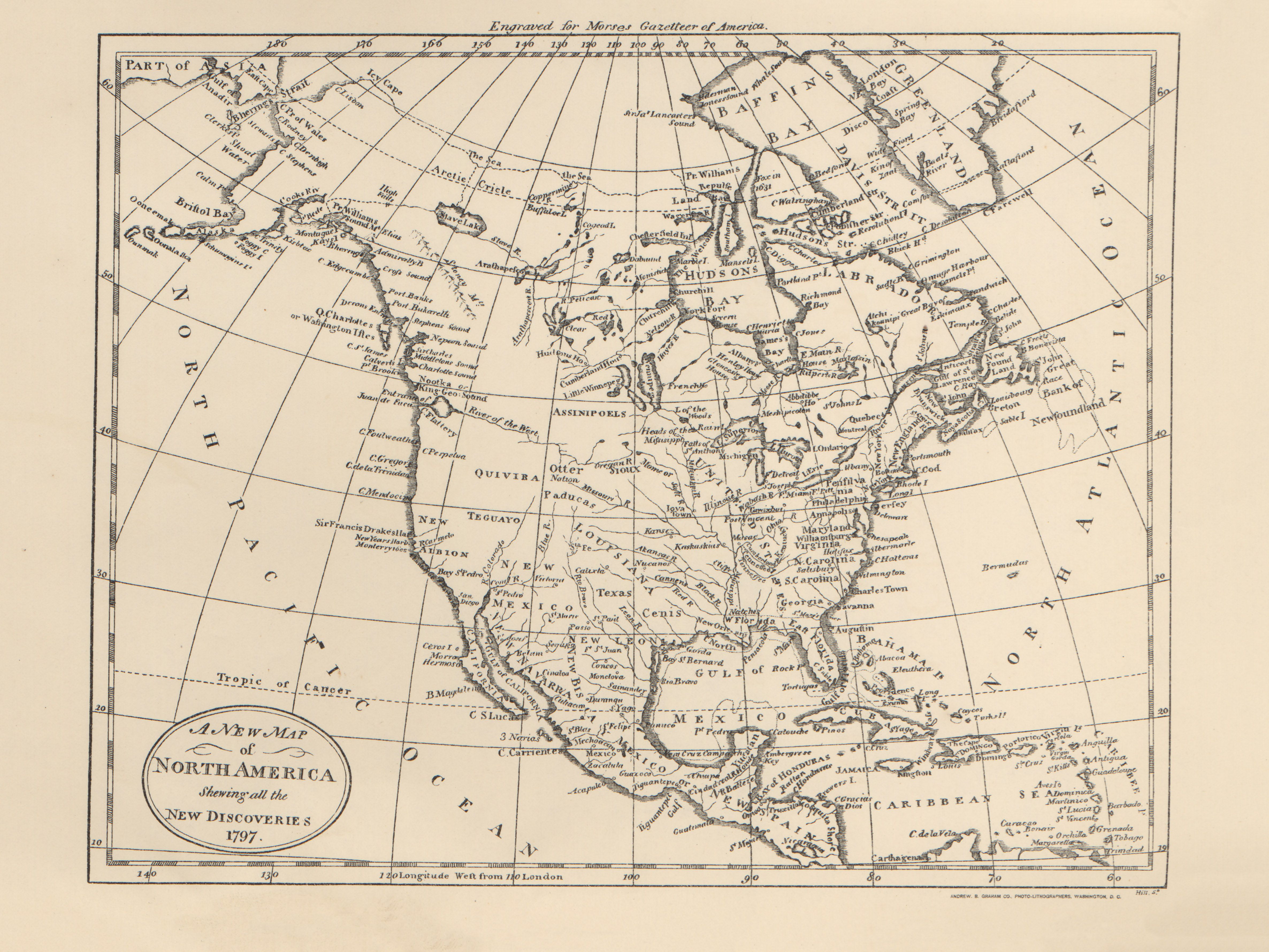
New Map of North America
(3.2MB)
"A New Map of North America" showing all the new discoveries, 1797.
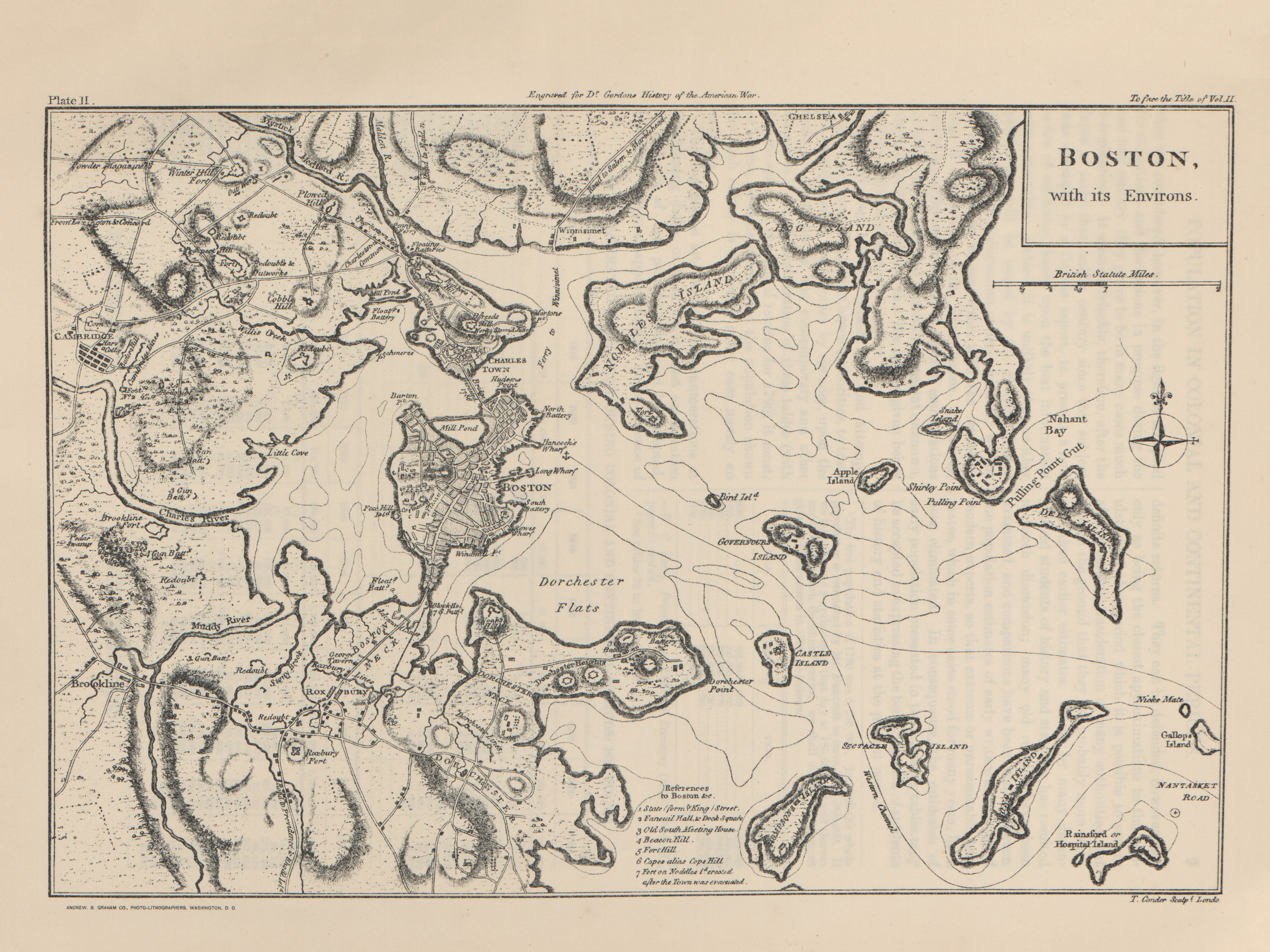
Boston
(4.1MB)
"Boston" with its Environs.
The United States
(2.2MB)
"The United States", Inhabited area in United States, 1790.
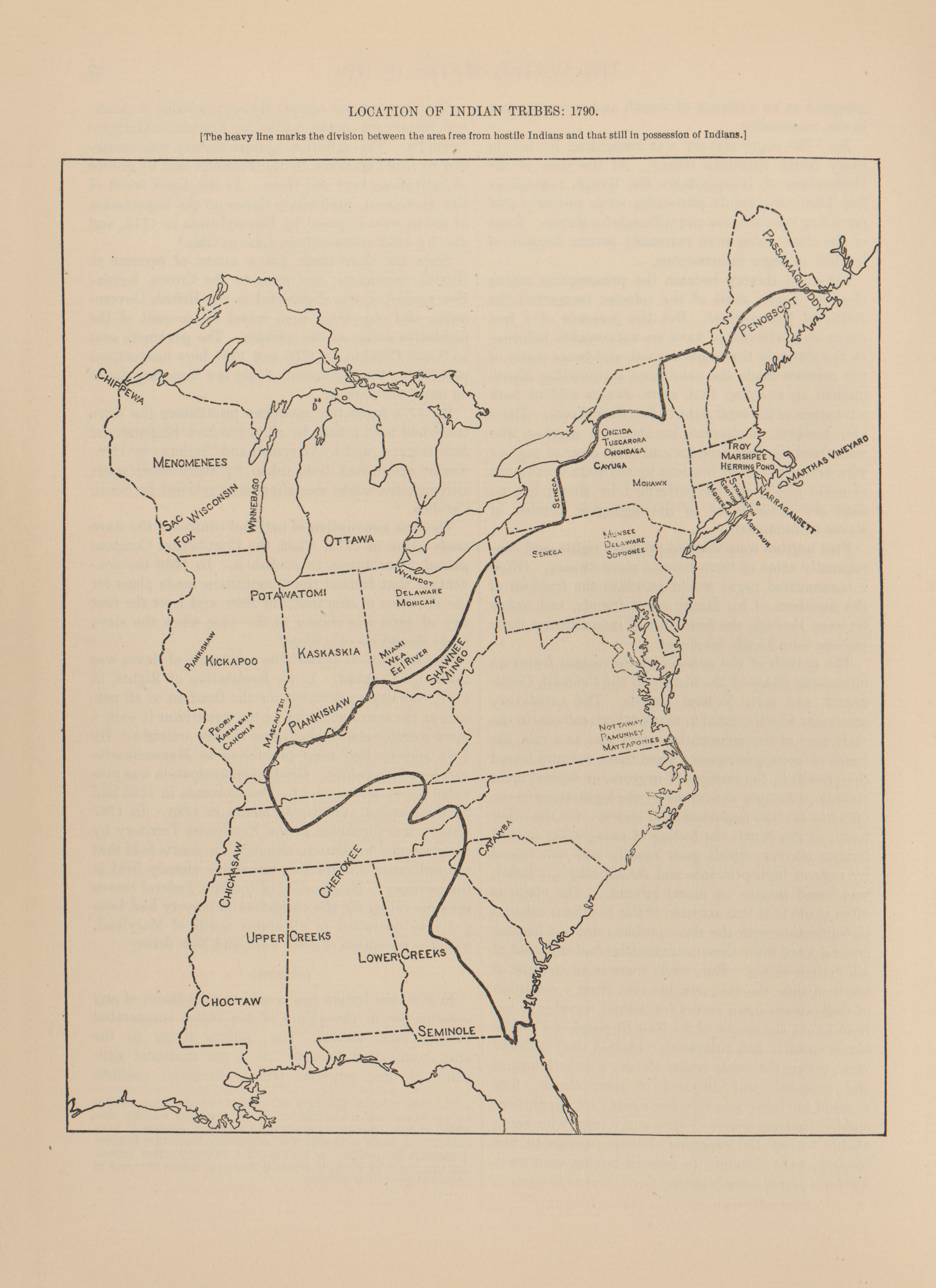
Location of Indian Tribes
(1.7MB)
"Location of Indian Tribes", Inhabited area in United States, 1790.
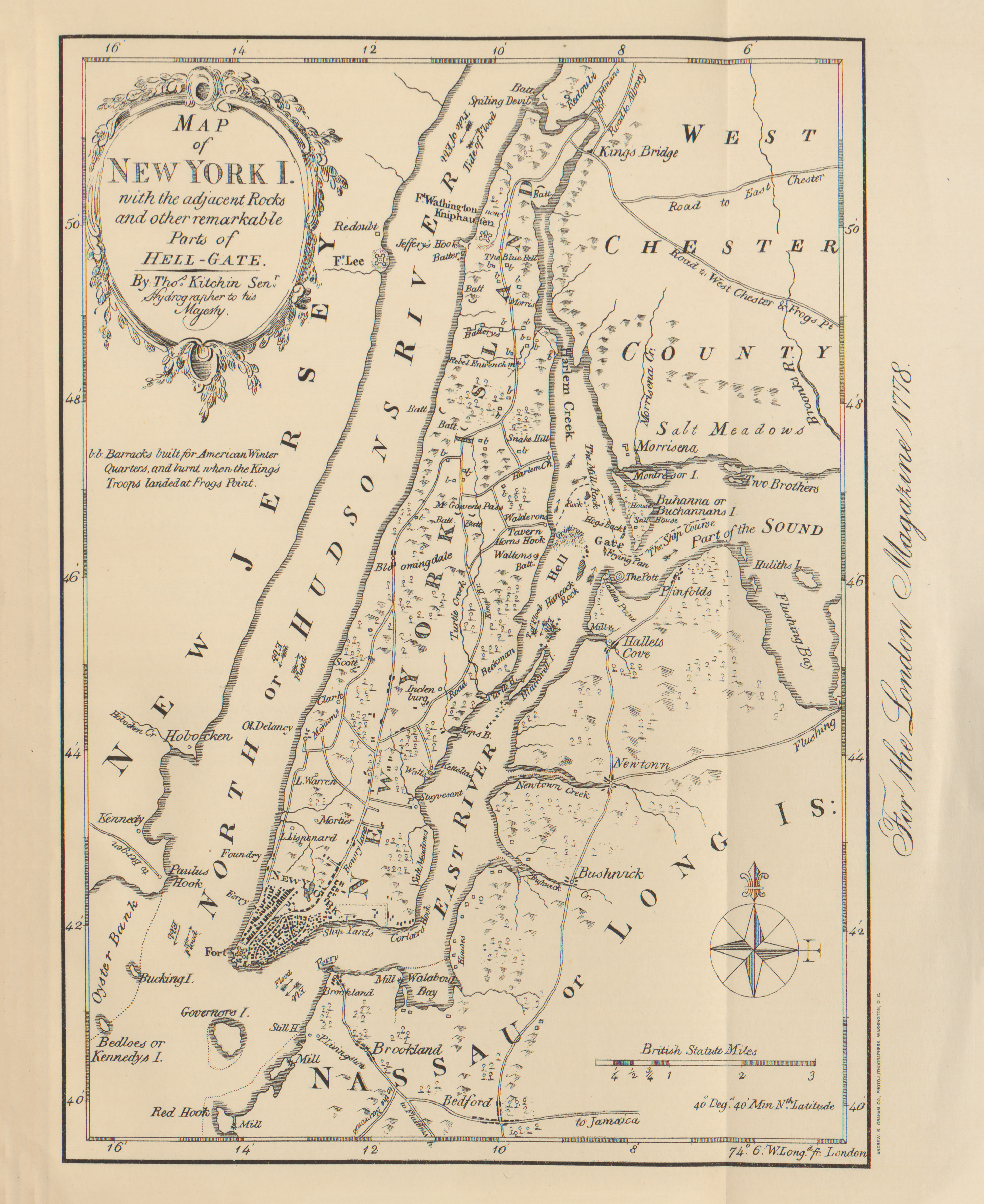
New York
(3.2MB)
"New York" with adjacent rocks and other remarkable parts of Hell-Gate, 1778.
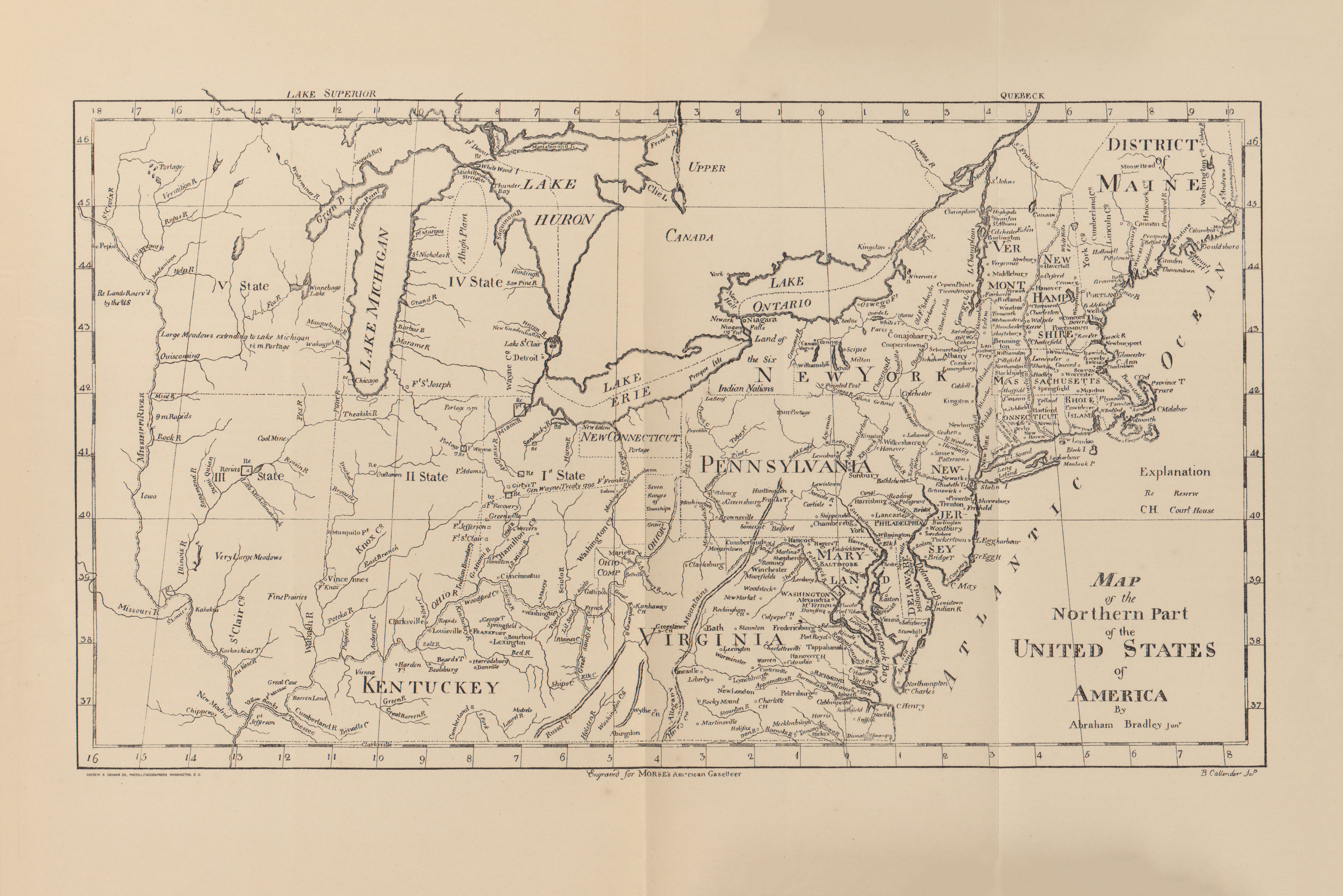
Northern Part of the United States
(5.3MB)
"Map of the Northern Part of the United States of America", Abraham Bradley.
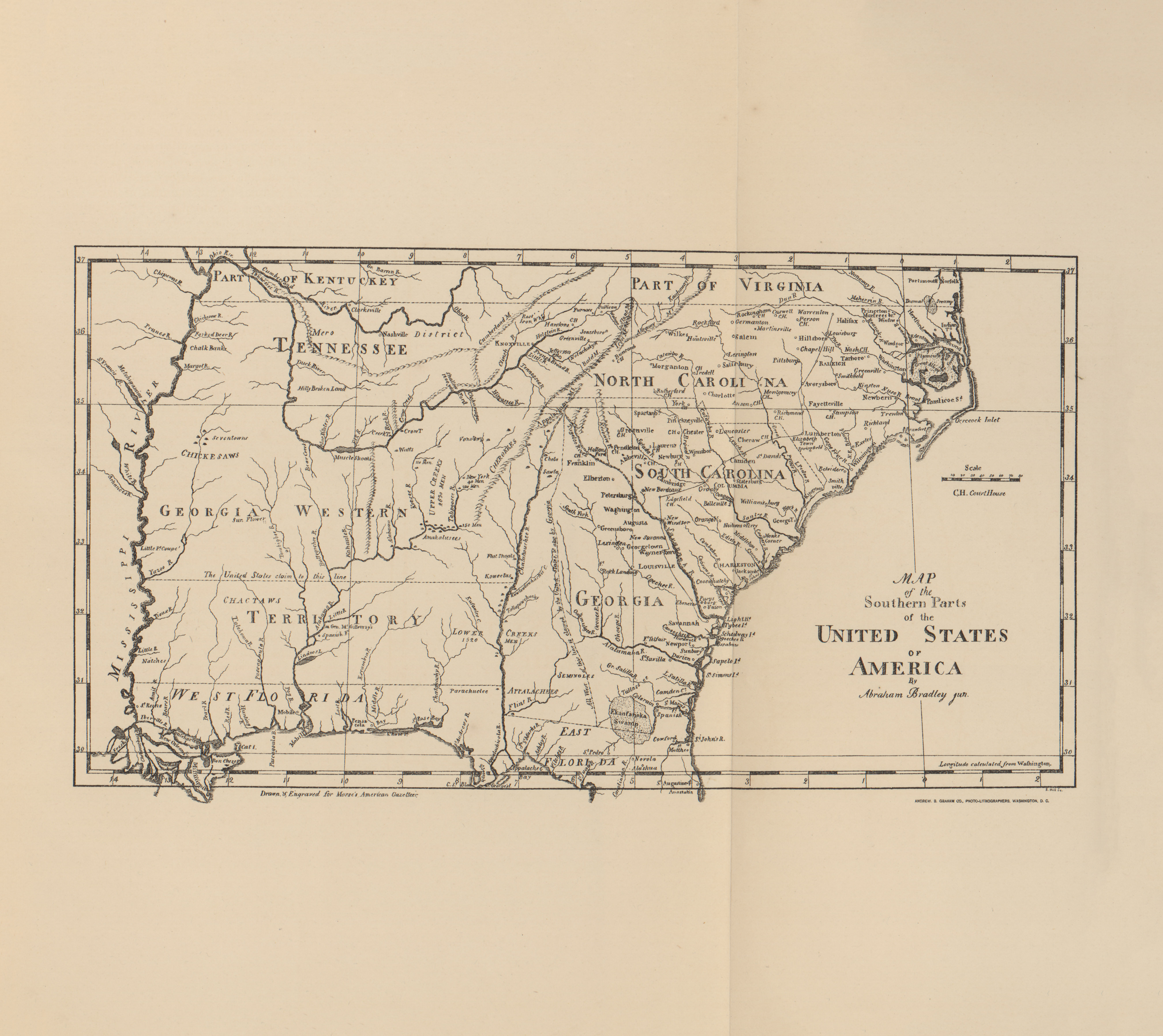
Southern Part of the United States
(3.4MB)
"Map of the Southern Part of the United States of America", Abraham Bradley.
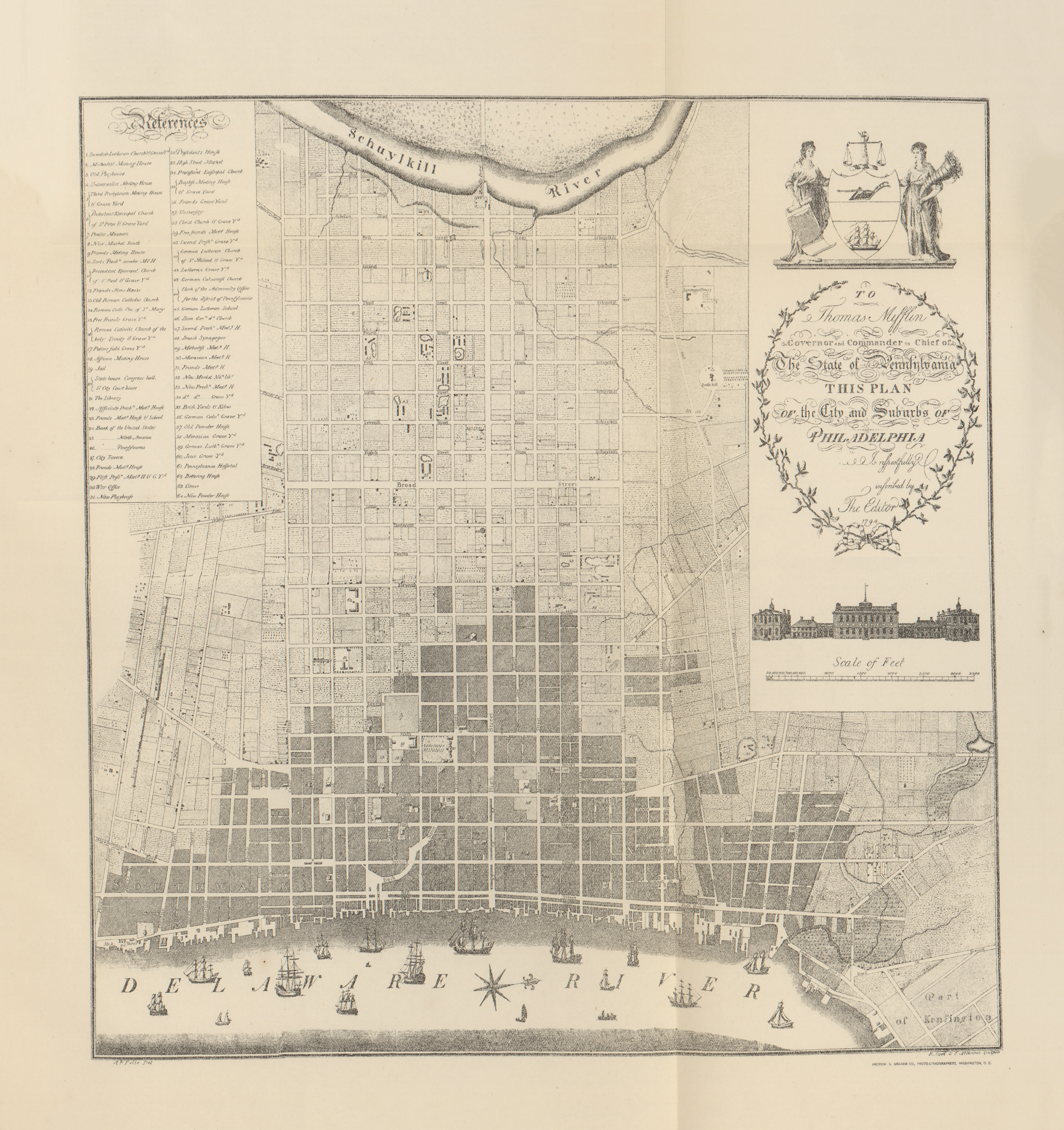
Philadelphia
(8.8MB)
"Philadelphia", Map showing plan of the city and suburbs of Philadelphia, 1794.
New York City Plan
(2.8MB)
"Plan of the City of New York", 1789.
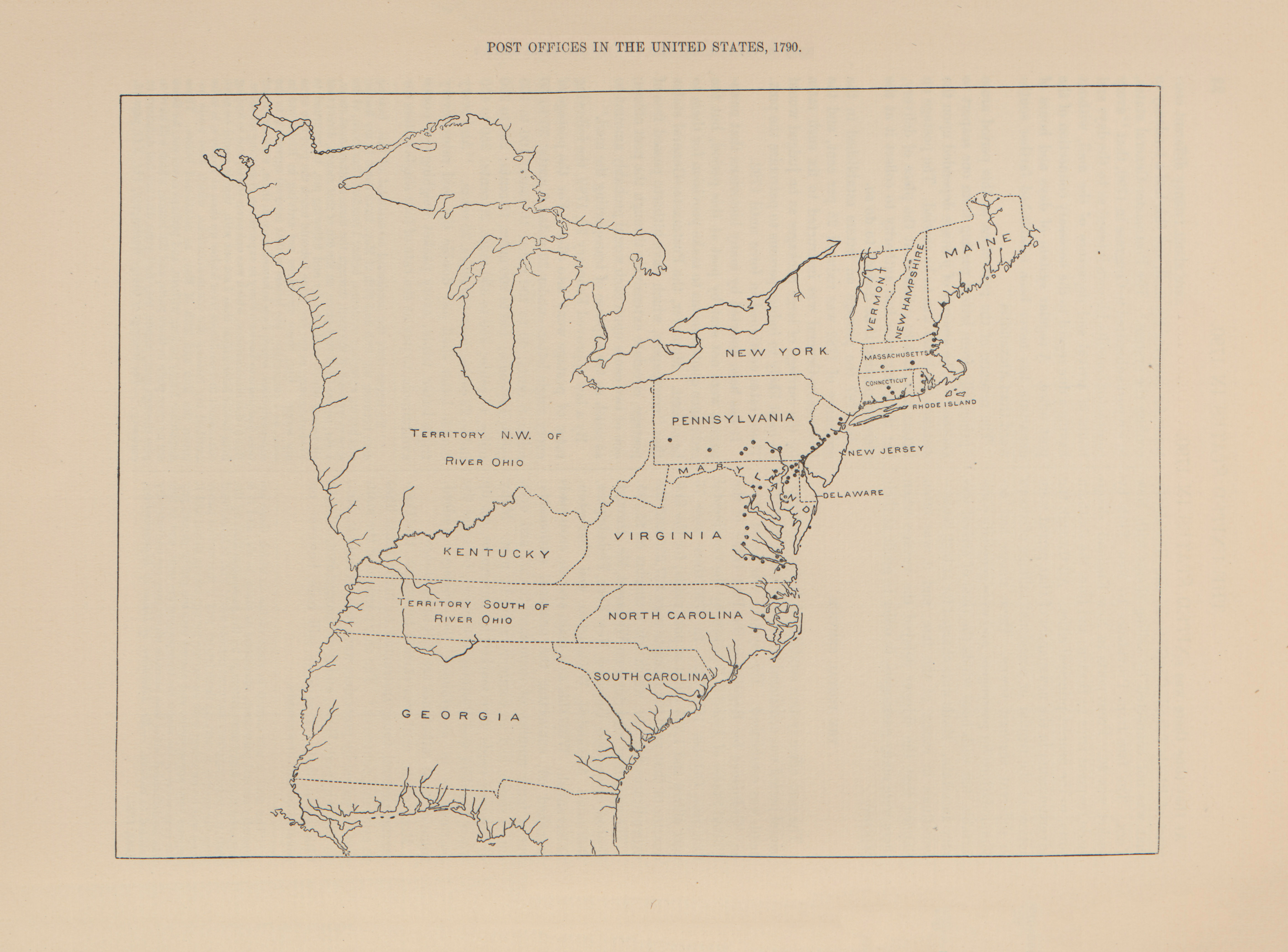
Post Offices in the United States
(1.5MB)
"Post Offices in the United States", 1790.