Perry-Castañeda Library
Map Collection
A Handbook of Mexico (1919)
The following are the maps from A Handbook of Mexico, Great Britain. Naval Intelligence Division, 1919.
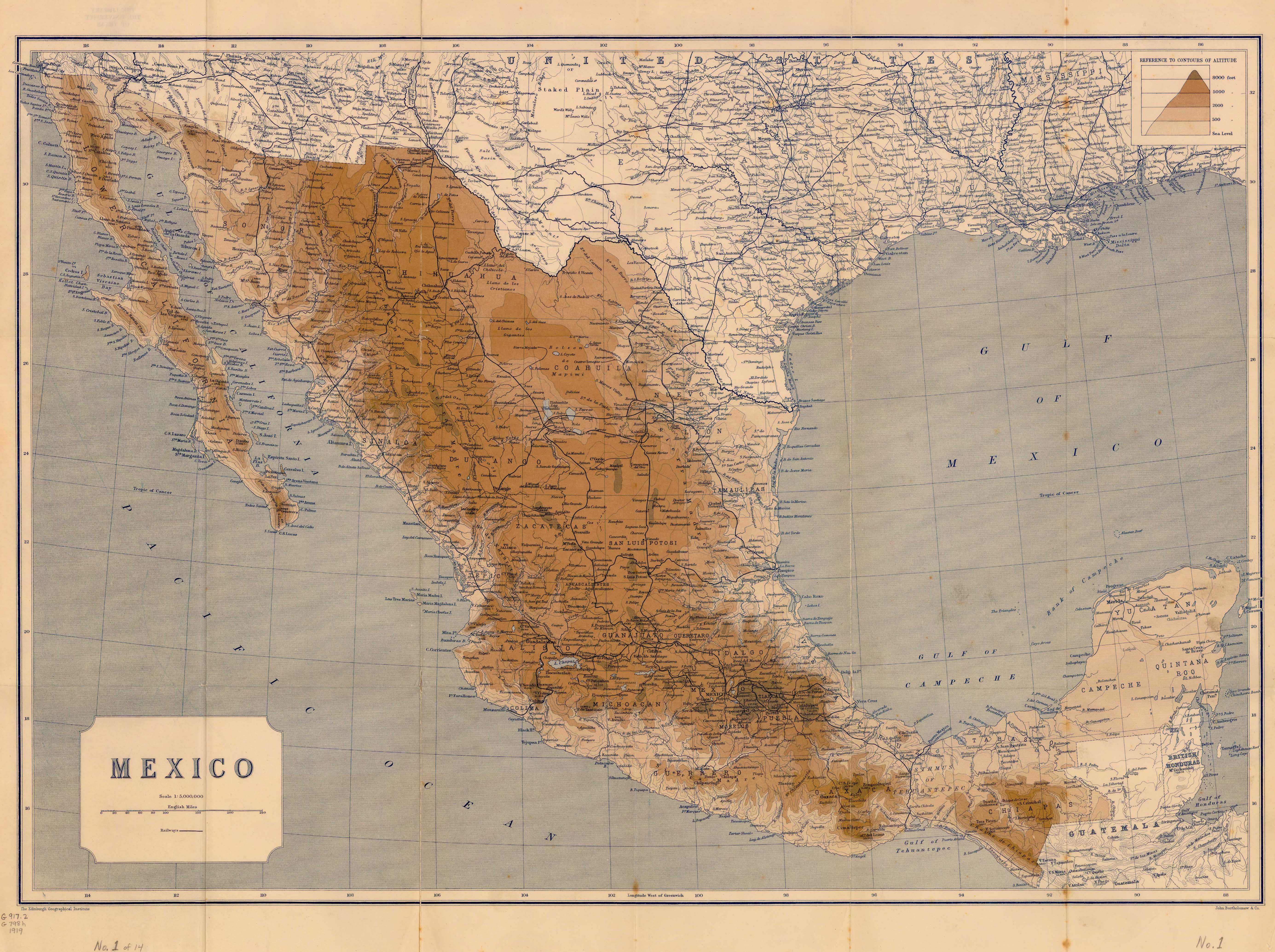
General Map of Mexico (2.53MB) Original scale 1:5,000,000
Northern Vera Cruz Oil Area (529K) Original scale 1:750,000
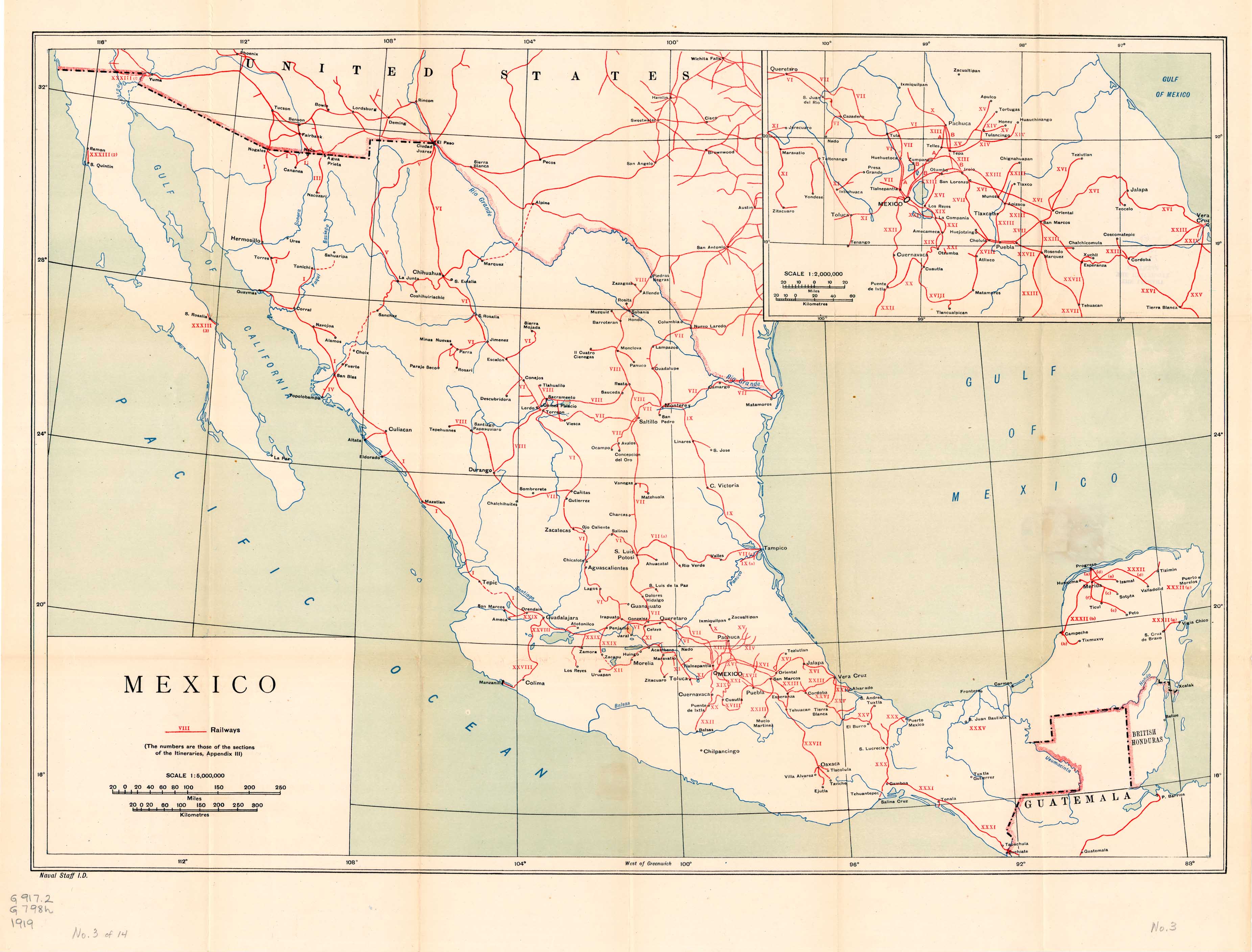
Railways (819K) Original scale 1:5,000,000
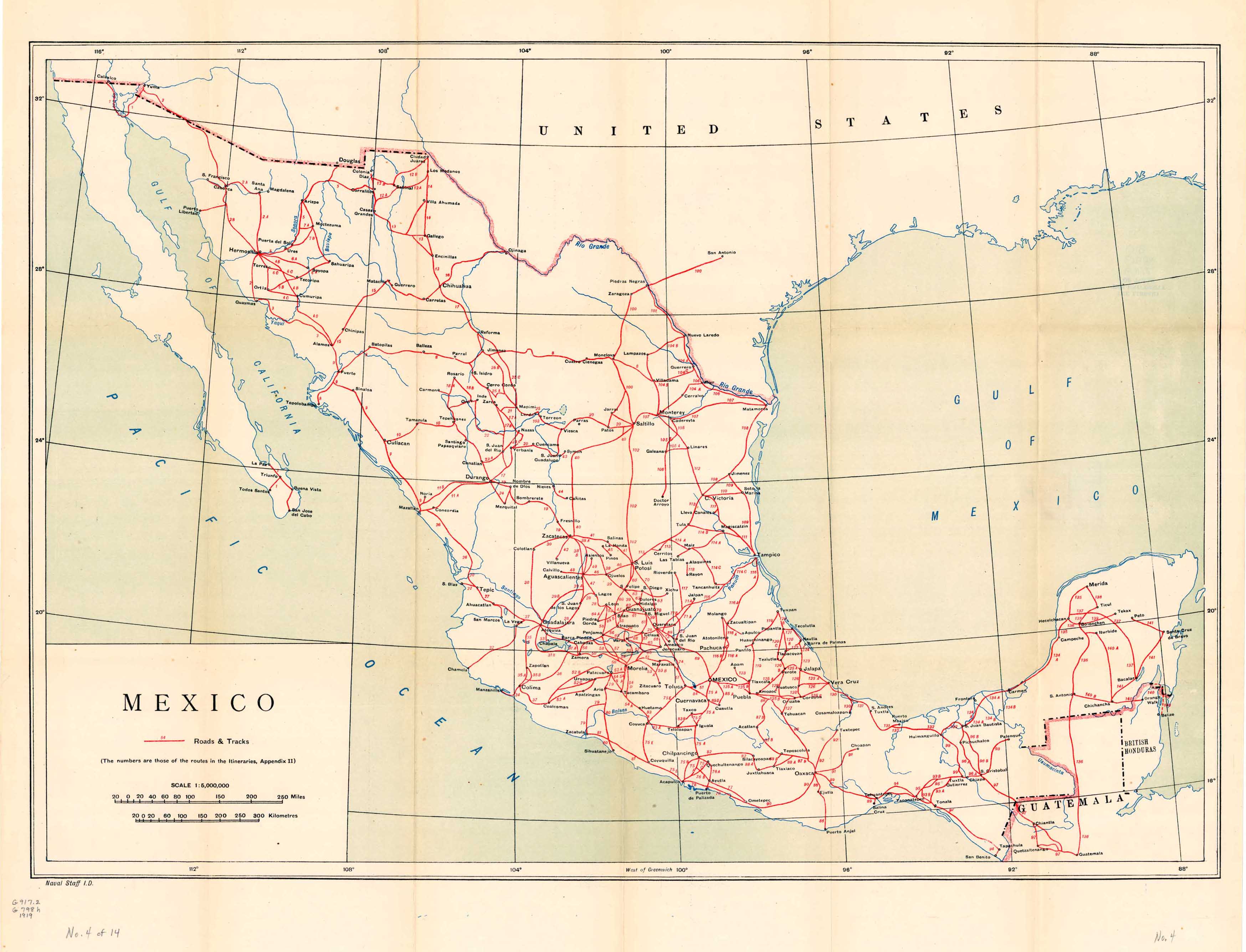
Roads and Tracks (723K) Original scale 1:5,000,000
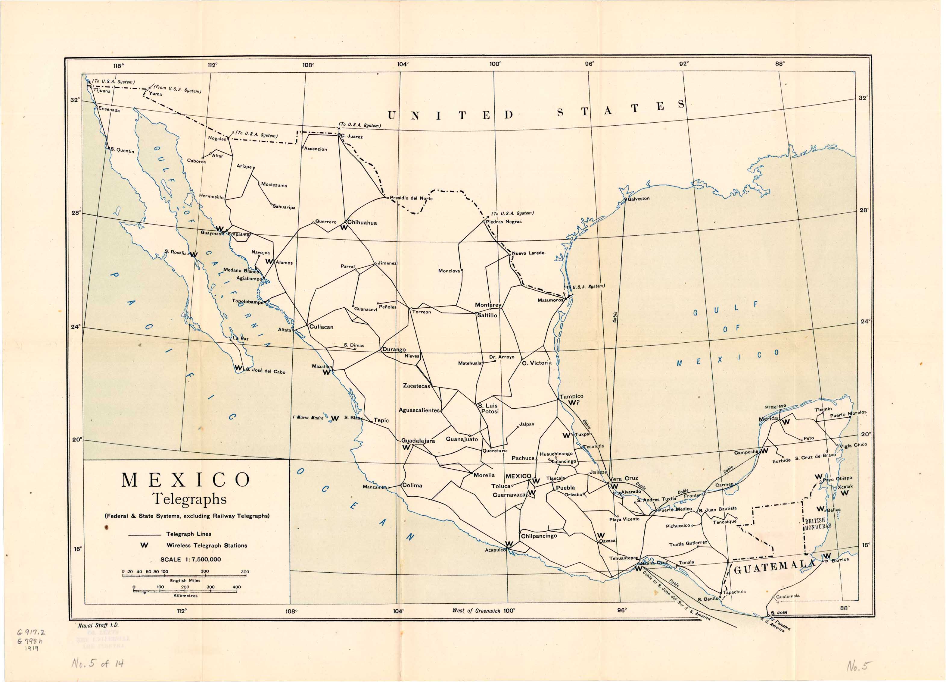
Telegraphs (488K) Original scale 1:7,500,000
Federal and State Systems, excluding Railways and Telegraphs.
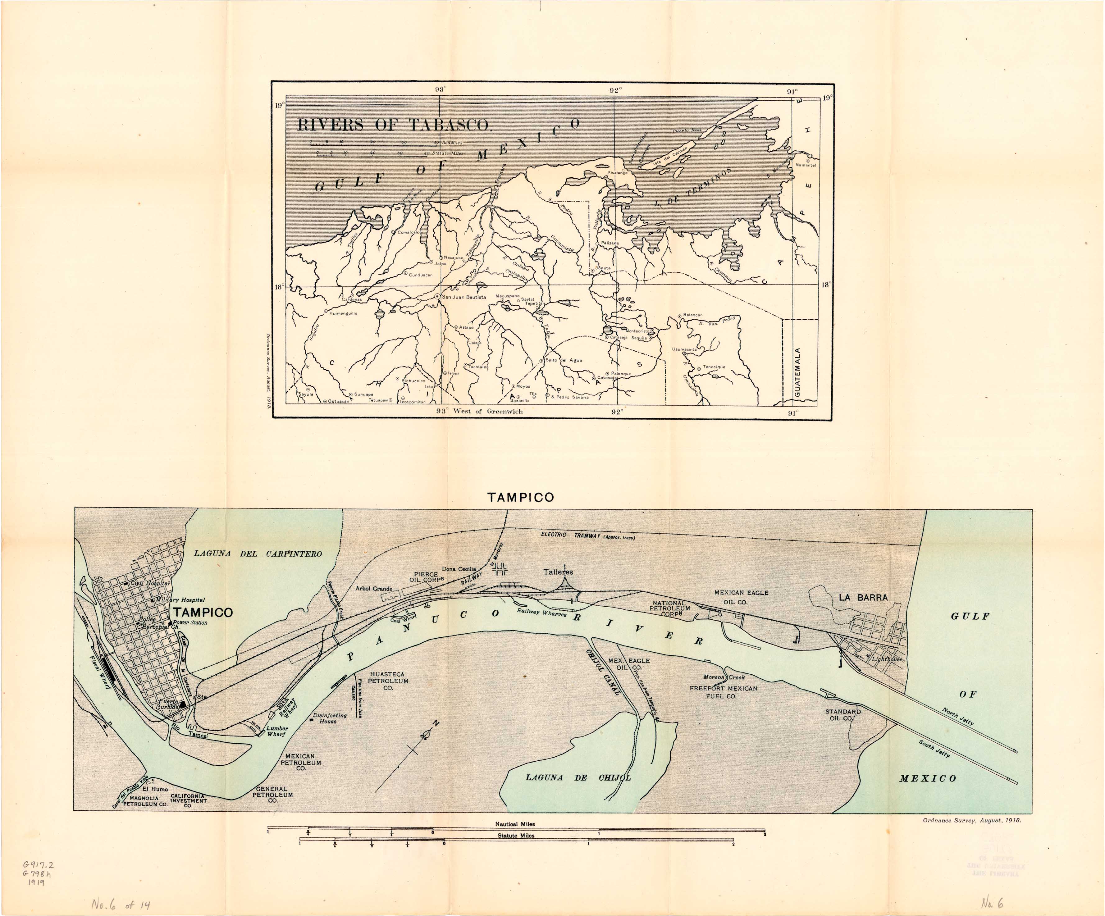
Rivers of Tabasco and Tampico (859K)
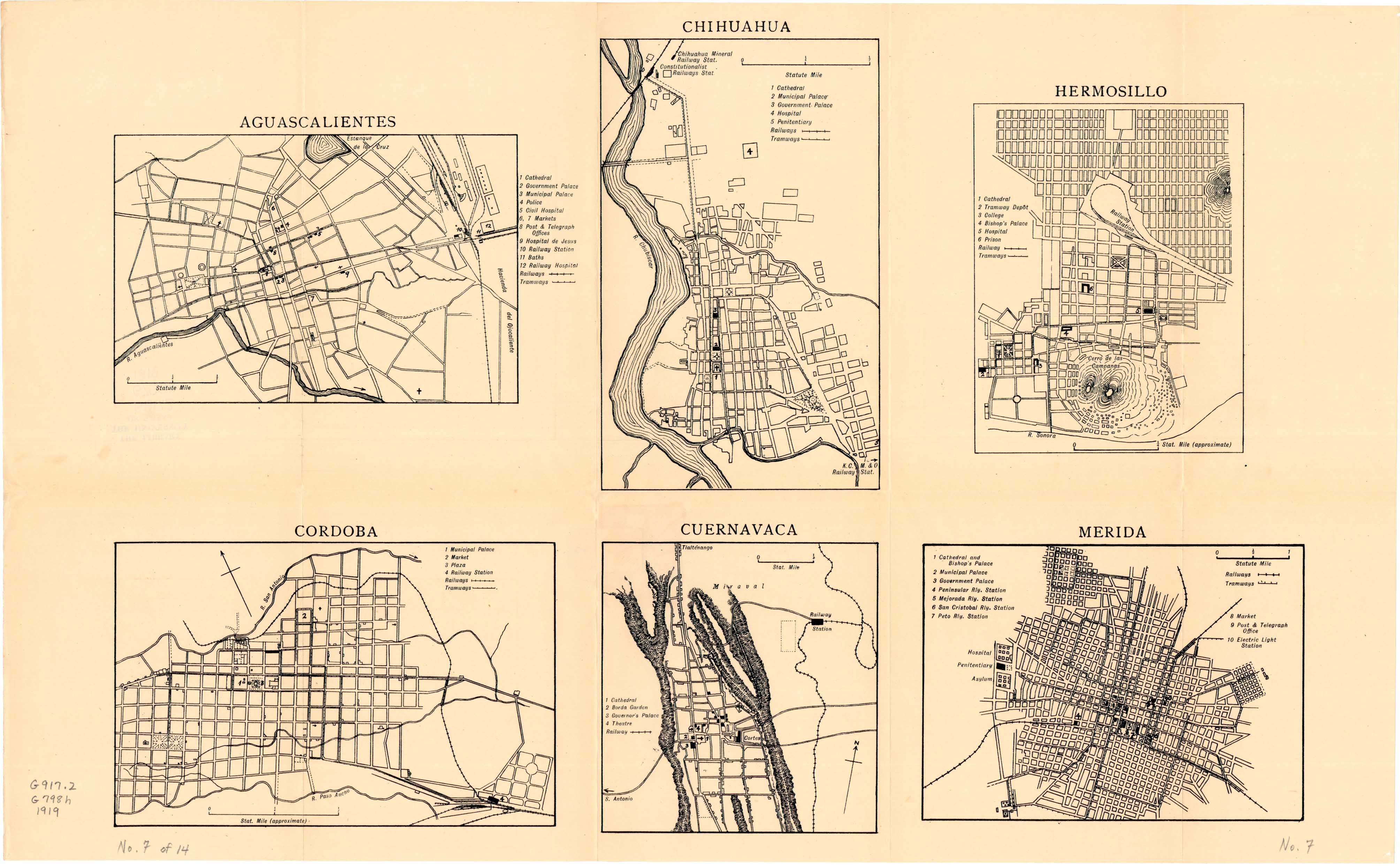
Plans of Inland Towns: Aguascalientes, Chihuahua, Cordoba, Cuernavaca, Hermosillo, Merida (819K)
Plans of Inland Towns: Durango, Guadalajara, Guanajuato, Mexico City (1.2MB)
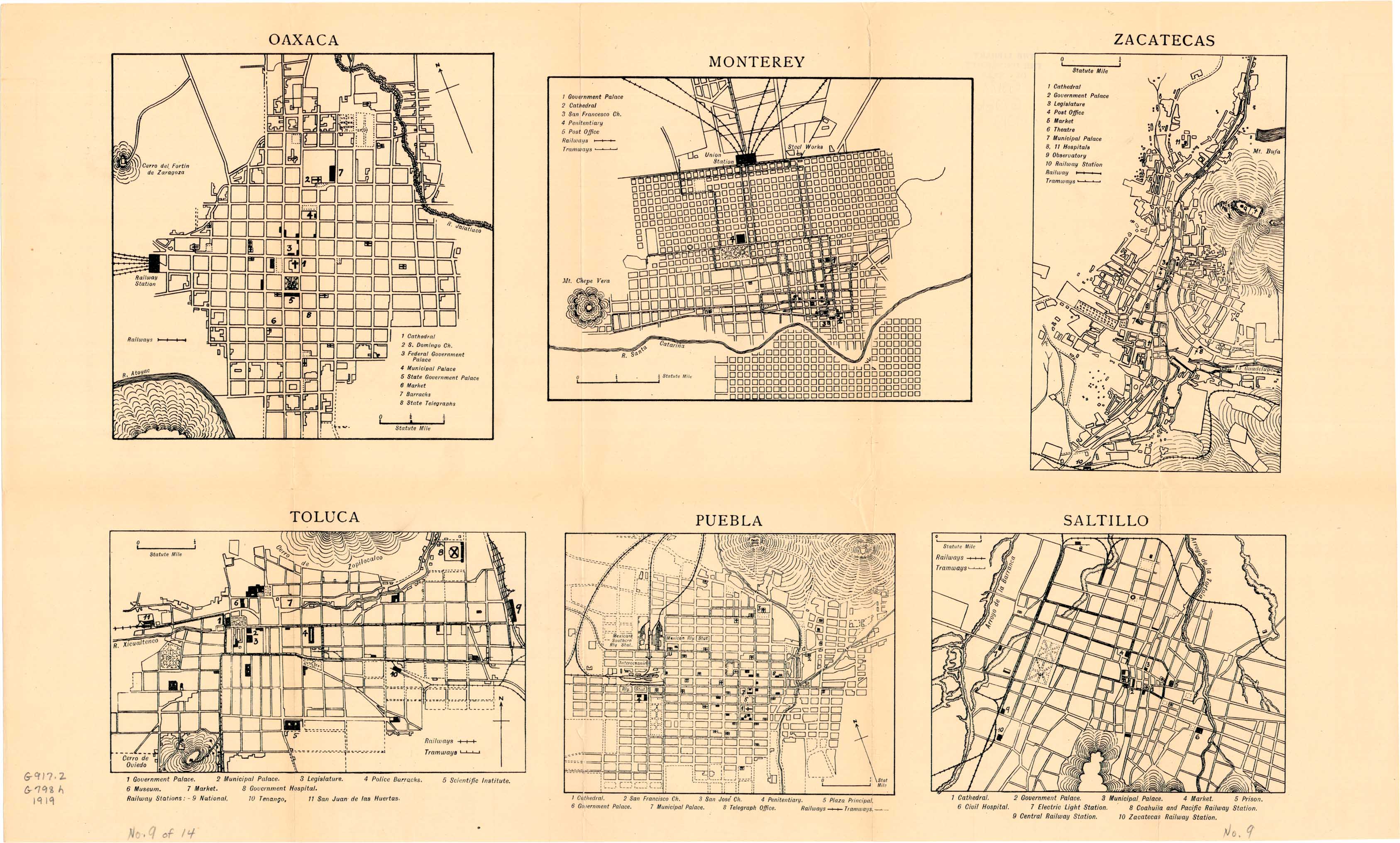
Plans of Inland Towns: Oaxaca, Monterey, Puebla, Saltillo, Toluca, Zacatecas (830K)
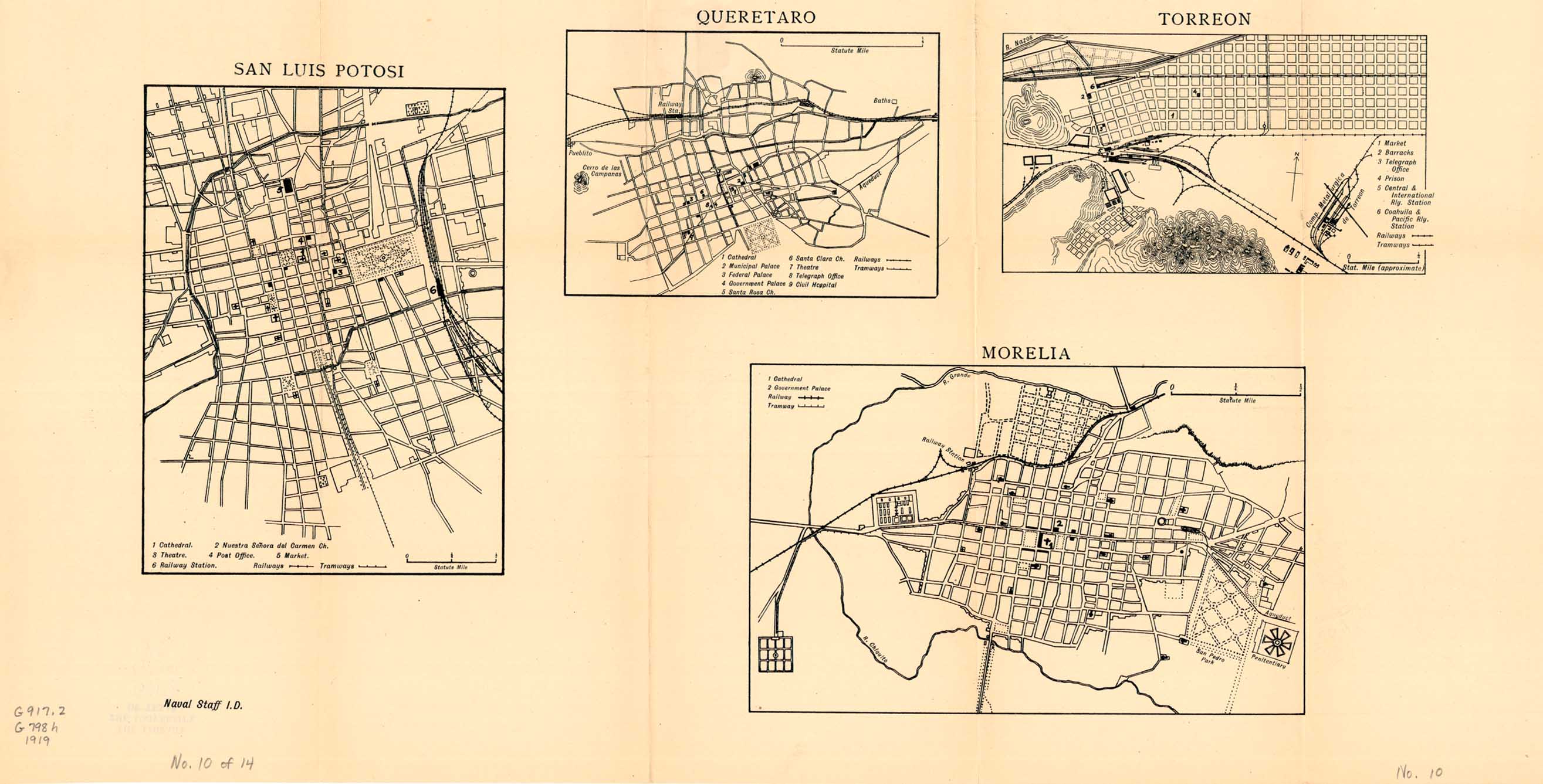
Plans of Inland Towns: Morelia, Queretaro, San Luis Potosi, Torreon (367K)
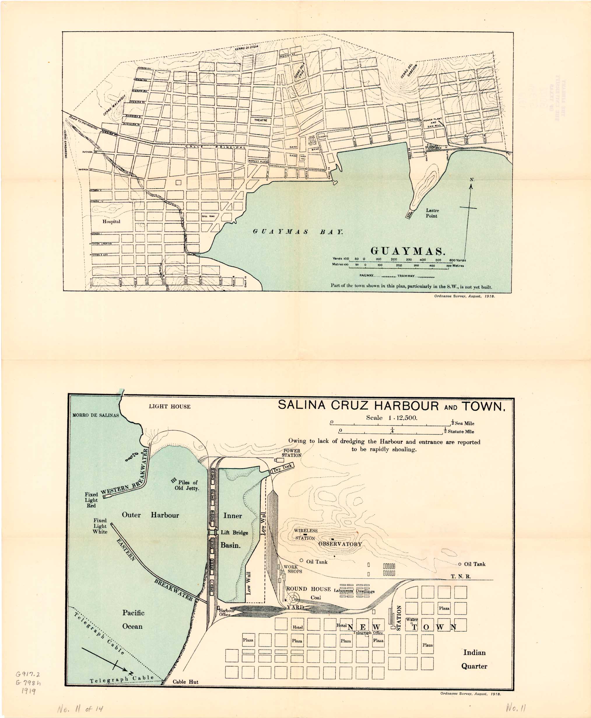
Plans of Seaport Towns: Guaymas and Salina Cruz Harbour and Town (402K)
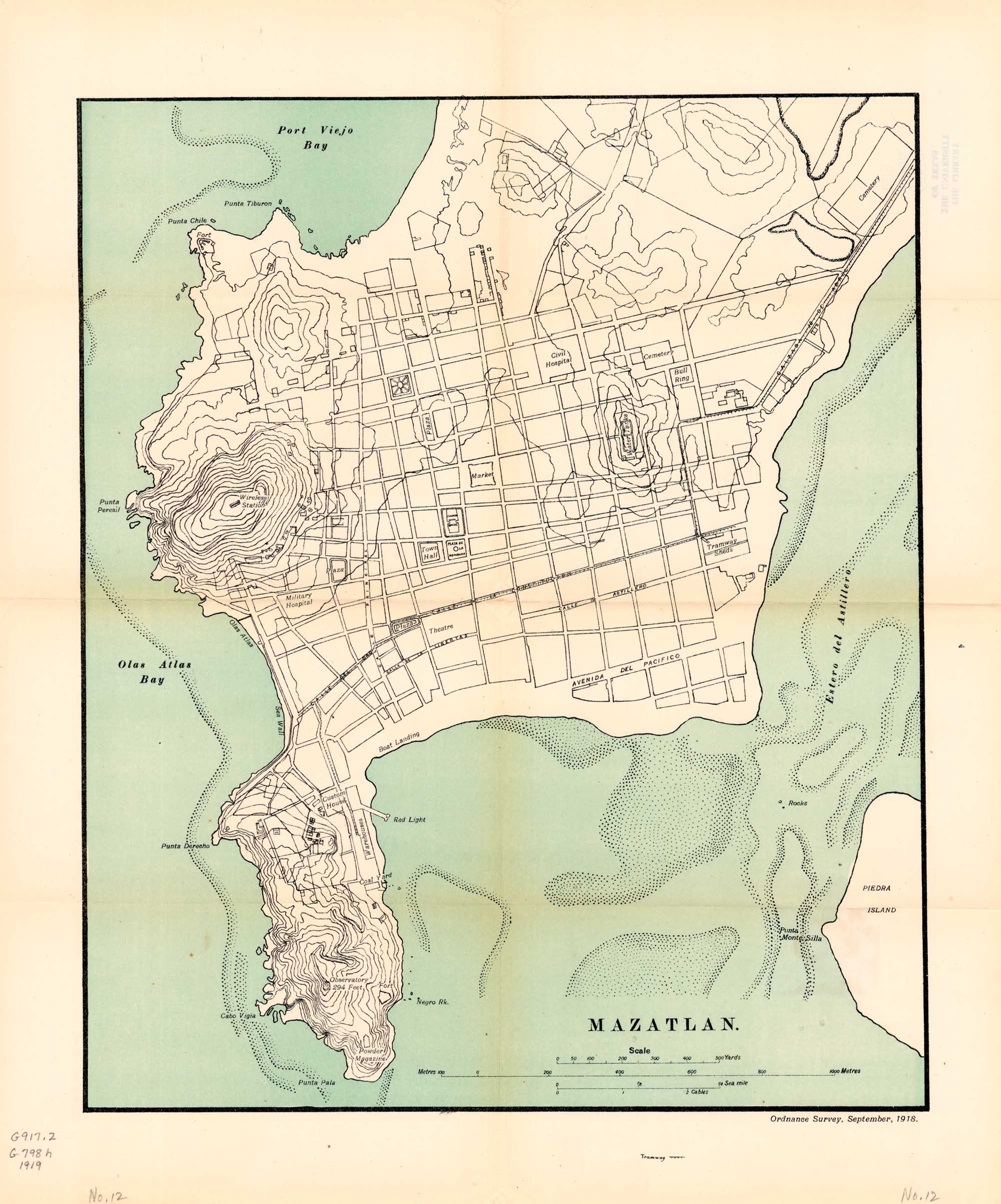
Plans of Seaport Towns: Mazatlan (505K)
Plans of Seaport Towns: Progreso and Vera Cruz (599K)
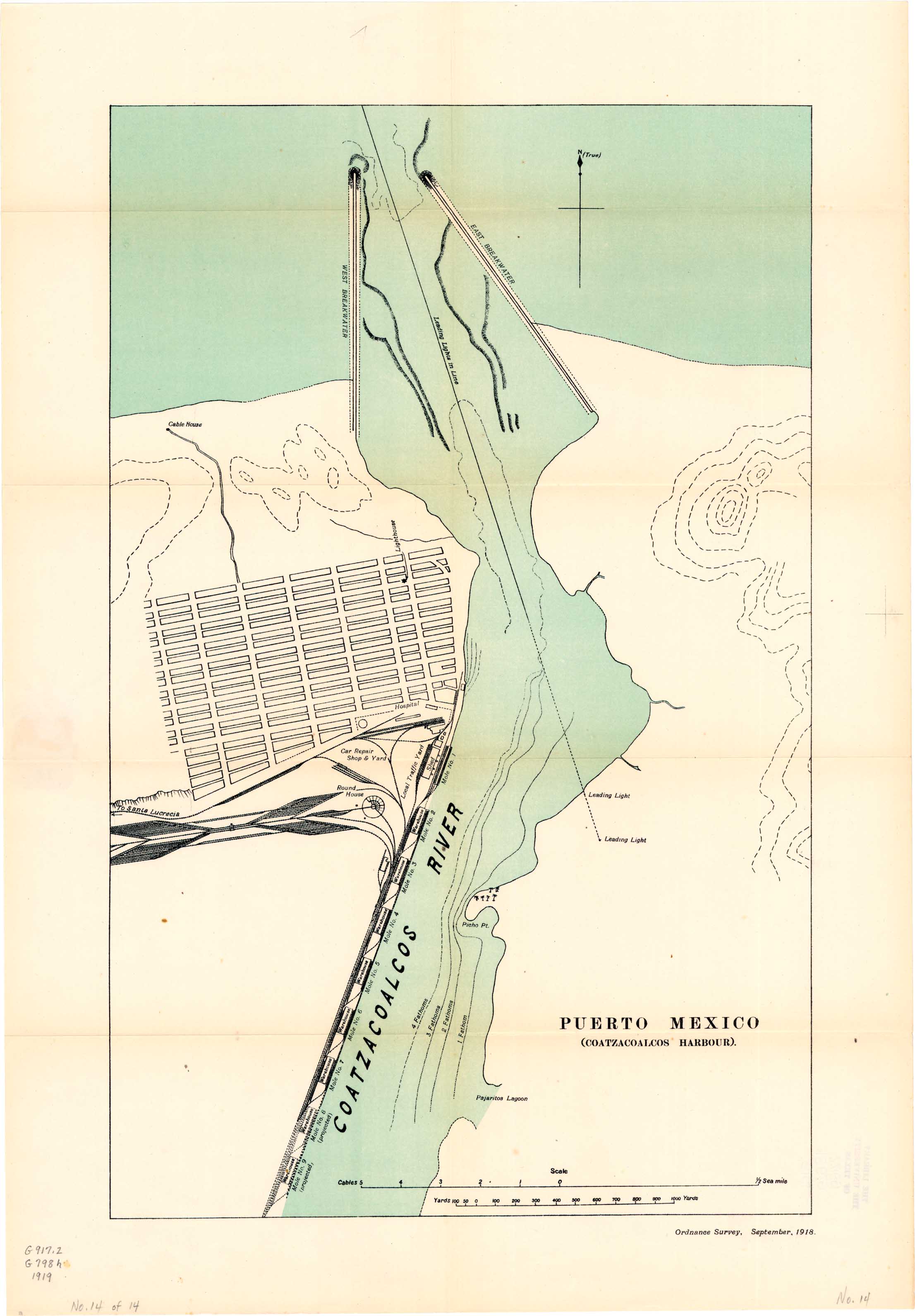
Plans of Seaport Towns: Puerto Mexico (Coatzacoalcos Harbour) (425K)