Perry-Castañeda Library
Map Collection
Historical Maps of Polar Regions and Oceans
- Amerikanischen Polynesien [American Polynesia] 1859 (1.1MB)
- From Petermann's Mittheilungen 1859.
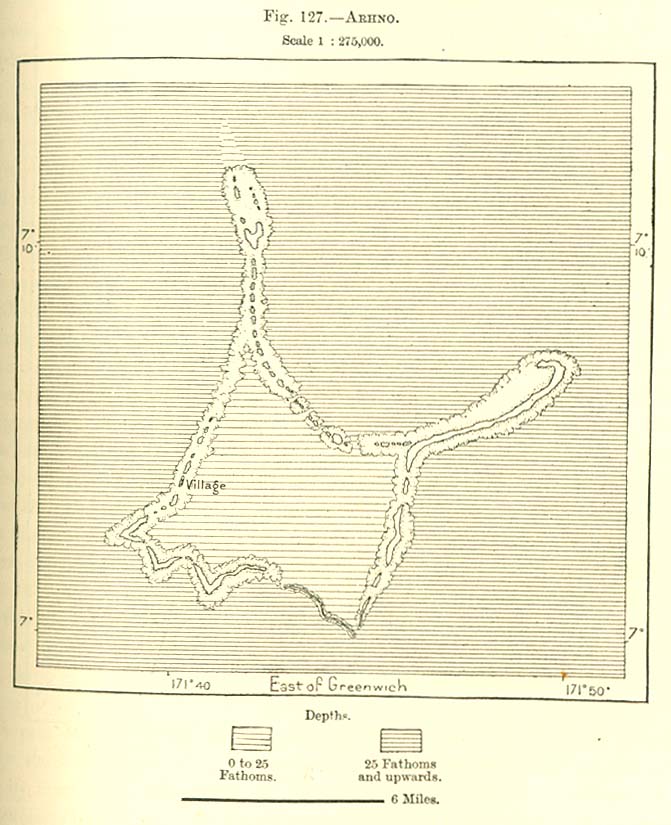
- Arhno Island 1890 (113K)
- From "The Earth and Its Inhabitants, Oceania" by Elisee Reclus, Edited by A.H. Keane, New York: D. Appleton and Company, 1890.
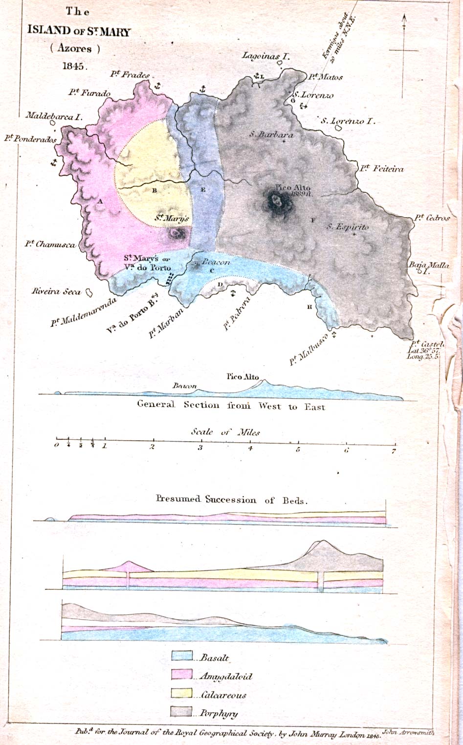
- Azores - St. Mary Island 1845 (194K)
- "The Island of St. Mary (Azores) 1845" from the Journal of the Royal Geographical Society, Volume 15, 1845 to accompany "A Description of the Island of St. Mary (Azores). By Carew Hunt, Esq., H.M.'s Consul for the Azores"
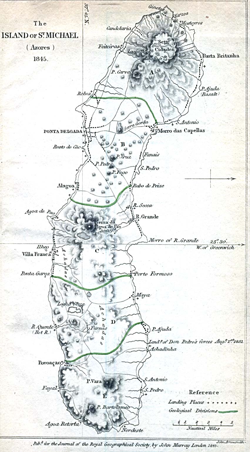
- Azores - St. Michael Island 1845 (233K)
- "The Island of St. Michael (Azores) 1845" from the Journal of the Royal Geographical Society, Volume 15, 1845 to accompany "A Description of the Island of St. Michael (Azores). By Mr. Consul Carew Hunt"
- Ceylon [Sri Lanka] 1914 (774K)
- "Ceylon" from Great Britain Parliament House of Commons Sessional Papers, Colonial Reports - Annual. No. 797. Ceylon. Report (Supplementary) for 1912.
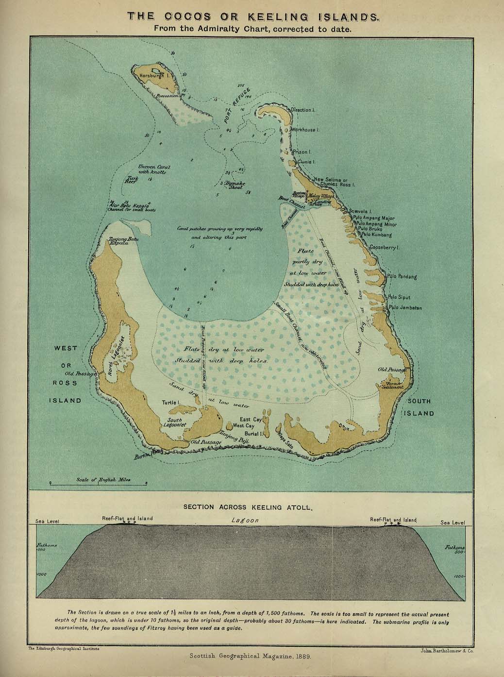
- Cocos or Keeling Islands 1889 (194K)
- From the Scottish Geographical Magazine. Published by the Scottish Geographical Society and edited by James Geikie and Arthur Silva White. Volume V, 1889.
- Deception Island 1832 [South Shetland Islands] (511K)
- "Deception Island New South Shetland by Lieut. E.N. Kendall 1829" from the Journal of the Royal Geographical Society, Volume 1, 1832 to accompany "Account of the Island of Deception, one of the New Shetland Isles. Extracted from the Private Journal of Lieutenant Kendal, R.N., embarked on board his Majesty's sloop Chanticleer, Captain Foster, on a scientific voyage; and communicated by John Barrow, Esq, F.R.S."
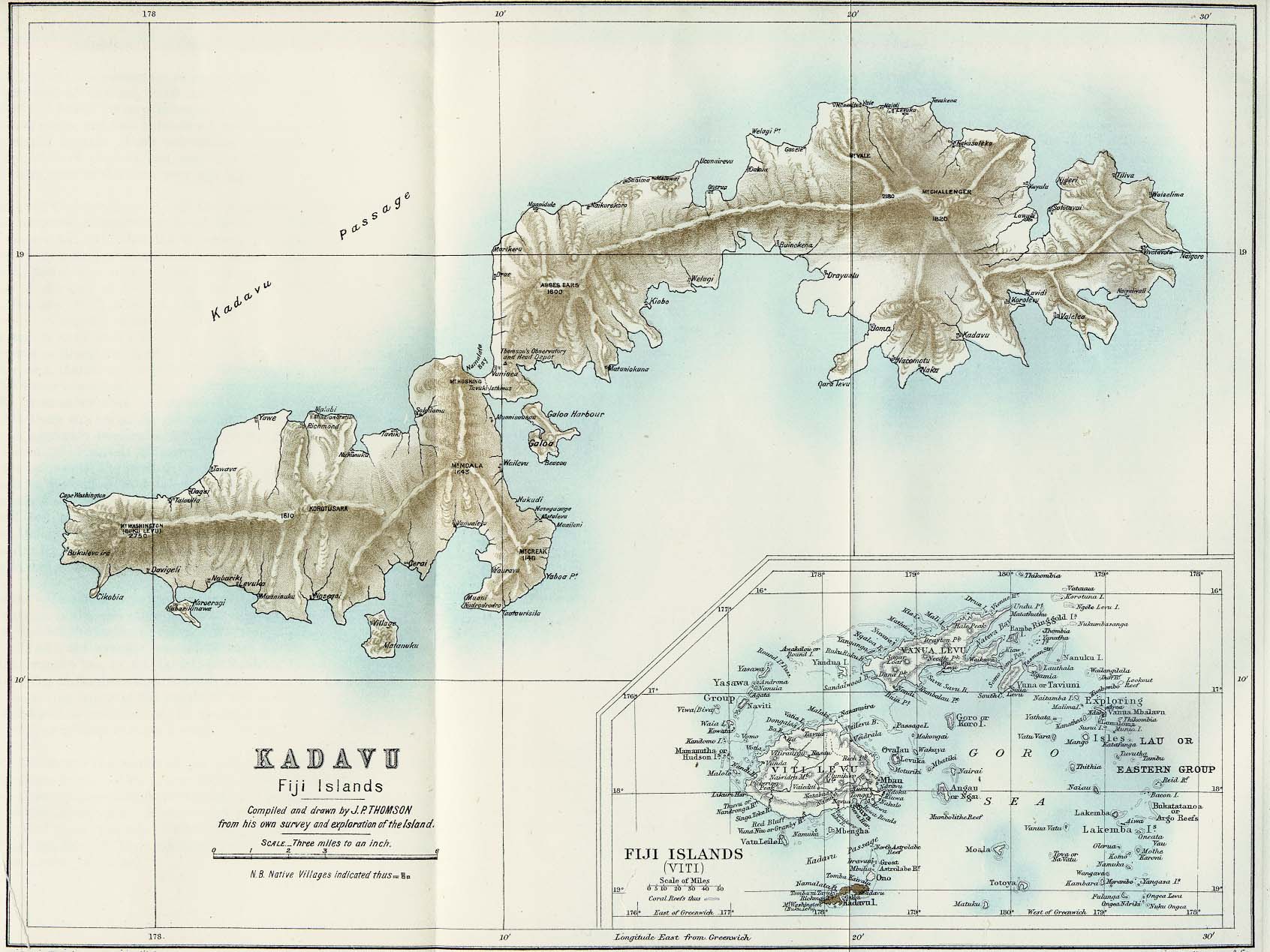
- Kadavu (Fiji Islands) 1889 (286K)
- From the Scottish Geographical Magazine. Published by the Scottish Geographical Society and edited by James Geikie and Arthur Silva White. Volume V, 1889.
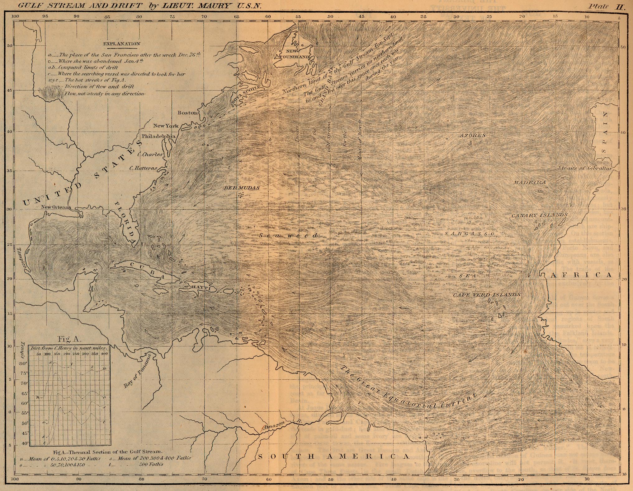
- Gulf Stream and Drift 1858 (867K)
- "Gulf Stream and Drift by Lieut. Maury U.S.N." from A Cyclopedia of Commerce and Commercial Cavigation by I. Smith (Isaac Smith) Homans, 1858.
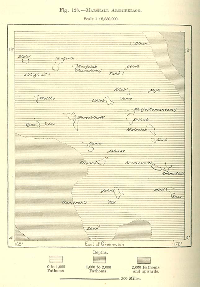
- Marshall Archipelago 1890 (106K)
- From "The Earth and Its Inhabitants, Oceania" by Elisee Reclus, Edited by A.H. Keane, New York: D. Appleton and Company, 1890.
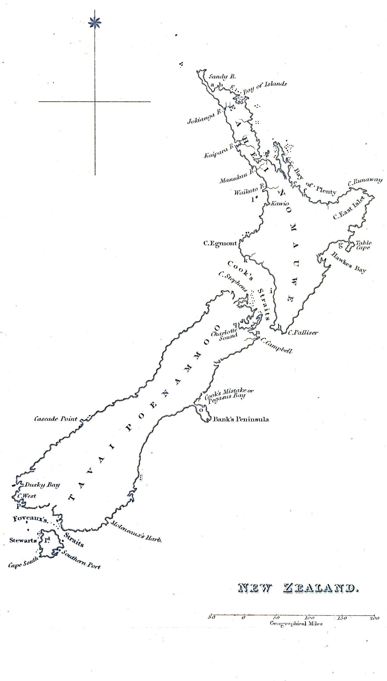
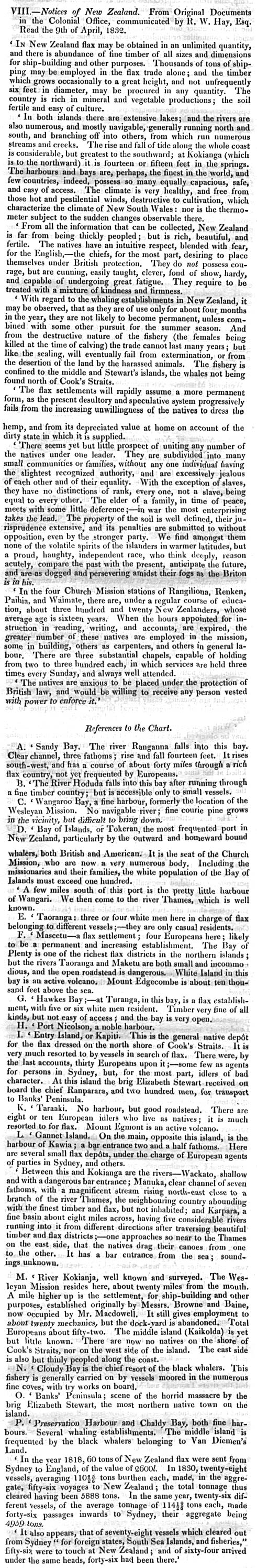
- New Zealand 1832 (160K)
- "New Zealand" from The Journal of the Royal Geographical Society, Volume 2, 1832 to accompany "Notices of New Zealand. From Original Documents in the Colonial Office. Communicated by R.W. Hay, Esq."
- New Zealand, North Island 1913 (514K)
- "New Zealand, North Island" and "Tasmania" from A Literary and Historical Atlas of Africa and Australasia, by J.G. Bartholomew. 1913.
- New Zealand, South Island 1913 (547K)
- "New Zealand, South Island" from A Literary and Historical Atlas of Africa and Australasia, by J.G. Bartholomew. 1913.
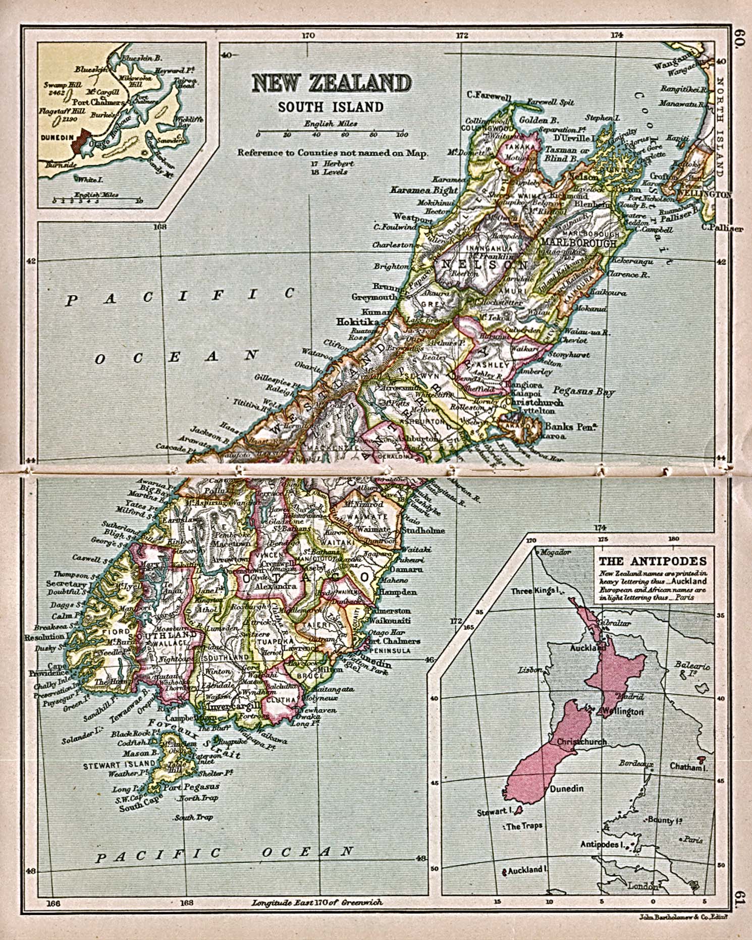
- North Pole 1882-1883 (366K)
- "North Polar Chart, showing International Polar Stations, 1882-1883" from the Scottish Geographical Magazine Volume I, No. 12 1885.
- Pacific Islands [Geographical Handbook Series] 1943-1945
- Maps from "Pacific Islands" [Geographical Handbook Series]. Great Britain. Admiralty. Naval Intelligence Division, 1943-1945.
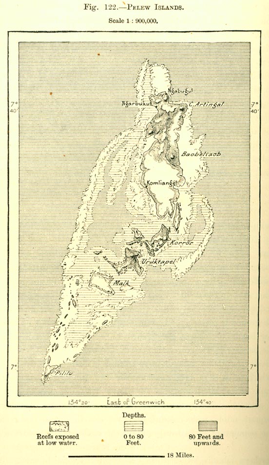
- Pelew Islands 1890 (144K)
- From "The Earth and Its Inhabitants, Oceania" by Elisee Reclus, Edited by A.H. Keane, New York: D. Appleton and Company, 1890.
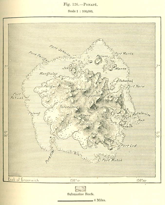
- Ponape Island 1890 (129K)
- From "The Earth and Its Inhabitants, Oceania" by Elisee Reclus, Edited by A.H. Keane, New York: D. Appleton and Company, 1890.
- R.L. Stevenson in the South Seas 1913 (255K)
- "R.L Stevenson in the South Seas"with the inset map of"Samoa"" from A Literary and Historical Atlas of Africa and Australasia, by J.G. Bartholomew. 1913.
- Ruk Island [Truk] 1890 (170K)
- From "The Earth and Its Inhabitants, Oceania" by Elisee Reclus, Edited by A.H. Keane, New York: D. Appleton and Company, 1890.
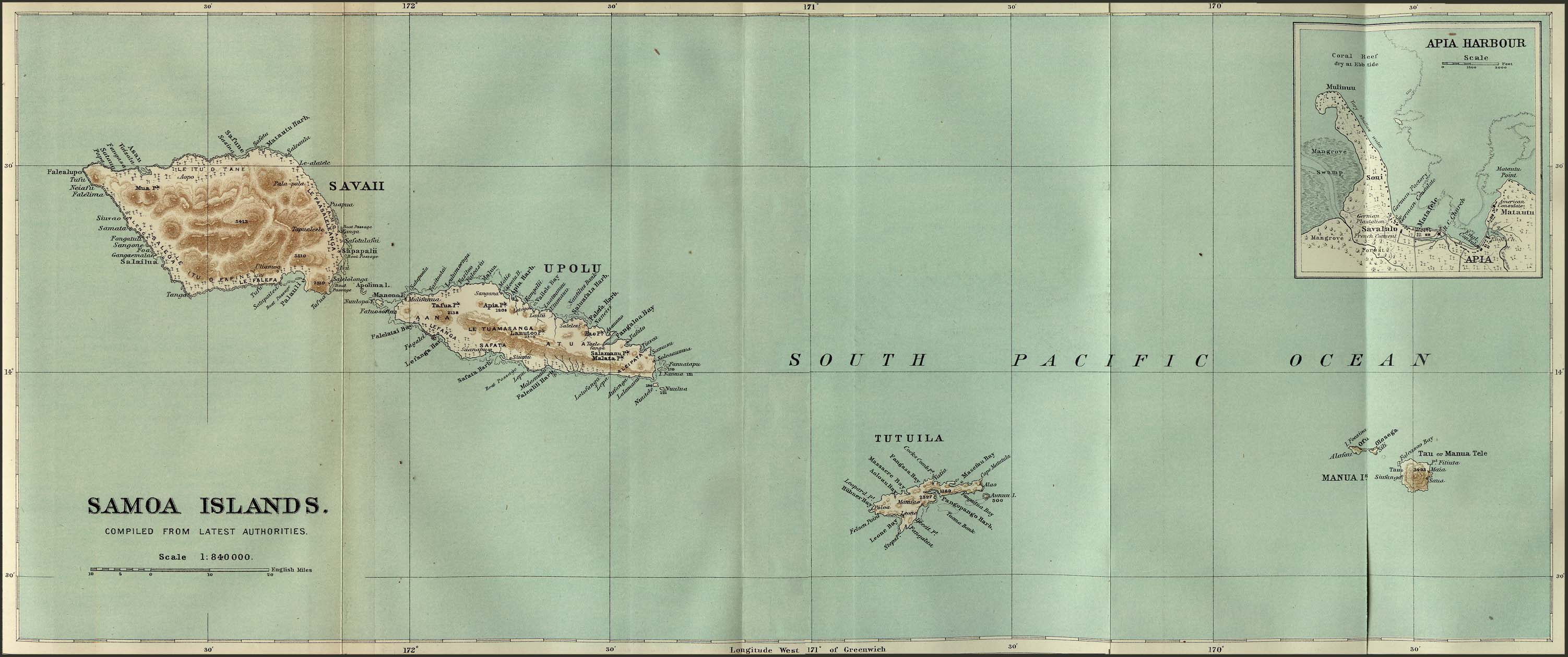
- Samoa Islands 1889 (349K)
- From the Scottish Geographical Magazine. Published by the Scottish Geographical Society and edited by James Geikie and Arthur Silva White. Volume V, 1889.
- South Pole 1894 (299K)
- "Sketch Map of South Polar Regions" from the Scottish Geographical Magazine Volume X, No. 2, 1894.
- Tasmania 1913 (514K)
- "New Zealand, North Island" and "Tasmania" from A Literary and Historical Atlas of Africa and Australasia, by J.G. Bartholomew. 1913.
- Tongatabu Island [Tonga] 1943 (672K)
- Portion of a topographic map, original scale 1:125,000 U.S. Army Map Service 1943.
- World War II Maps of the Asia-Pacific Theater (30 Maps)
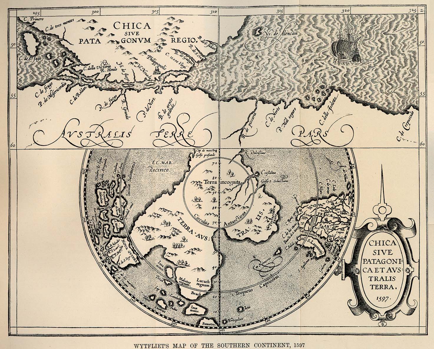
- Wytfliet's Map of the Southern Continent, 1597 (493K)
- From The Scottish Geographical Magazine Vol. XVI, No. 1, 1900.
- Yap Island 1890 (150K)
- From "The Earth and Its Inhabitants, Oceania" by Elisee Reclus, Edited by A.H. Keane, New York: D. Appleton and Company, 1890.
![Amerikanischen Polynesien [American Polynesia] 1859](polynesien_1859.jpg)
![Ceylon [Sri Lanka] 1914](ceylon_1914.jpg)
![Deception Island 1832 [South Shetland Islands]](/maps/islands_oceans_poles/deception_island.jpg)
![Ruk Island [Truk] 1890](ruk_islands_1890.jpg)
![Tongatabu Island [Tonga] 1943](/maps/islands_oceans_poles/tongatabu_1943.jpg)