Perry-Casta�eda Library
Map Collection
Historical Maps of Australia and the Pacific
- [Ambon, Netherlands East Indies] - Tan Toey Prisoners of War Camp 1943 (429K)
- "Sketch Map of Tan Toey Prisoners of War Camp, Amboina" from Allied Geographical Section, Southwest Pacific Area. Area Study of Ambon Island, Terrain Study No. 45, 13 January 1943.
- Amerikanischen Polynesien [American Polynesia] 1859 (1.1MB)
- From Petermann's Mittheilungen 1859.
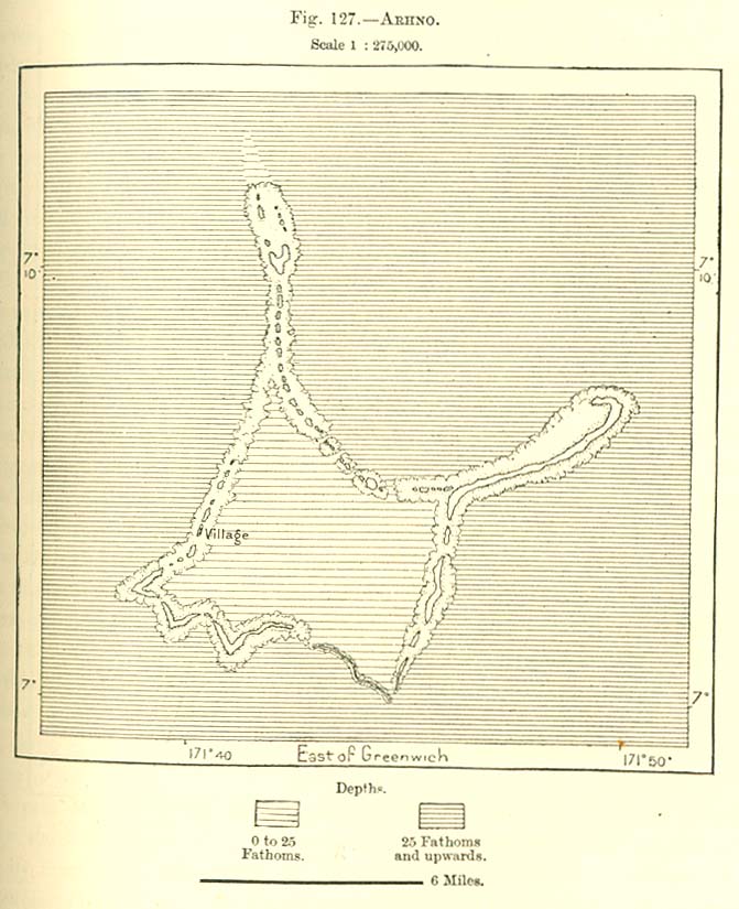
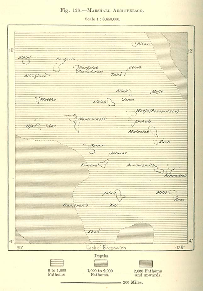
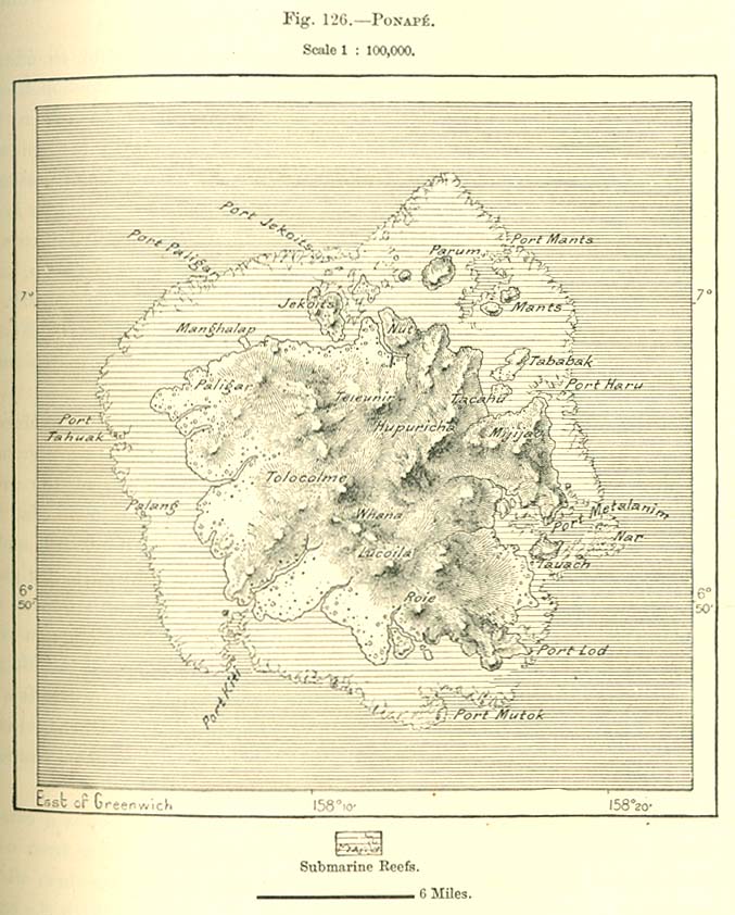
- Arhno Island 1890 (113K)
- From "The Earth and Its Inhabitants, Oceania" by Elisee Reclus, Edited by A.H. Keane, New York: D. Appleton and Company, 1890.
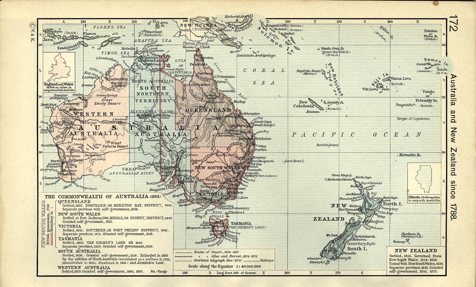
- Australia and New Zealand since 1788 (370K) [p.172]
- From The Historical Atlas by William R. Shepherd, 1911.
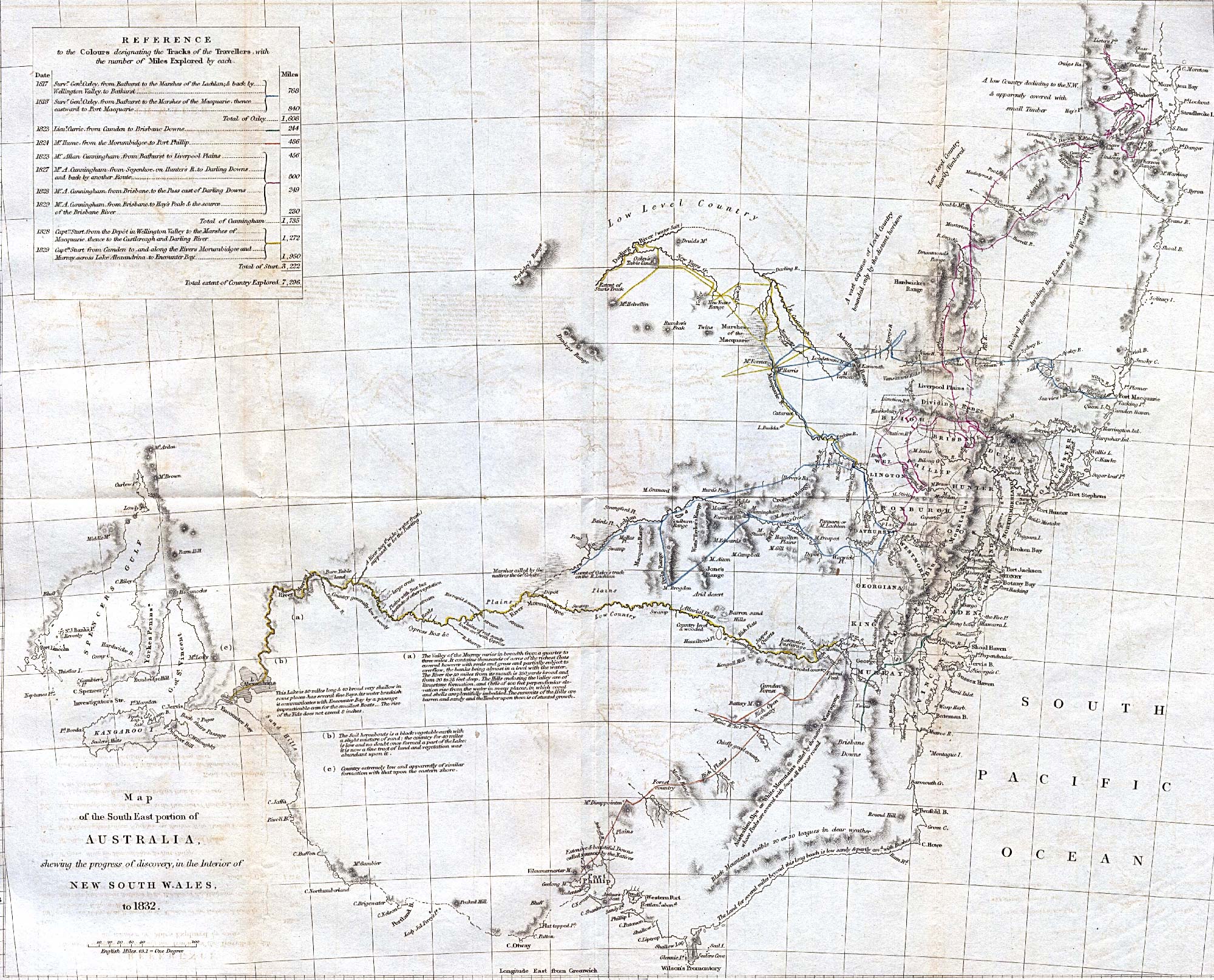
- Australia Southeast 1832 (871K)
- "Map of the SouthEast portion of Australia, showing the progress of discovery, in the interior of New South Wales, to 1832." from The Journal of the Royal Geographical Society, Volume 2, 1832 to accompany "Recent Information from Australia. From communications made to the Royal Geographical Society."
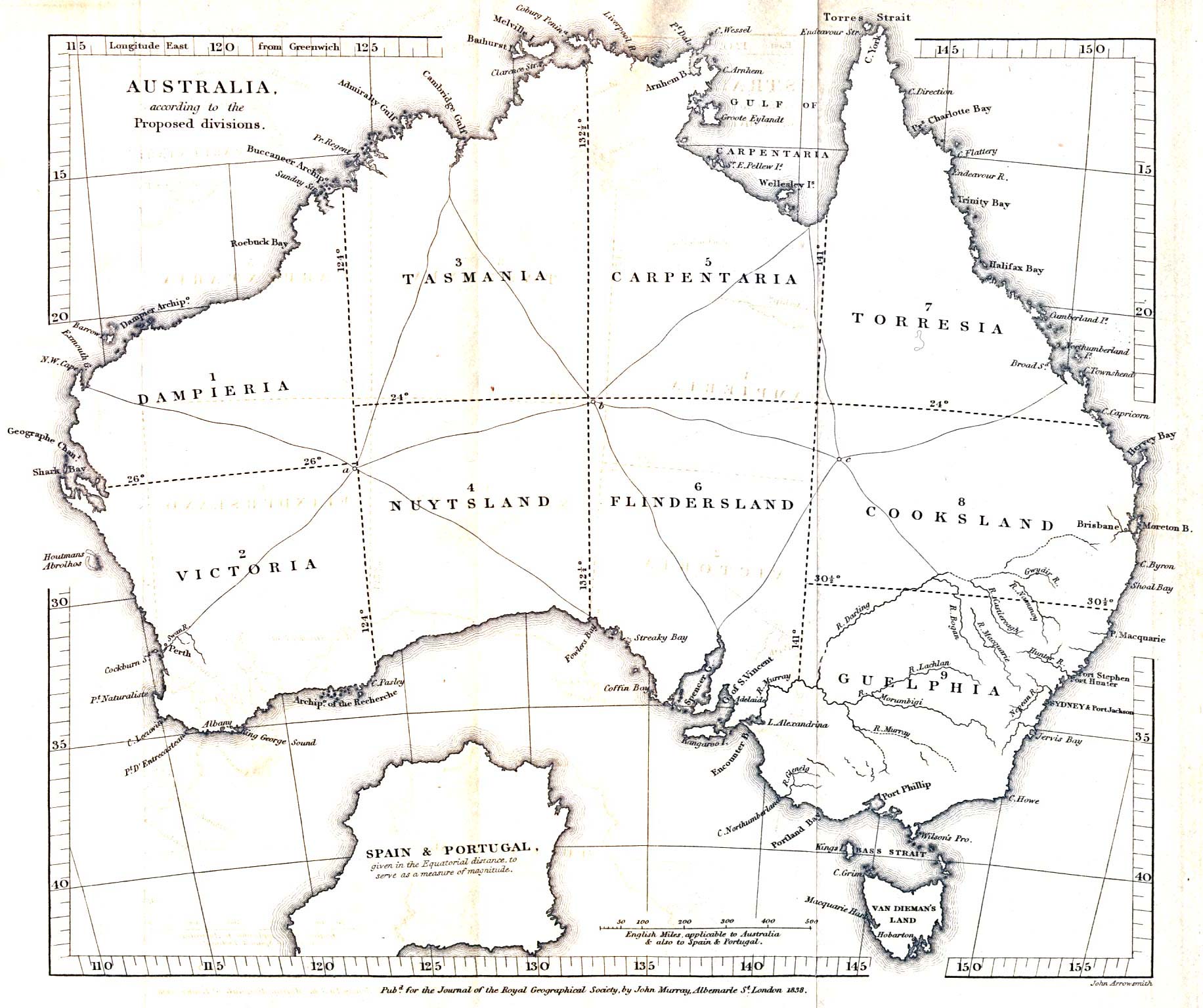
- Australia, Proposed Divisions 1838 (379K)
- "Australia, according to the Proposed divisions." from The Journal of the Royal Geographical Society, Volume 8, 1838 to accompany "Considerations on the Political Geography and Geographical Nomenclature of Australia by Captain Vetch, Royal Engineers, F.R.S."
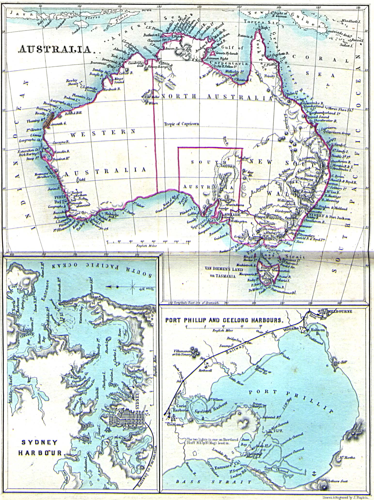
- Australia 1860 (742K)
- "Australia" with inset maps of "Sydney Harbour" and "Port Phillip and Geelong Harbours". from Stones, William. My First Voyage: A Book for Youth. Second Edition. London: Simpkin, Marshall & Co. 1860.
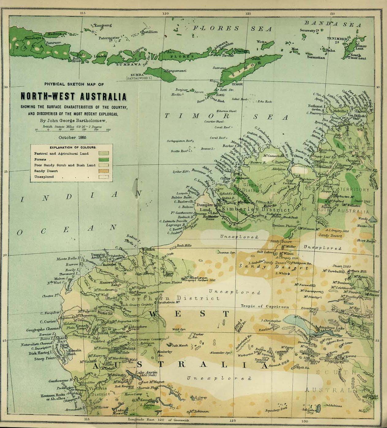
- Australia Northwest 1885 (296K)
- "Physical Sketch Map of Northwest Australia showing the surface characteristics of the country and discoveries of the most recent explorers." from the Scottish Geographical Magazine. Published by the Scottish Geographical Society and edited by Hugh A. Webster and Arthur Silva White. Volume I, 1885.
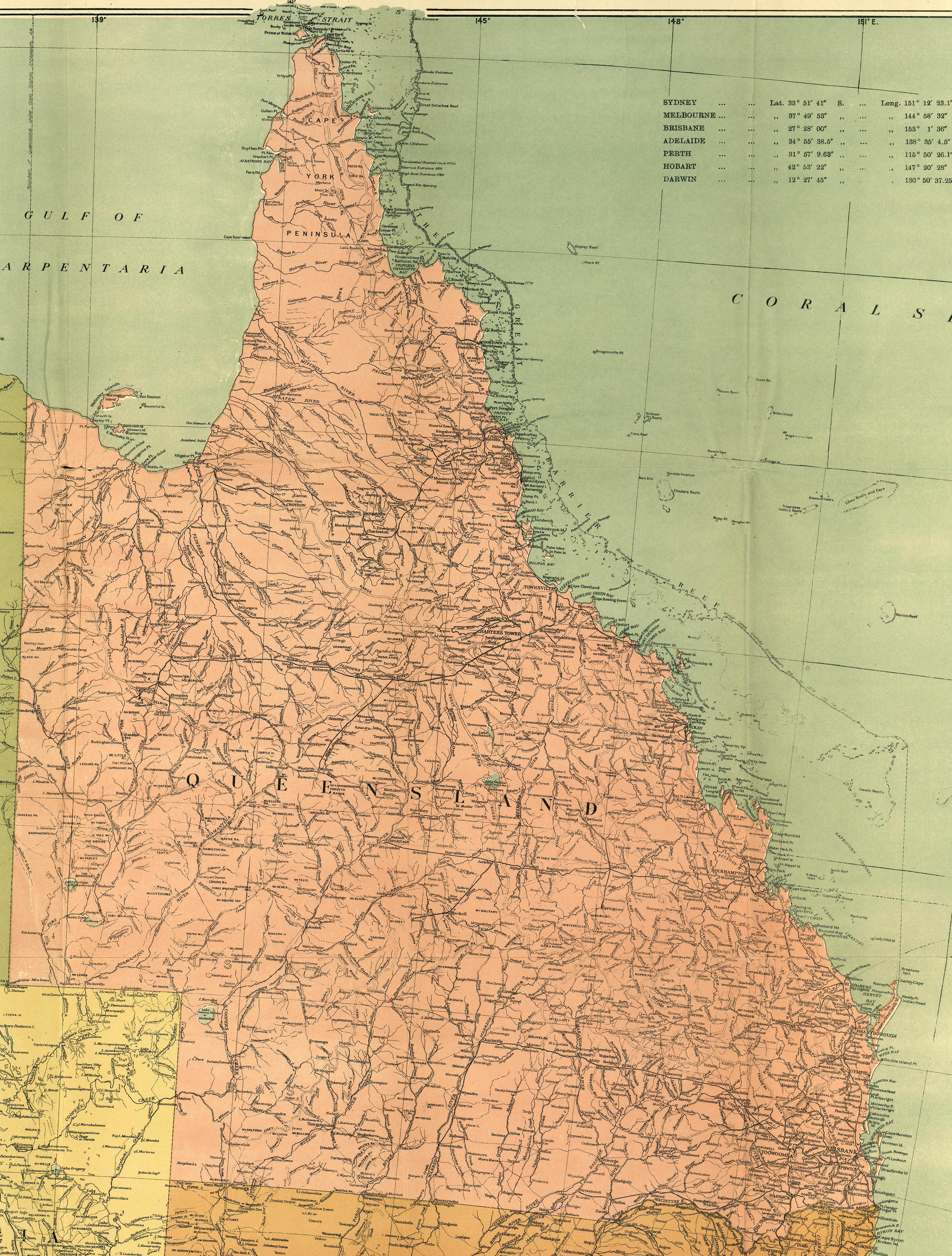
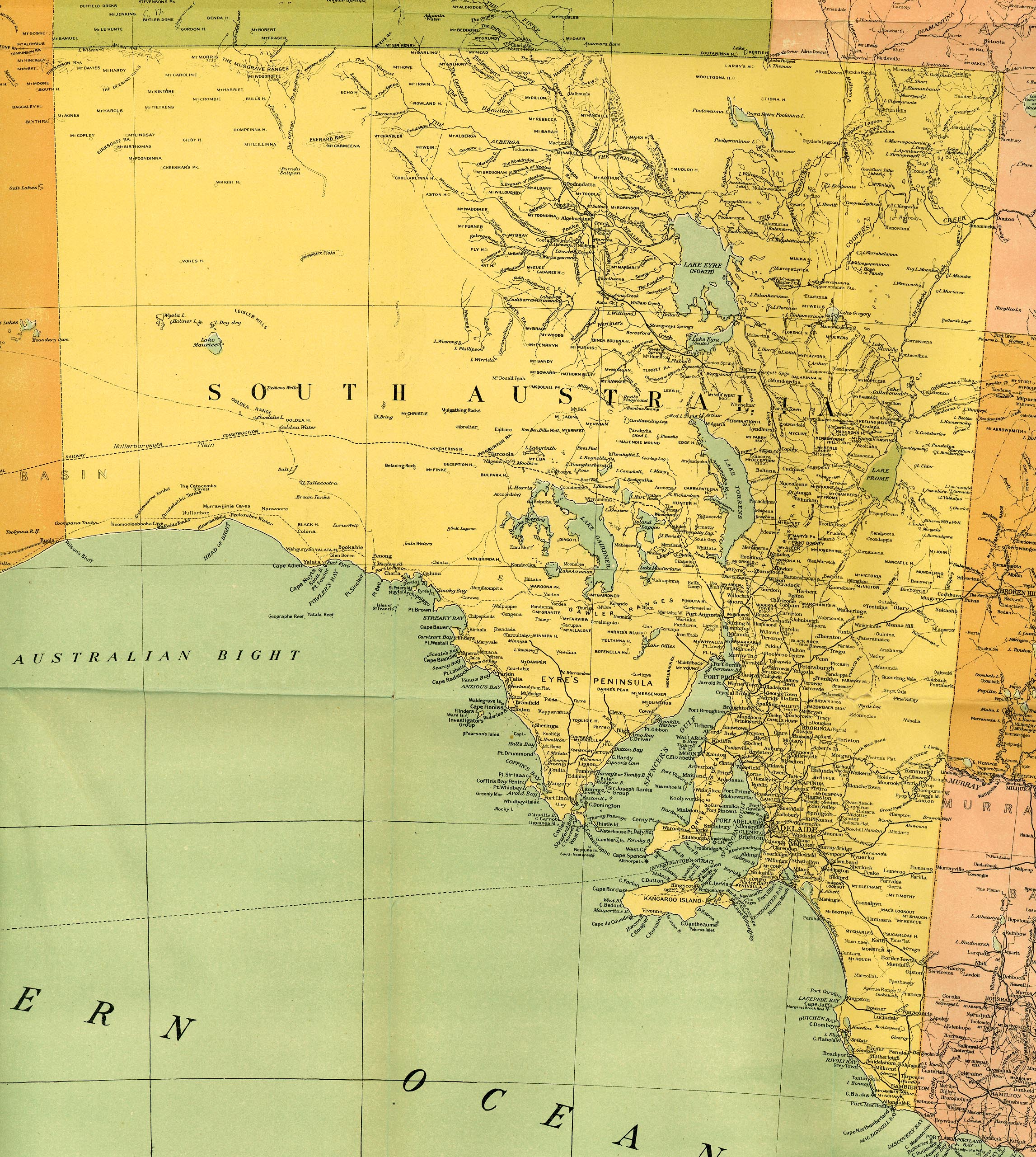
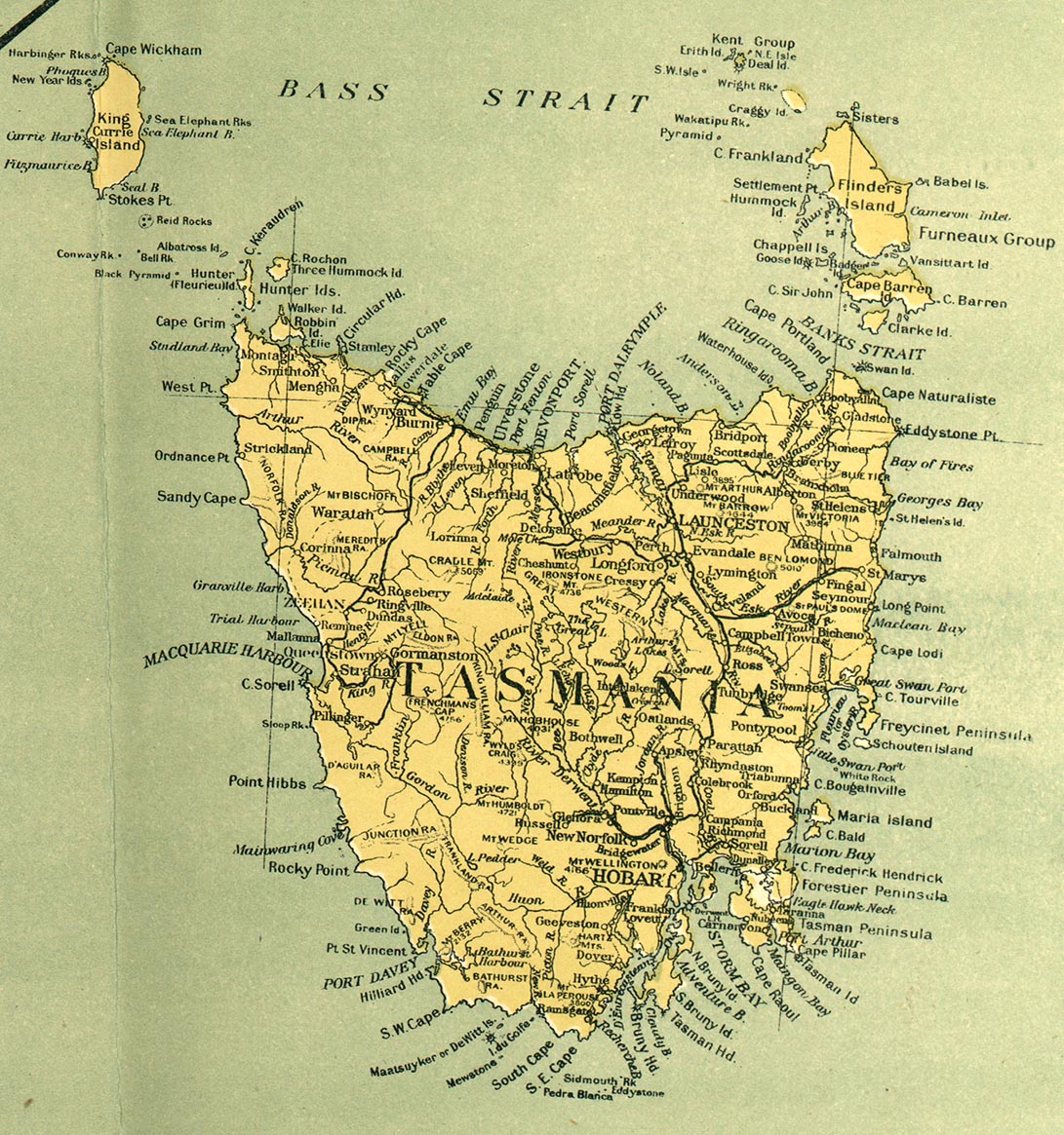
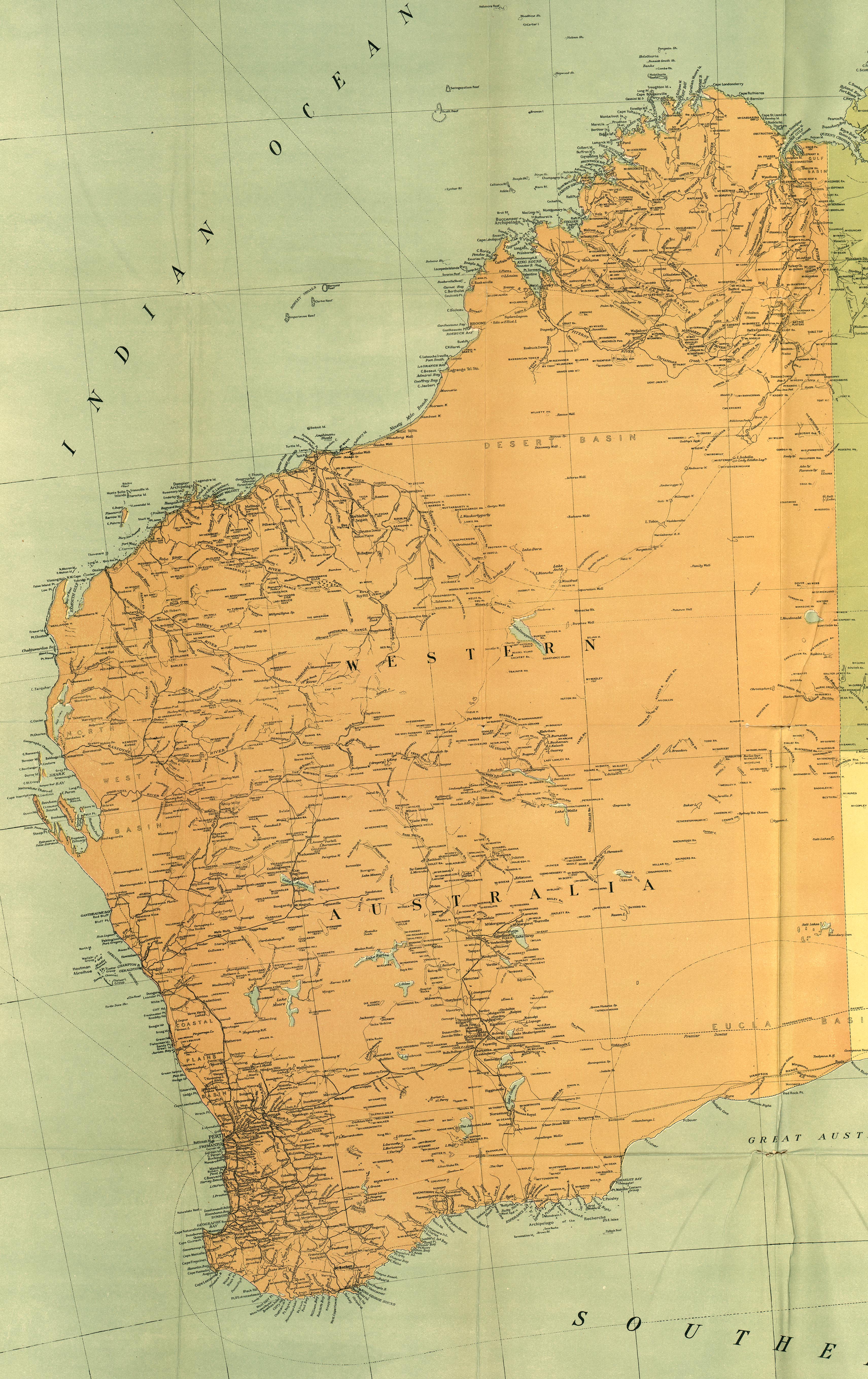
- Australia 1916
- From the map "Commonwealth of Australia", published with the Official Year Book of the Commonwealth of Australia, Melbourne: McCarron, Bird and Co., 1916.
![[Ambon, Netherlands East Indies] - Tan Toey Prisoners of War Camp 1943](ambon_1943.jpg)
![Amerikanischen Polynesien [American Polynesia] 1859](polynesien_1859.jpg)
![Ruk Island [Truk] 1890](ruk_islands_1890.jpg)
![Tongatabu Island [Tonga] 1943](/maps/islands_oceans_poles/tongatabu_1943.jpg)