Perry-Castañeda Library
Map Collection
Historical Maps of Africa
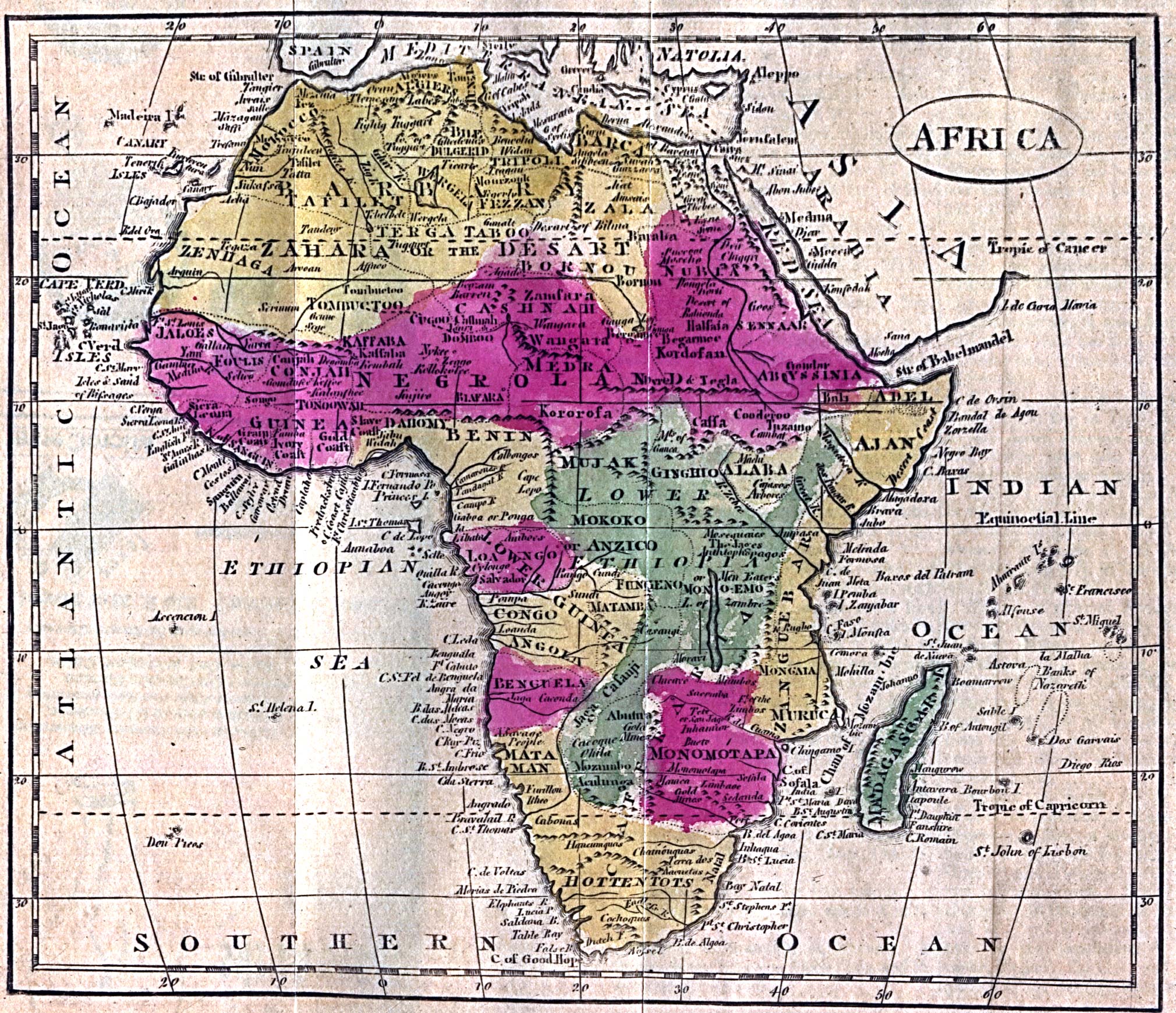
- Africa 1808 (918K)
- "Africa" from Brookes, R., The General Gazetteer; or Compendious Geographical Dictionary. Eighth Edition. Dublin, 1808.
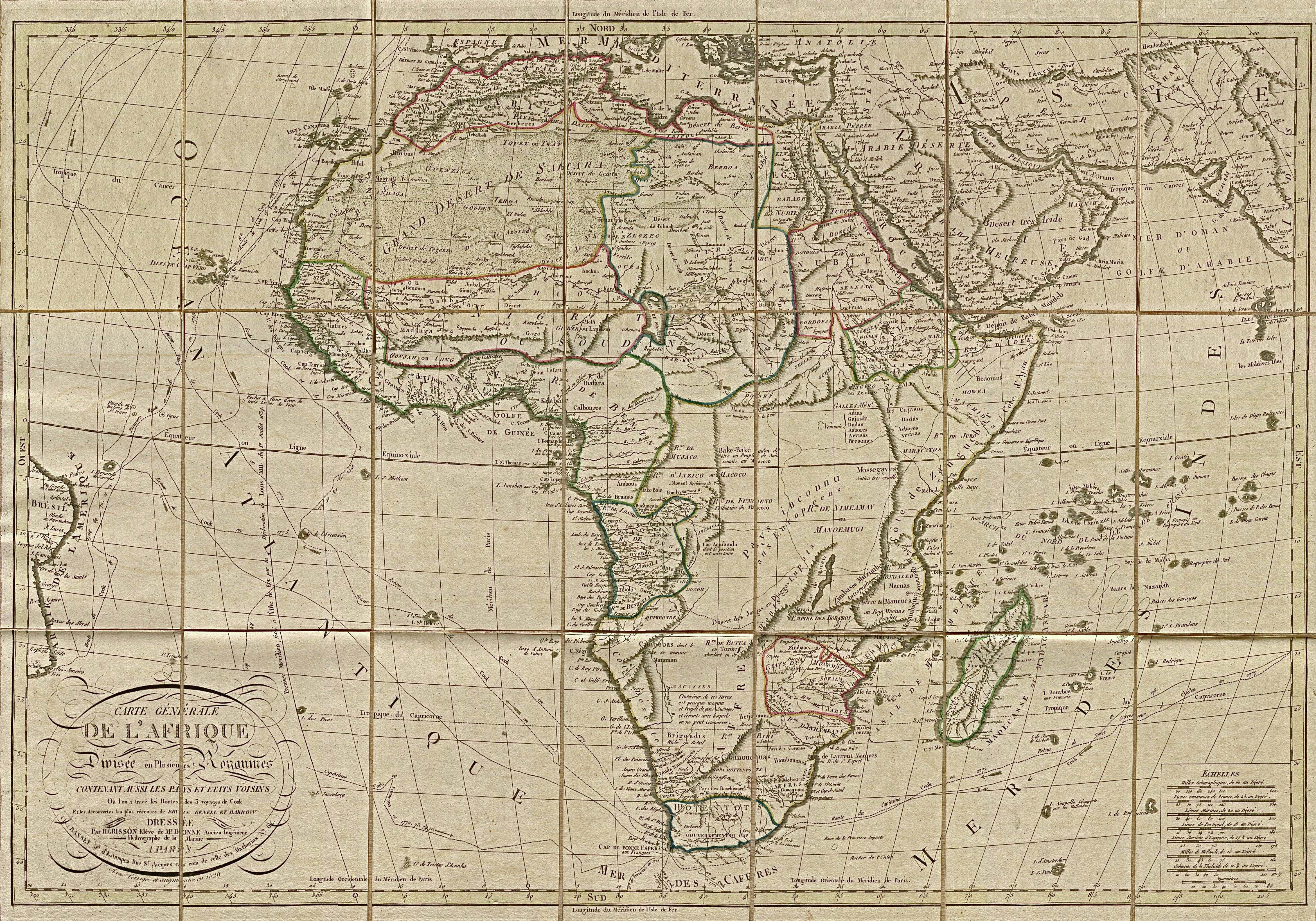
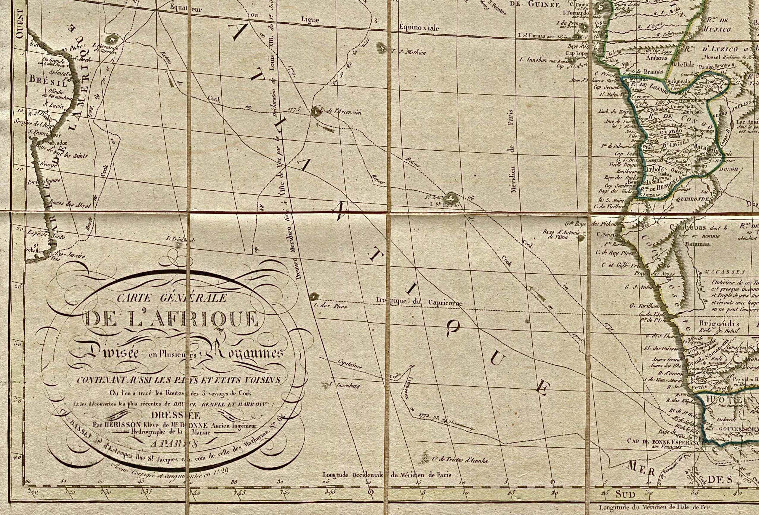
- Africa 1829 Entire map - large file (3.4MB)
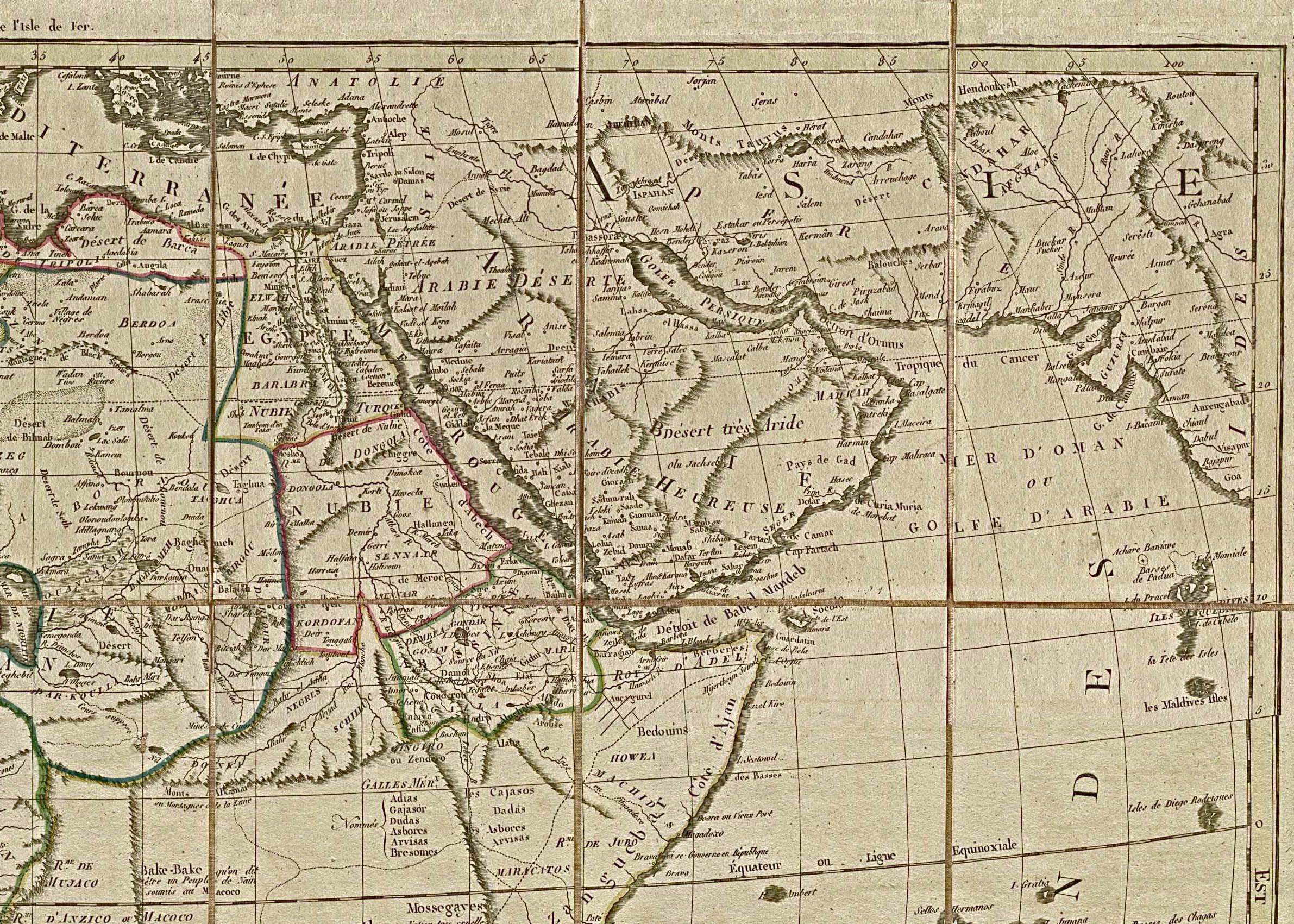
- Africa 1829 - Northeast Africa/Near East (942K)
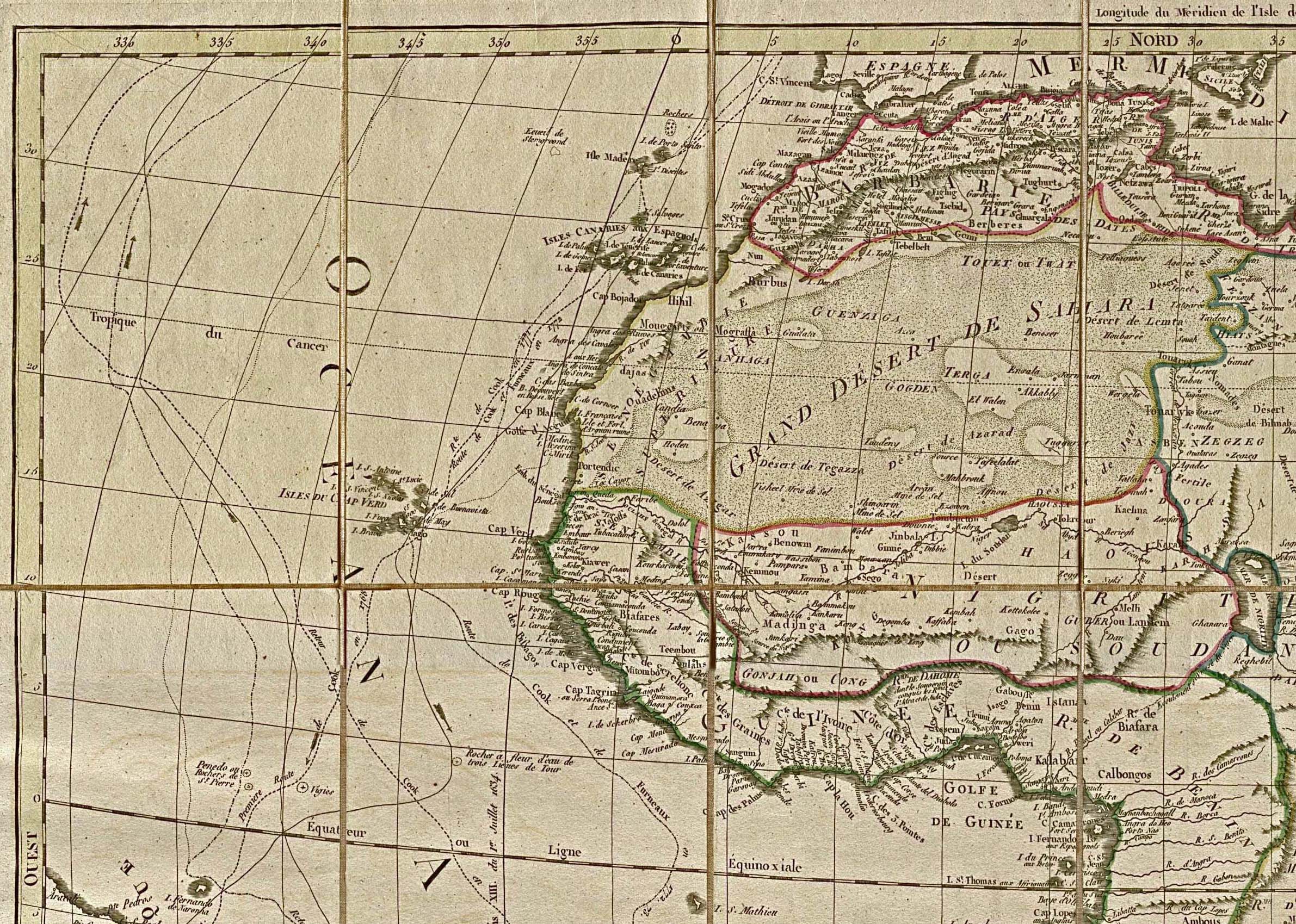
- Africa 1829 - Northwest Africa (938K)
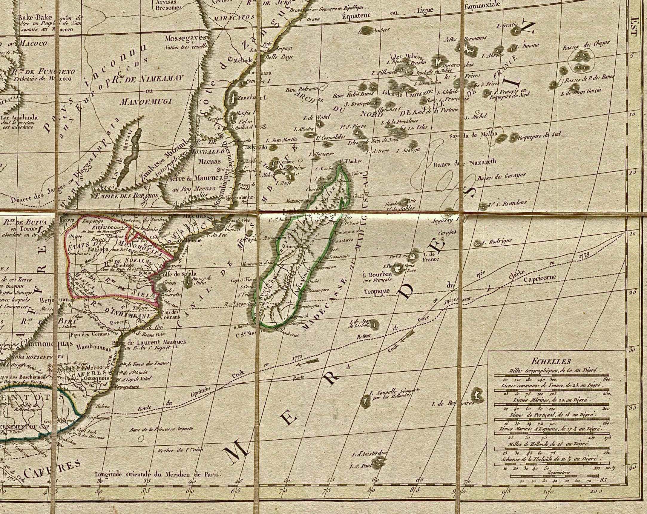
- Africa 1829 - Southeast Africa, Madagascar and Adjacent Indian Ocean (790K)
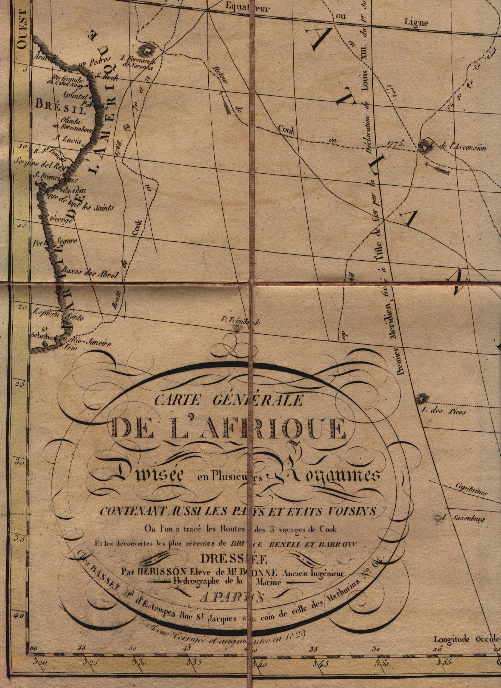
- Africa 1829 - Southwest Africa, Map Legend and Coast of Brazil (883K)
- Map Legend (547K)
- Africa 1829 - Northeast Africa/Near East (942K)
- "Carte Generale De L'Afrique" by Eustache Herisson, 1829.
- Africa 1885 (347K)
- From the Scottish Geographical Magazine. Published by the Scottish Geographical Society and edited by Hugh A. Webster and Arthur Silva White. Volume I, 1885.
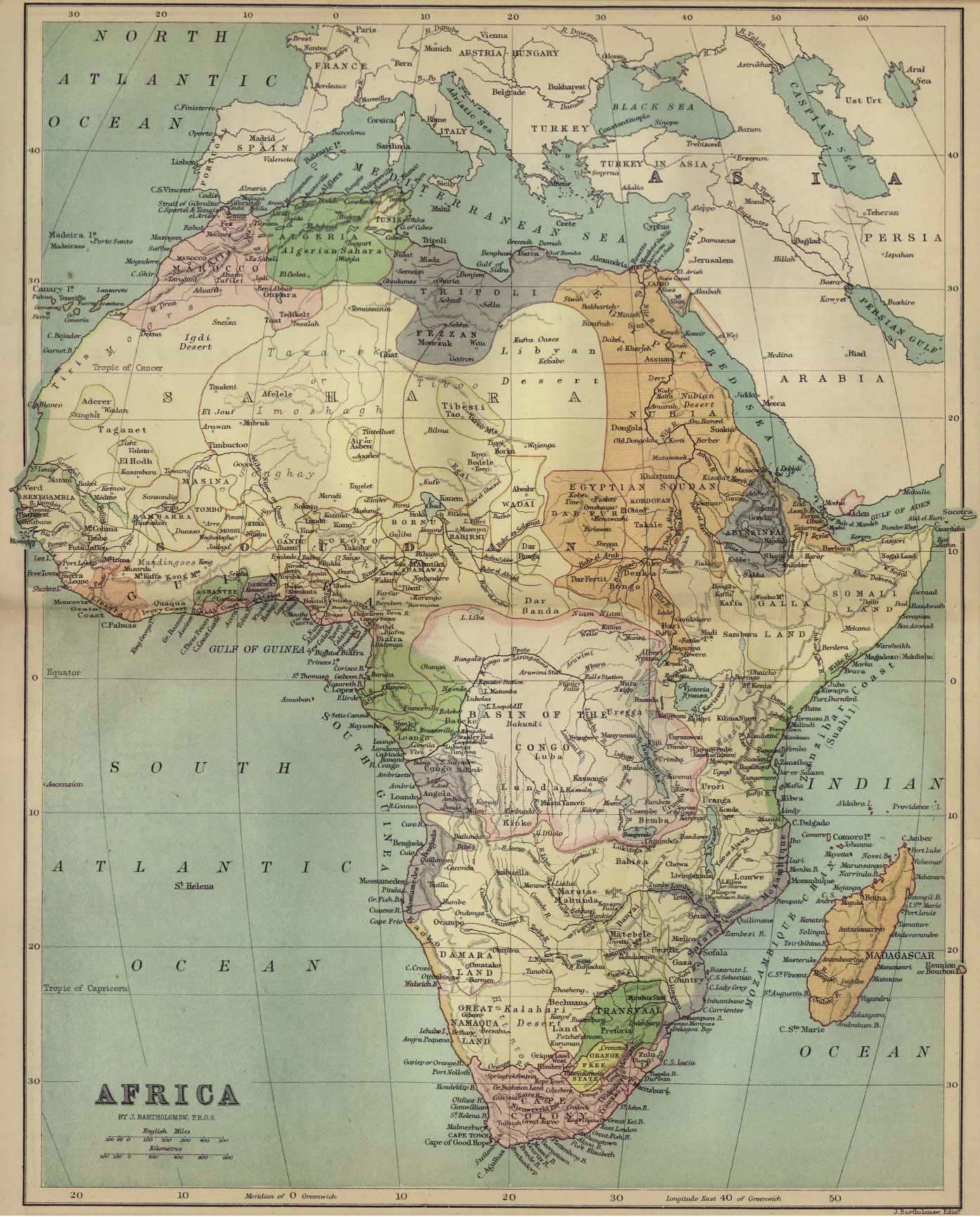
- Africa 1890 (1.2MB)
- "Africa" from Americanized Encyclopaedia Britannica Vol. 1, Chicago 1892.
- Africa Religions and Missions 1913 (323K)
- "Africa Religions and Missions" from Literary and Historical Atlas of Africa and Australasia, by J.G.Bartholomew 1913.
- Africa West Coast 1832 (682K)
- "West Coast of Africa to illustrate Capt. Belcher's Observations" from The Journal of the Royal Geographical Society, Volume 2, 1832 to accompany "Extracts from Observations on various Points of the West Coast of Africa surveyed by His Majesty's Ship Aetna in 1830-32, By Captain Belcher, R.N."
- Angola - Benguela District 1895 (7MB)
- Provincia de Angola, carta dos districtos de Benguella e Mossamedes. 1:1,000,000. Portugal. Comiss�o de Cartografia das Col�nias. 1895.
- Angola - Cabinda 1904 (9.1MB)
- Provincia de Angola, carta dos territorios de Cabinda e Malembo. 1:200,000. Portugal. Commiss�o de Cartographia. 1904.
- Bathurst [Banjul] Gambia 1941 (581K)
- Surveyed in 1910-11 and partly Revised in 1918 by W.F. Crook, Engineer Reproduction Plant , U.S. Army 1941.
- Bophuthatswana 1977 (259K)
- U.S. Central Intelligence Agency
- Bechuanaland 1887 (181K)
- "Sketch Map of British Bechuanaland, May 1887" from the Scottish Geographical Magazine. Published by the Scottish Geographical Society and edited by Arthur Silva White. Volume III, 1887.
- Central Africa 1895 (1MB)
- "Afrique Centrale" from Annales de Geographie Tome IV, Paris 1895.
- Congo River 1883 - West (9.3MB)
- Carta do curso do Rio Zaire de Stanley-Pool au Oceano. Scale ca. 1:500,000. Portugal. Comiss�o de Cartografia das Col�nias and Minist�rio da Marinha e Ultramar. 1883.
- Congo River 1883 - East (8.6MB)
- Carta do curso do Rio Zaire de Stanley-Pool au Oceano. Scale ca. 1:500,000. Portugal. Comiss�o de Cartografia das Col�nias and Minist�rio da Marinha e Ultramar. 1883.
- Egypt 1450 B.C. (344K)
- From The Historical Atlas by William R. Shepherd, 1923.
- Eritrea [Abyssinia and Sudan] 1896 (22MB)
- "Seconda edizione della nuova carta dei dominii e Protettorati Italiani nell' Eritrea e regioni Limitrofe (Sudan - Abissinia - Harar)". 1:1,500,000. Italie. Ministero della Guerra. 1896.
- Gold Coast Colony 1896 (315K)
- From the Scottish Geographical Magazine. Published by the Royal Scottish Geographical Society and edited by James Geikie and W.A. Taylor. Volume XII, 1896.
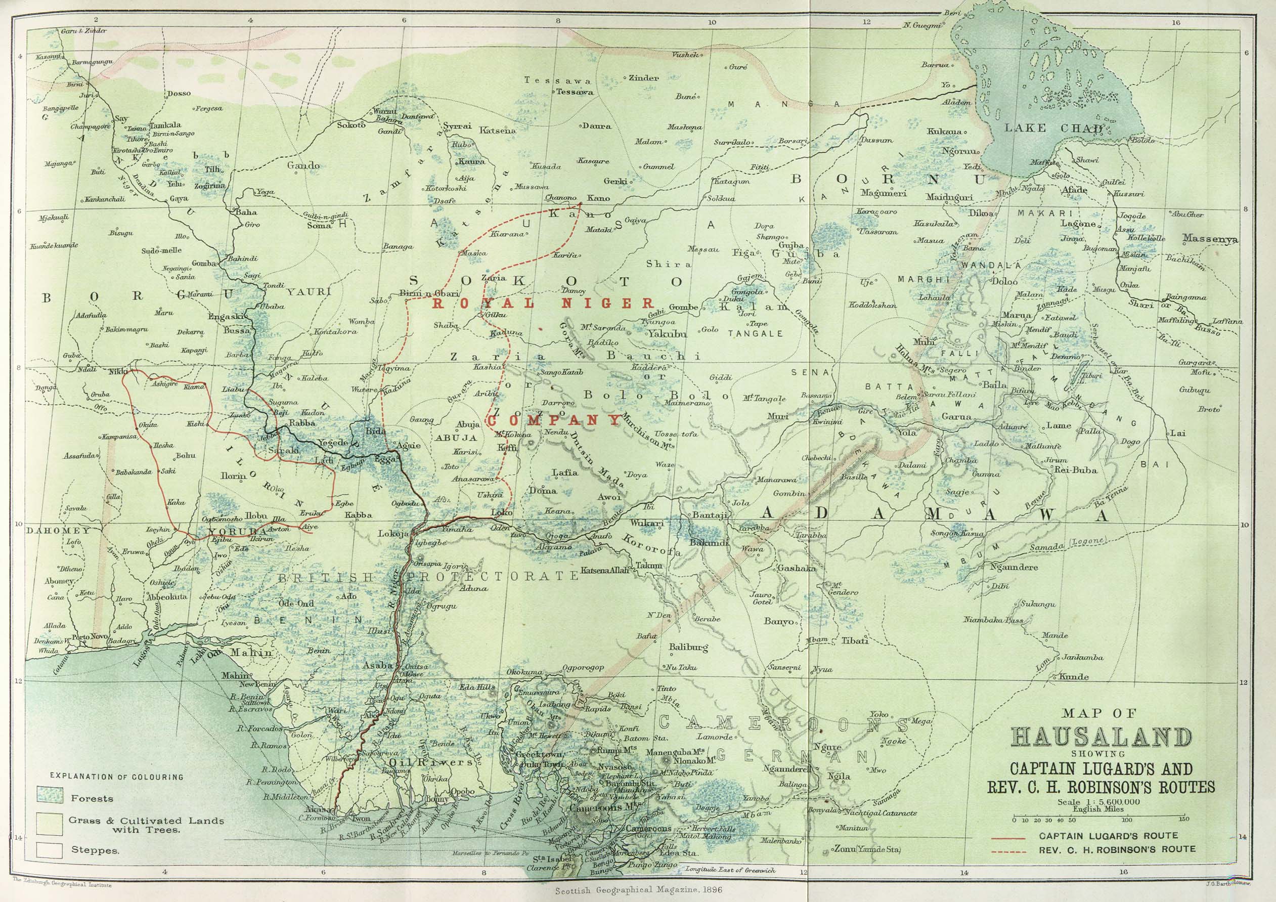
- Hausaland 1896 (674K)
- "Map of Hausaland showing Captain Lugard's and Rev. Robinson's routes" from the Scottish Geographical Magazine. Published by the Royal Scottish Geographical Society and edited by James Geikie and W. A. Taylor. Volume XII, 1896.
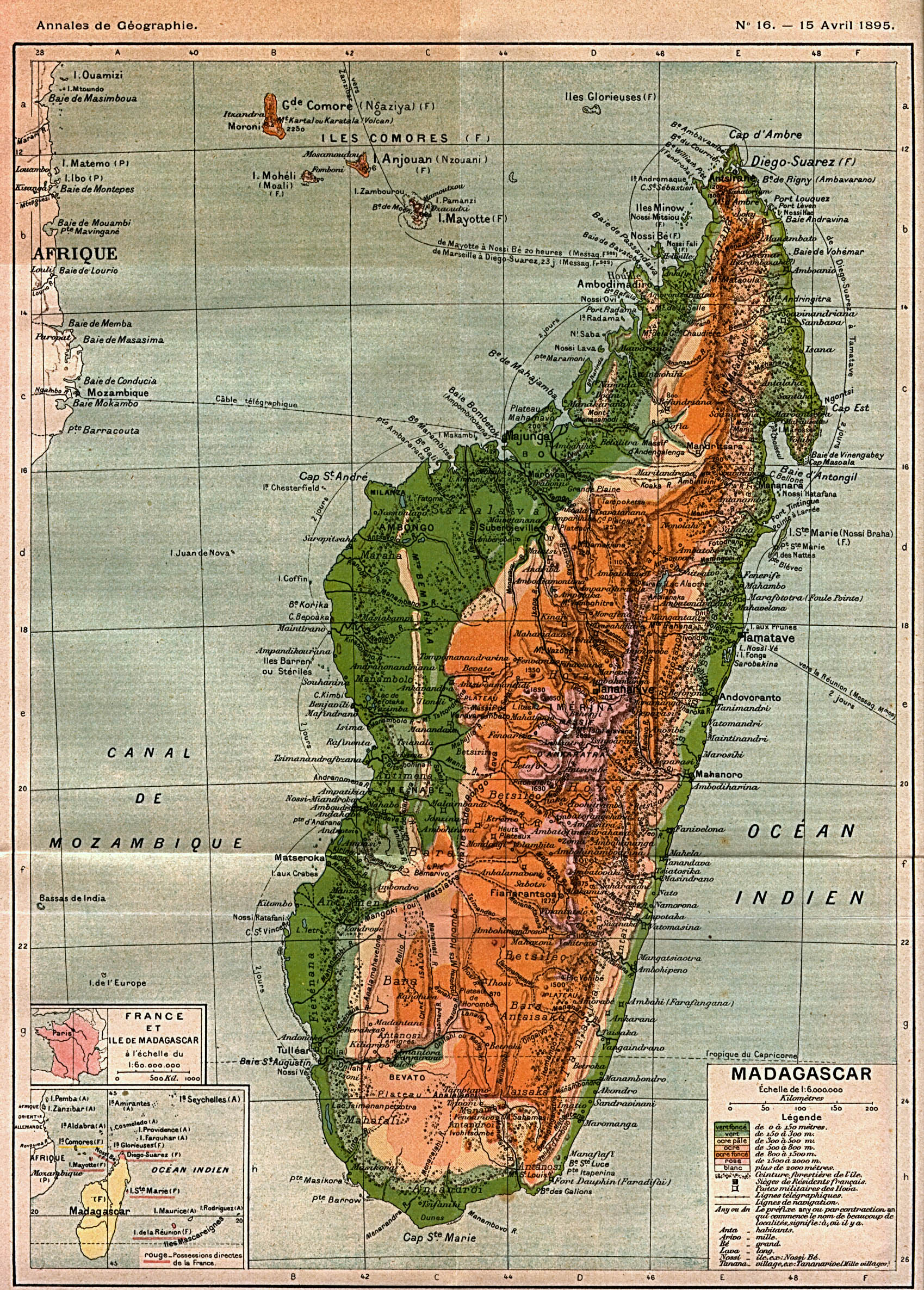
- Madagascar 1895 (1.1MB)
- "Madagascar" from Annales de Geographie Tome IV, Paris 1895.
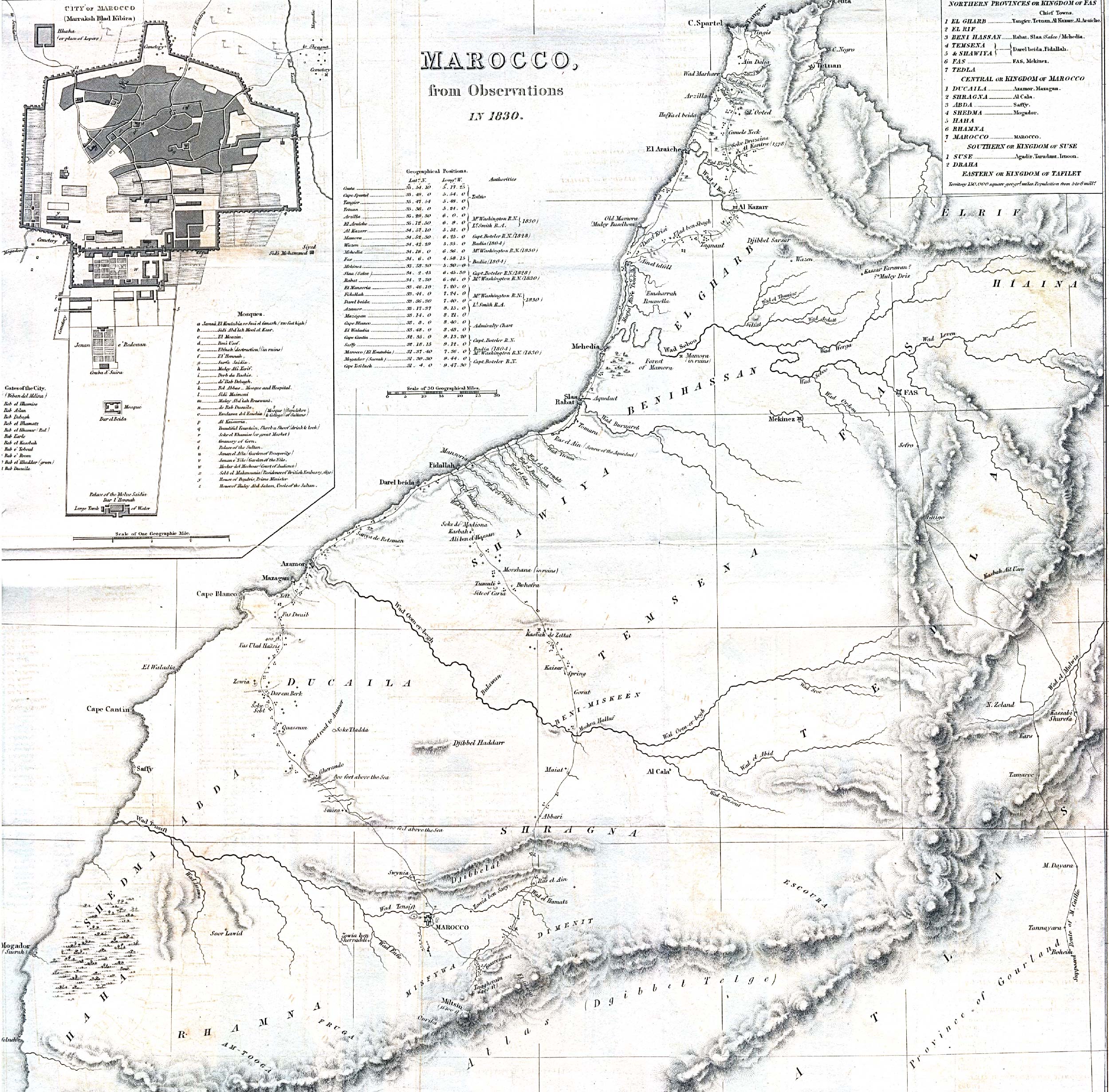
- Morocco 1830 (1.39MB)
- "Marocco from Observations In 1830" with inset map of "City of Marocco (Marraksh Blad Kibira)" [Marrakech] from the Journal of the Royal Geographical Society, Volume 1, 1832 to accompany "Geographical Notice of the Empire of Marocco. By Lieutenant Washington, R.N."
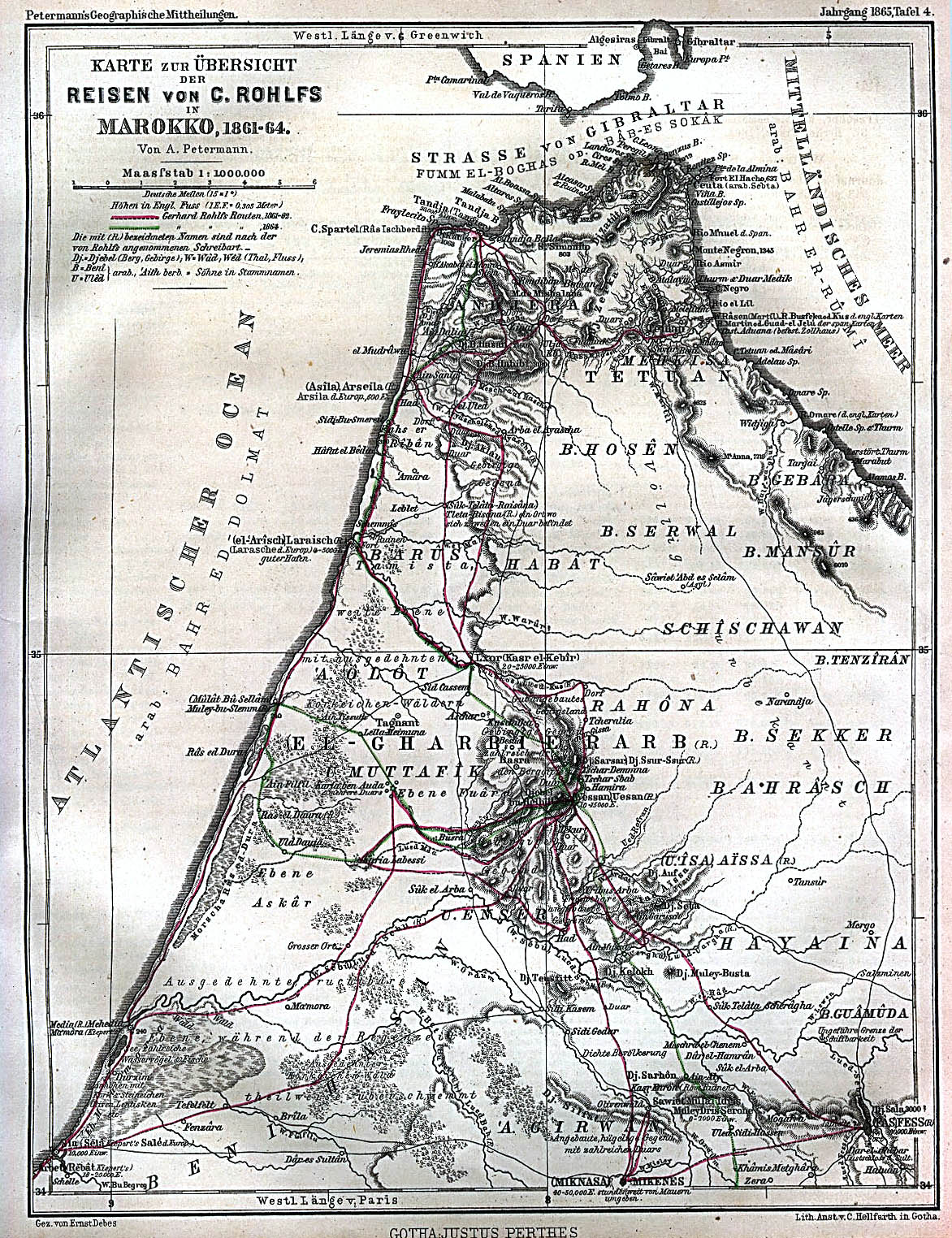
- Morocco 1861-1864 (636K)
- "Karte zur Übersicht der Reisen von C. Rolhfs in Marokko 1861-64" From Mittheilungen aus Justus Perthes' Geographischer Anstalt uber Wichtige Neue Erforschungen auf dem Gesammtgebiete der Geographie von Dr. A. Petermann. Tafel 4, 1865.
- Namibia [Homelands] 1978 (564K)
- U.S. Central Intelligence Agency
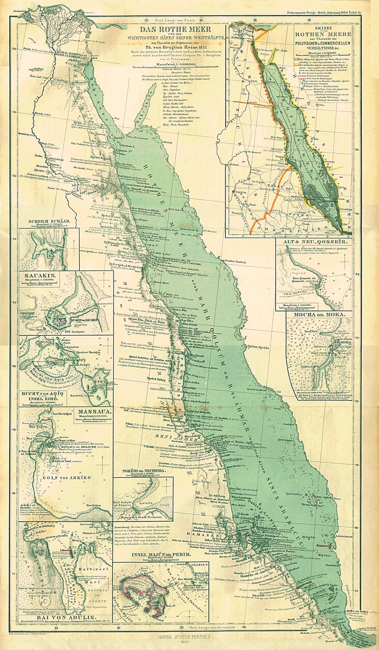
- Red Sea 1860 (1MB)
- "Das Rothe Meer und die Wichtigsten Hafen Seiner Westhalfte" [Includes plans of Rothen Meere Politischen u. Commerciellen, Scherm Schaab, Sauakin (Sudan), Bucht von Aqiq und Insel Eiro (Sudan), Massaua (Massawa, Eritrea), Bai von Adulis (Eritrea), Nokeri od. Nechesia, Insel Majun od. Perim, Alt und Neu Qosseir, Mocha od. Moka (Yemen)]. From Mittheilungen aus Justus Perthes' Geographischer Anstalt uber Wichtige Neue Erforschungen auf dem Gesammtgebiete der Geographie von Dr. A. Petermann. Volume 6, 1860.
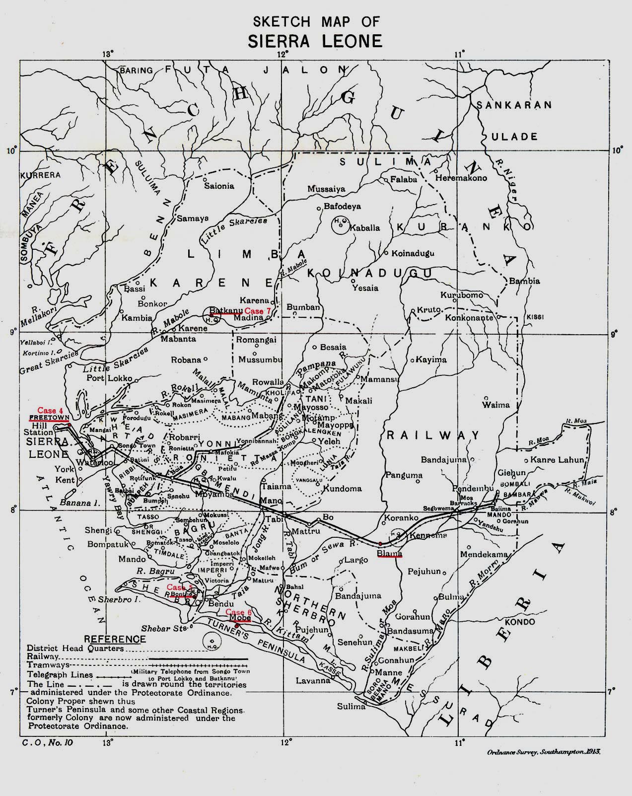
- Sierra Leone 1913 (516K)
- "Sketch Map of Sierra Leone" from Great Britain Parliament House of Commons Sessional Papers, Colonial Reports - Annual. No. 797, 1913.
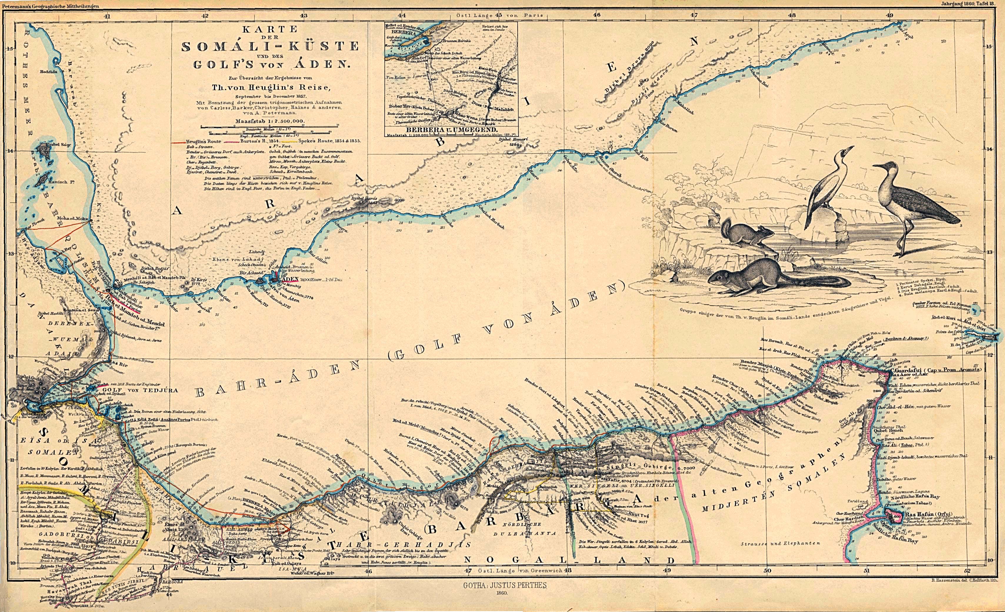
- Somali Coast and Aden Gulf 1860 (1MB)
- "Karte der Somali-Kuste und des Golf's von Aden" From Mittheilungen aus Justus Perthes' Geographischer Anstalt uber Wichtige Neue Erforschungen auf dem Gesammtgebiete der Geographie von Dr. A. Petermann. Volume 6, 1860.
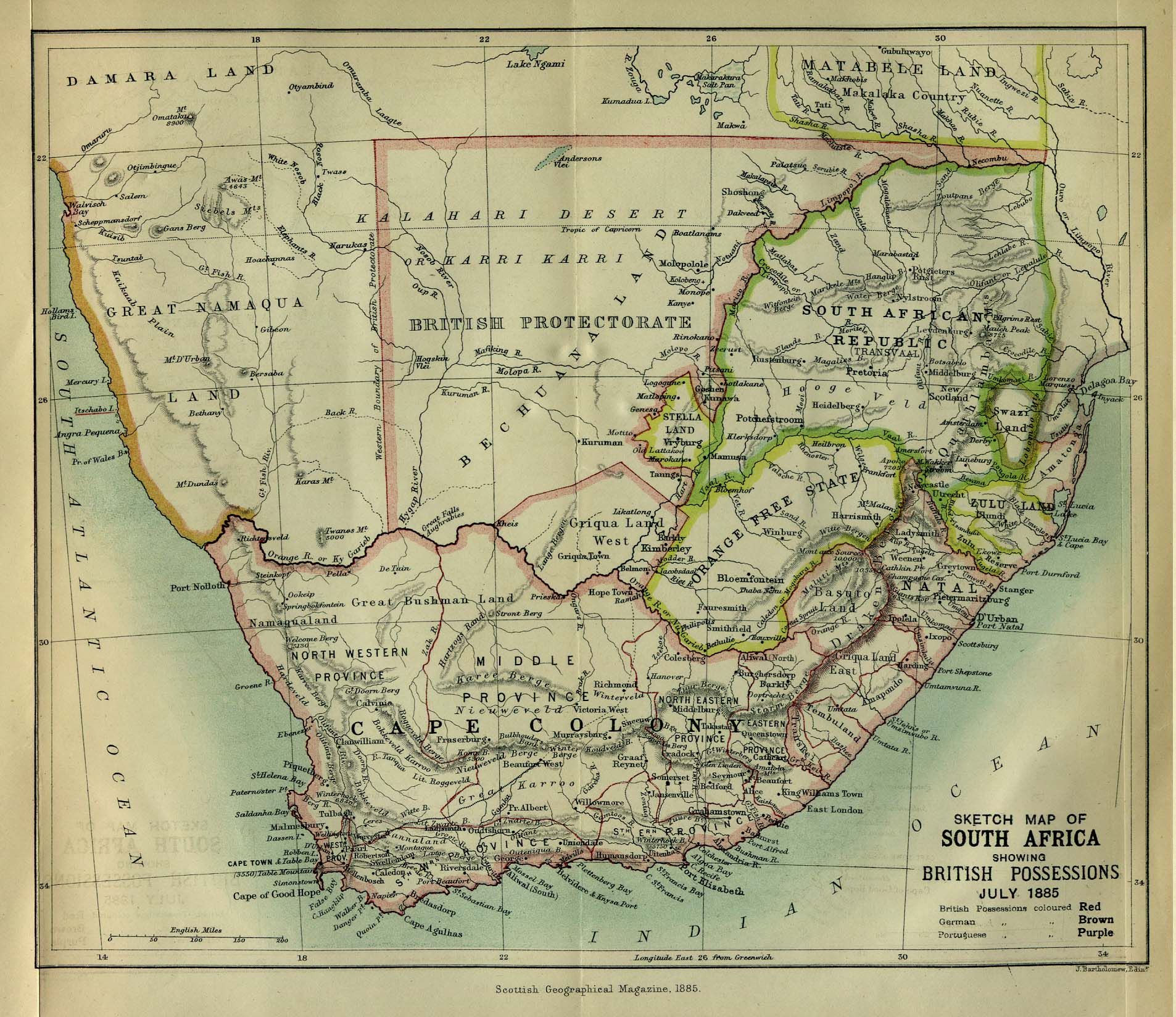
- South Africa 1885 (531K)
- "Sketch Map of South Africa showing British Possessions July 1885" from the Scottish Geographical Magazine. Published by the Scottish Geographical Society and edited by Hugh A. Webster and Arthur Silva White. Volume I, 1885.
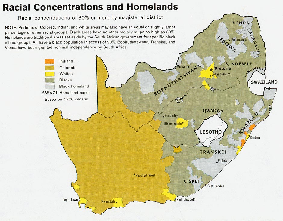
- South Africa - Racial Concentrations and Homelands 1979 (177K)
- U.S. Central Intelligence Agency, from Map No. 503971 1979
- South Africa: Black Homelands 1986 (225K)
- U.S. Central Intelligence Agency
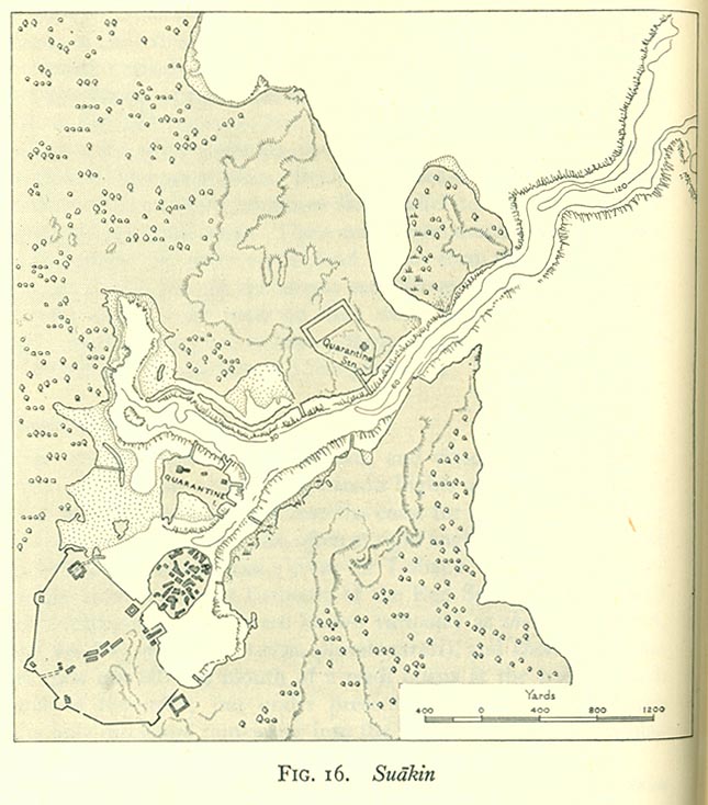
- Suakin 1946 (111K)
- From Western Arabia and The Red Sea, Geographical Handbook Series B.R. 527, [U.K.] Naval Intelligence Division, June 1946.
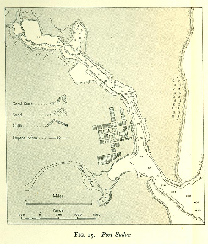
- Port Sudan 1946 (149K)
- From Western Arabia and The Red Sea, Geographical Handbook Series B.R. 527, [U.K.] Naval Intelligence Division, June 1946.
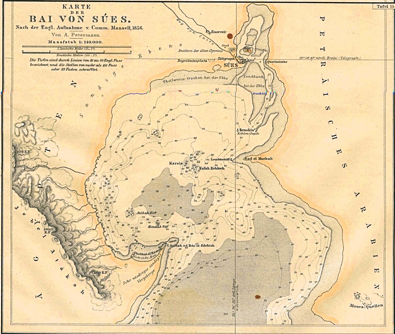
- Suez Bay, Egypt 1856 (351K)
- "Karte der Bai von Sues" From Mittheilungen aus Justus Perthes' Geographischer Anstalt uber Wichtige Neue Erforschungen auf dem Gesammtgebiete der Geographie von Dr. A. Petermann. Volume 7, 1861.
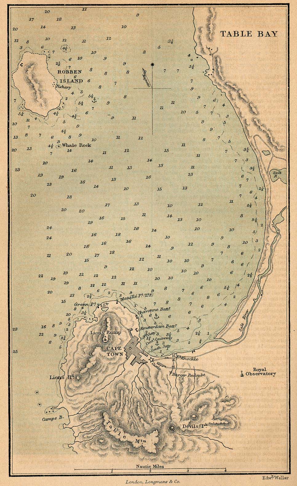
- Table Bay (267K)
- A Dictionary, Practical, Theoretical, and Historical of Commerce and Commercial Navigation, by J.R. M'Culloch. 1882
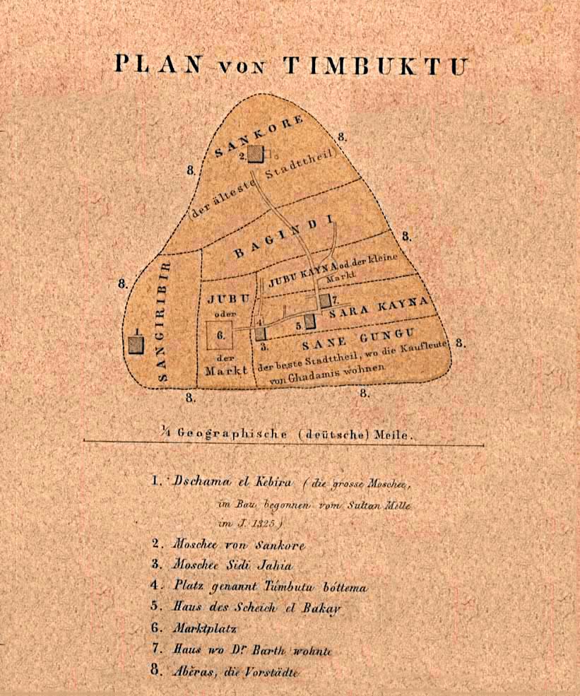
- Timbuktu 1855 (161K)
- "Plan von Timbuktu" [Tombouctou, Mali] From Mittheilungen aus Justus Perthes' Geographischer Anstalt uber Wichtige Neue Erforschungen auf dem Gesammtgebiete der Geographie von Dr. A. Petermann. Volume 1, 1855.
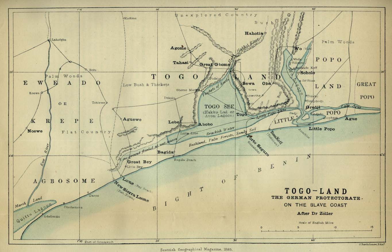
- Togo Land 1885 (126K)
- "Togo Land, the German Protectorate on the Slave Coast" from the Scottish Geographical Magazine. Published by the Scottish Geographical Society and edited by Hugh A. Webster and Arthur Silva White. Volume I, 1885.
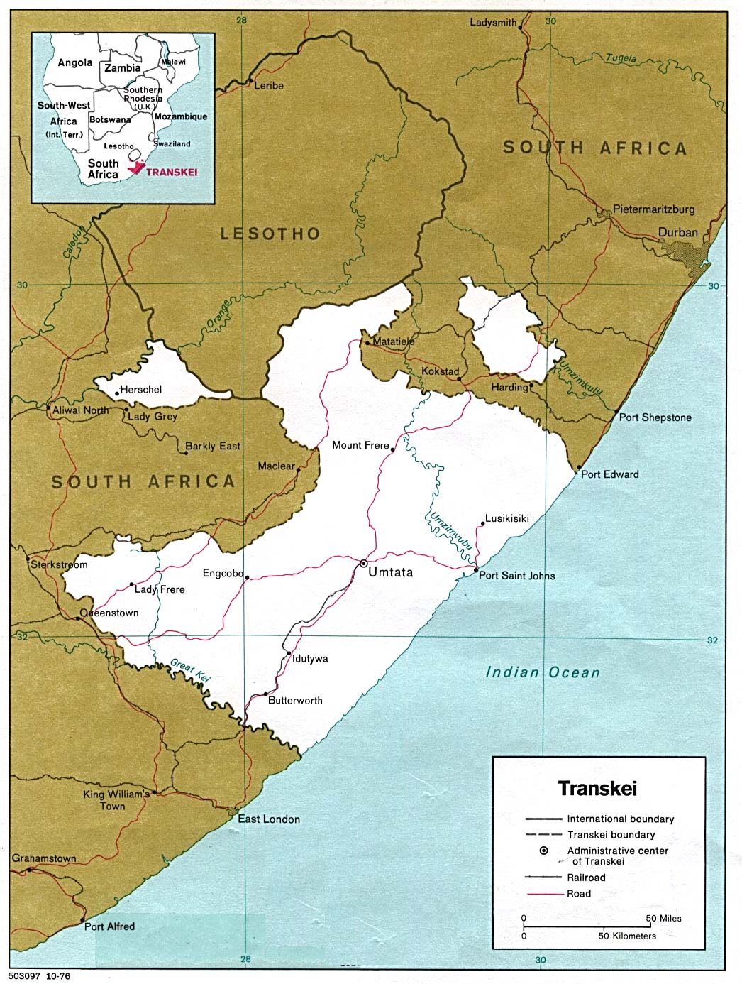
- Transkei 1978 (266K)
- U.S. Central Intelligence Agency
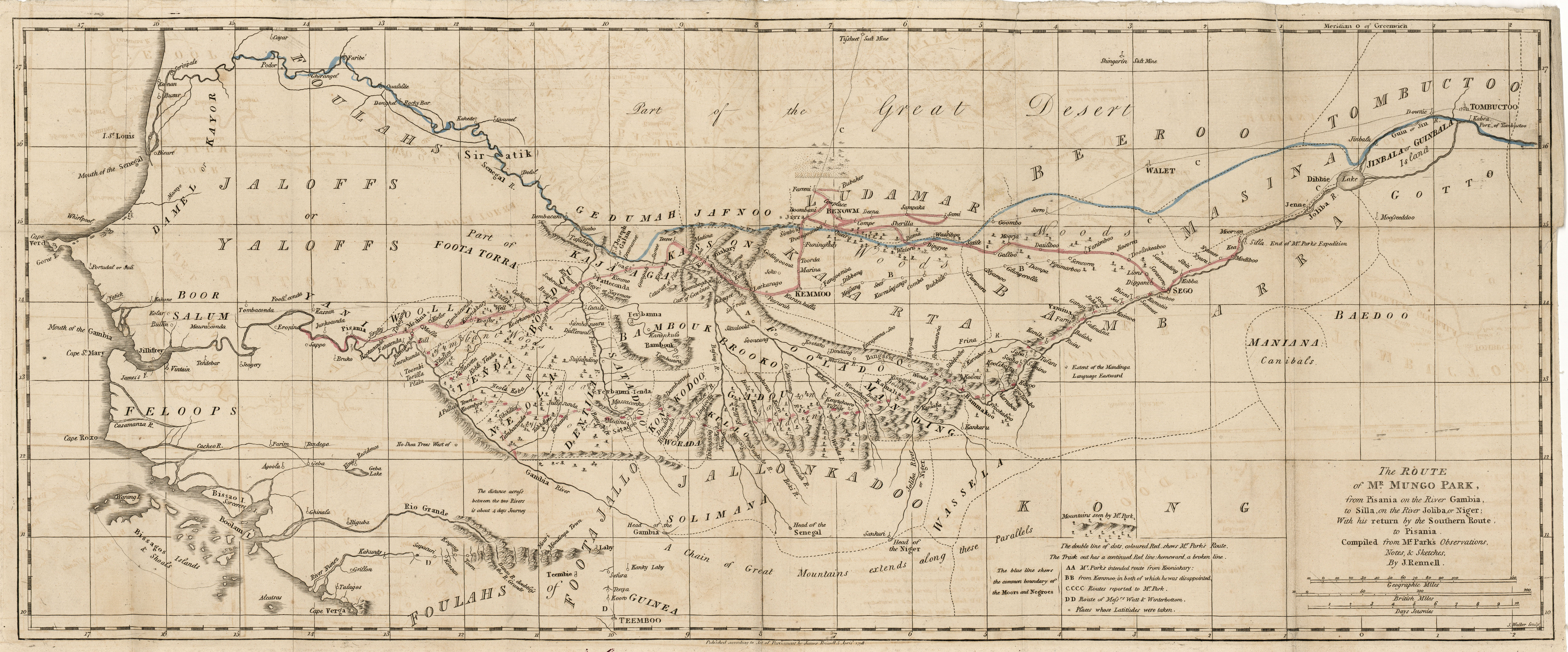
- West Africa 1810 (4.8MB)
- "Route of Mr. Mungo Park from Pisania on the River Gambia, to Silla, or the River Joliba, or Niger; With his return by the Southern Route to Pisania" from Travels in the Interior Districts of Africa by Mungo Park, sixth edition, W. Bulmer and Co. 1810.
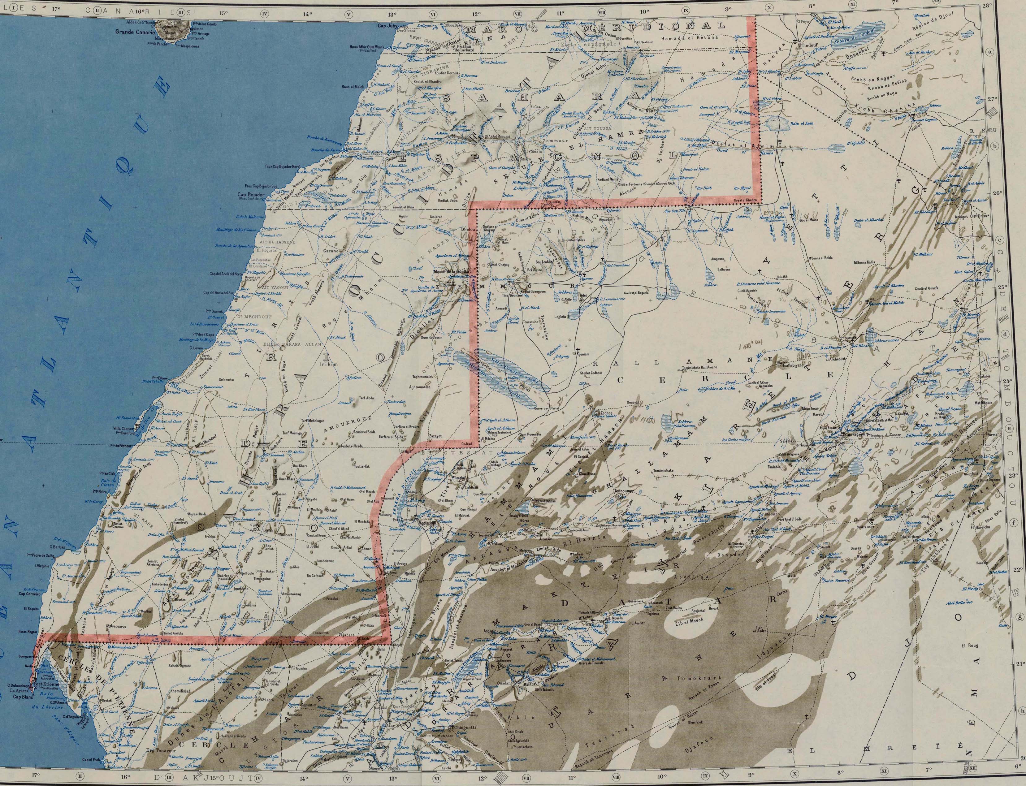
- Western Sahara and Northern Mauritania 1958 (1.1MB) and map key and scale (592K)
- Portion of Series 2201, Sheet NG 28-29/NF 28-29 "Mauritanie" Edition 3-IGNF, original scale 1:2,000,000. Published by U.S. Army Map Service, 1958. This map includes the territories of Sahara Espagnol and Rio de Oro.
![Bathurst [Banjul] Gambia 1941](bathurst_1941.jpg)
![Eritrea [Abyssinia and Sudan] 1896](http://maps.lib.utexas.edu/maps/historical/txu-oclc-70774585-eritrea-1896.jpg)
![Namibia [Homelands] 1978](/maps/africa/namibia_homelands_78.jpg)