Perry-Castañeda Library
Map Collection
Alaska Maps
State Maps
- Alaska (base map) JPEG format (478K) County boundaries and names, county seats, rivers. Original scale 1:2,500,000 U.S. Geological Survey, 1972 limited update 1990
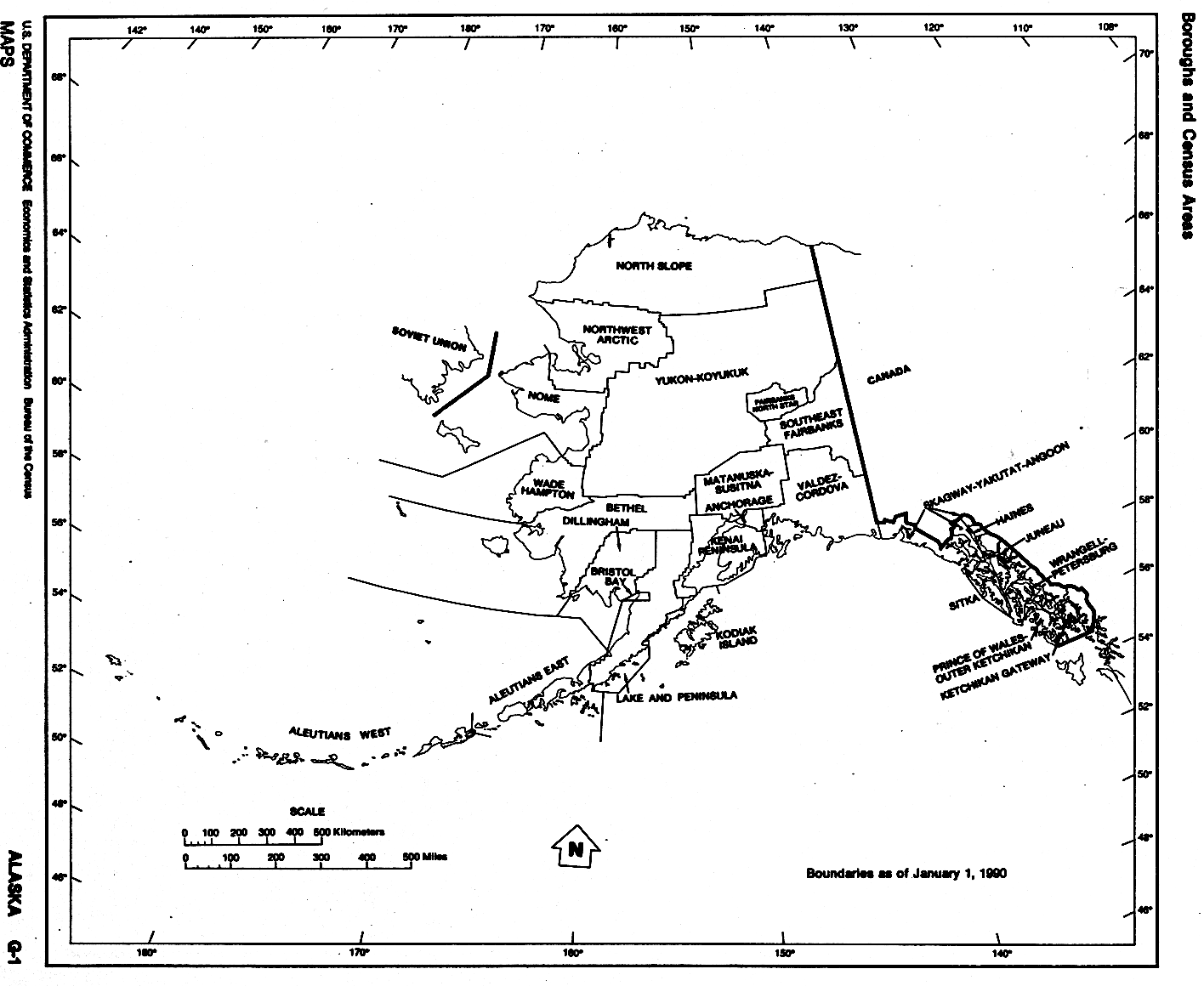
- Alaska (outline map) JPEG format (77K) County boundaries and names. U.S. Bureau of the Census, 1990
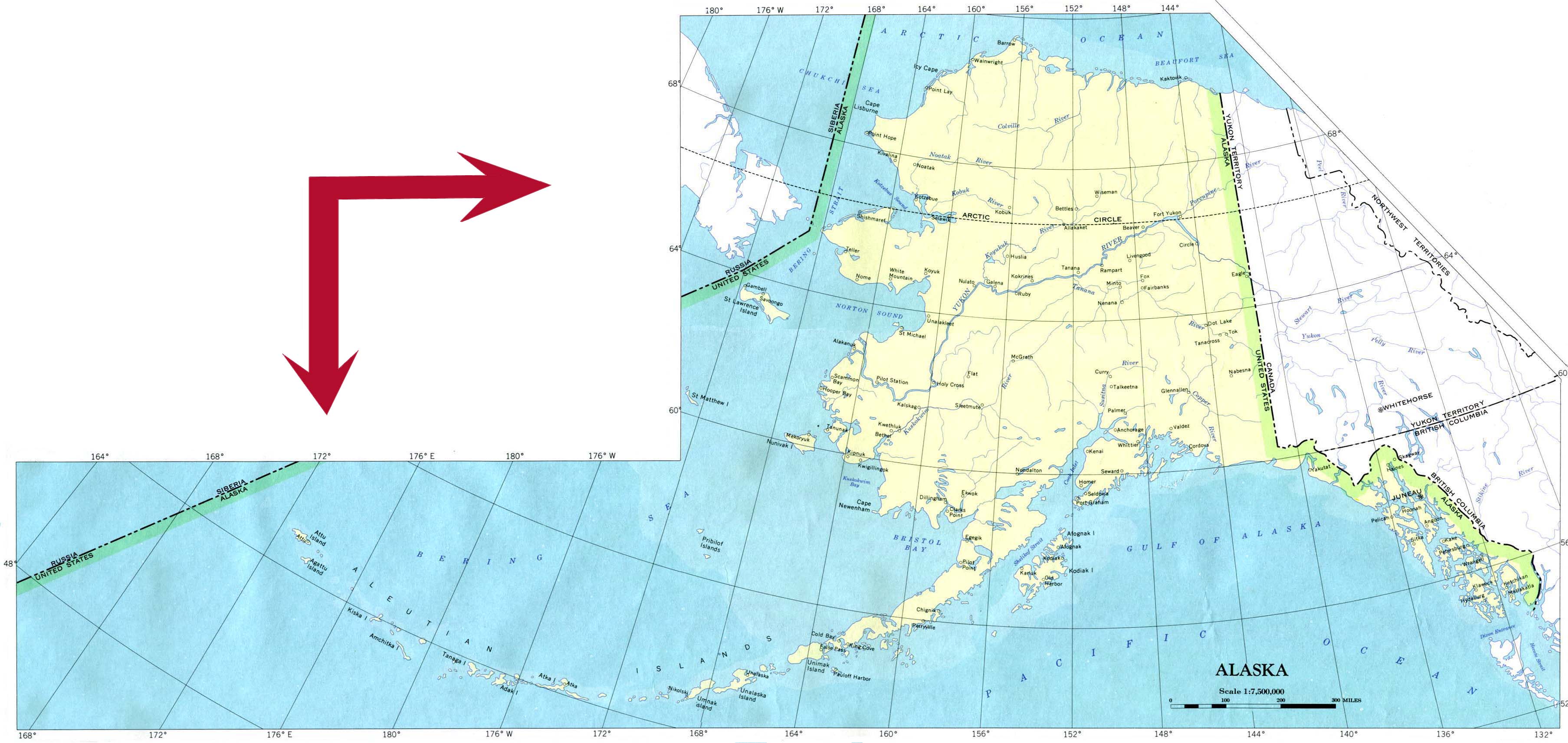
- Alaska (reference map) JPEG format (1.2MB) Shaded relief map with state boundaries, forest cover, place names, major highways. Portion of "The National Atlas of the United States of America. General Reference", compiled by U.S. Geological Survey 2001, printed 2002
- Alaska - Federal Lands and Indian Reservations PDF format (10MB) The National Atlas of the United States of America, U.S. Geological Survey, 2003
- Alaska - National Highway System PDF format (1.2 MB) U.S. Department of Transportation, Federal Highway Administration, 2005
City Maps
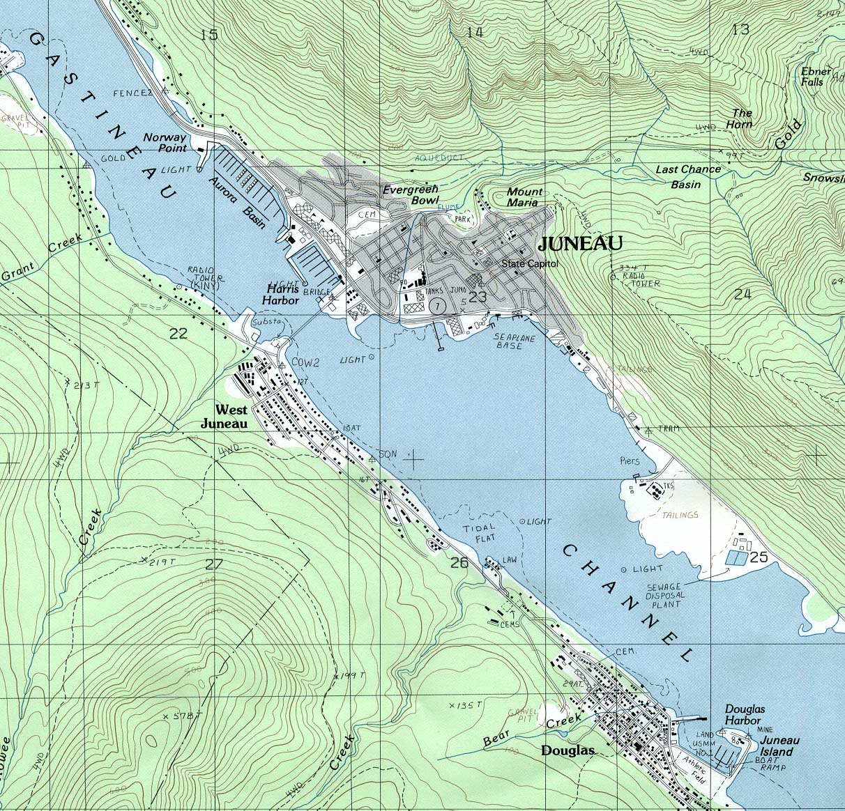
- Juneau (topographic) original scale 1:24,000 U.S.G.S. 1986 (468K)
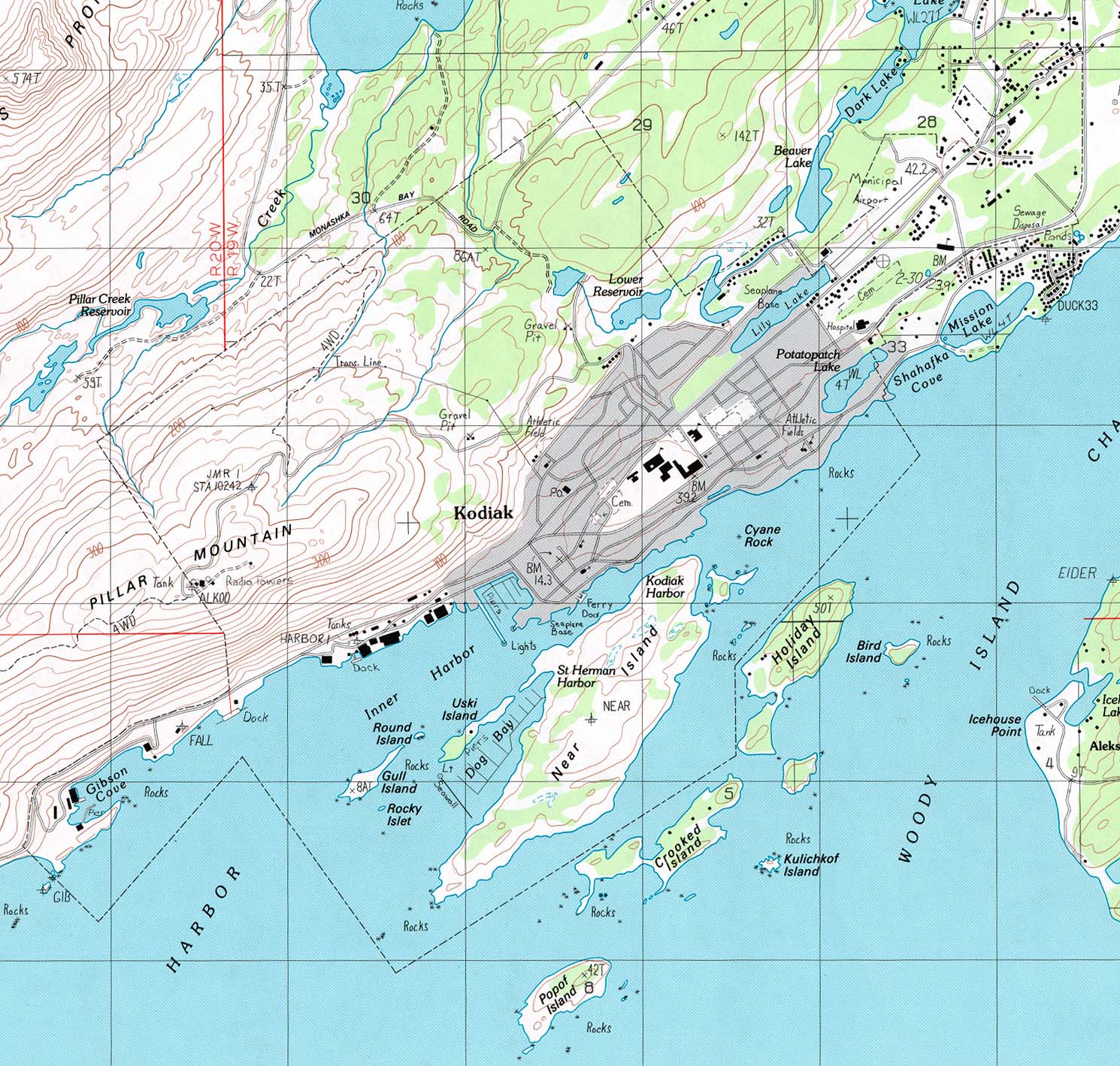
- Kodiak (topographic) original scale 1:25,000 U.S.G.S. 1988 (444K)
Topographic Maps
- Alaska Topographic Maps Scales 1:250,000 and 1:1,000,000. U.S. Geological Survey
- Alaska Historical Topographic Maps 1902-1938. U.S. Geological Survey
- Alaska Aeronautical Charts Operational Navigation Chart series, scale 1:1,000,000. U.S. Defense Mapping Agency Aerospace Center [Not for navigational use]
- Alaska Aeronautical Charts Tactical Pilotage Chart series, scale 1:500,000. U.S. Defense Mapping Agency Aerospace Center [Not for navigational use]
Historical Maps
- Alaska Historical Topographic Maps 1902-1938
- Alaska Territory 1915 (679K)
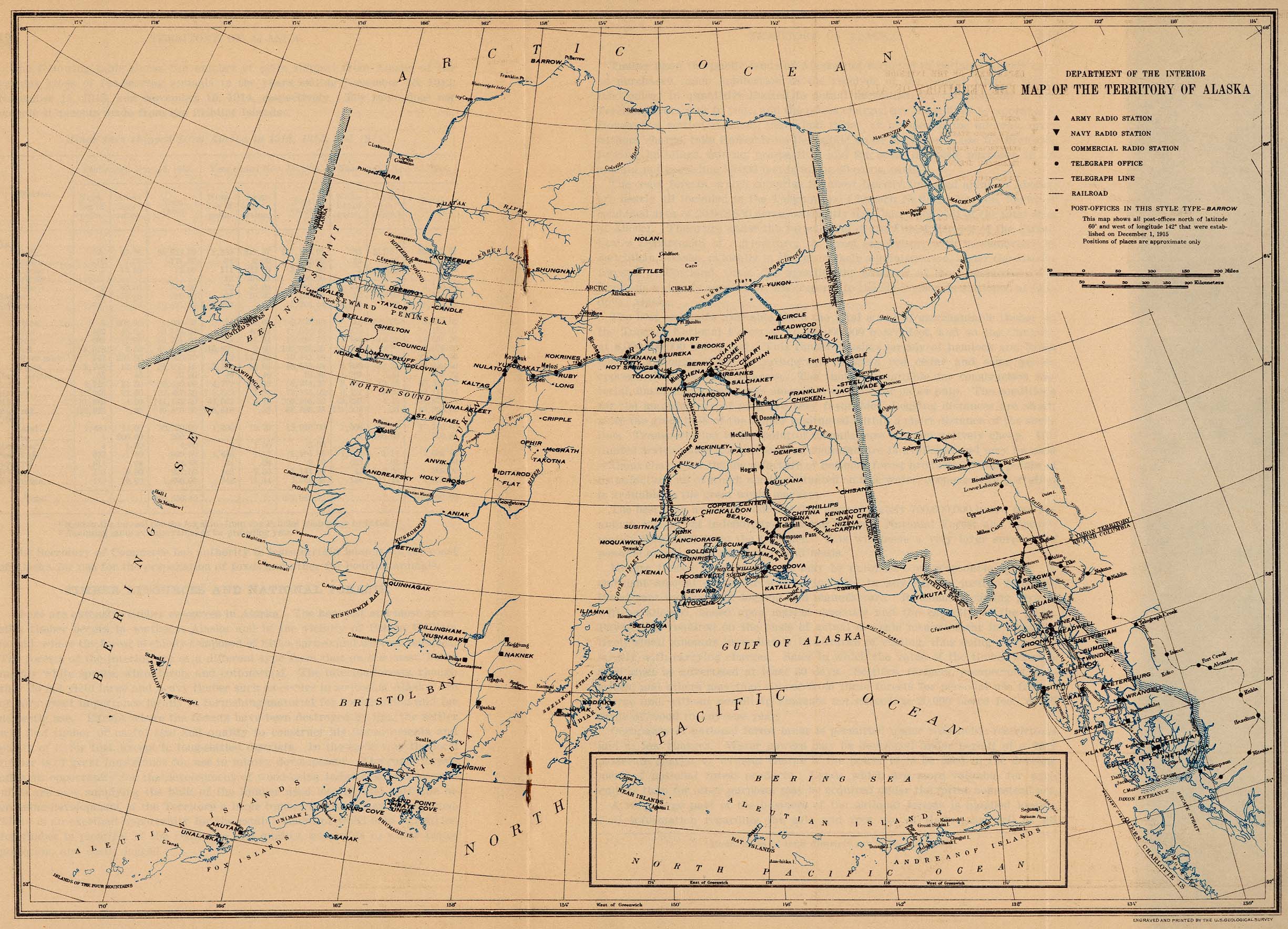
- "Map of the Territory of Alaska" From General Information Regarding the Territory of Alaska, Department of the Interior, Office of the Secretary. January 1916. The map shows locations of Army, Navy and commercial radio stations, telegraph offices and lines, railroads and post-offices.
- Alaska 1917 (1,806K)
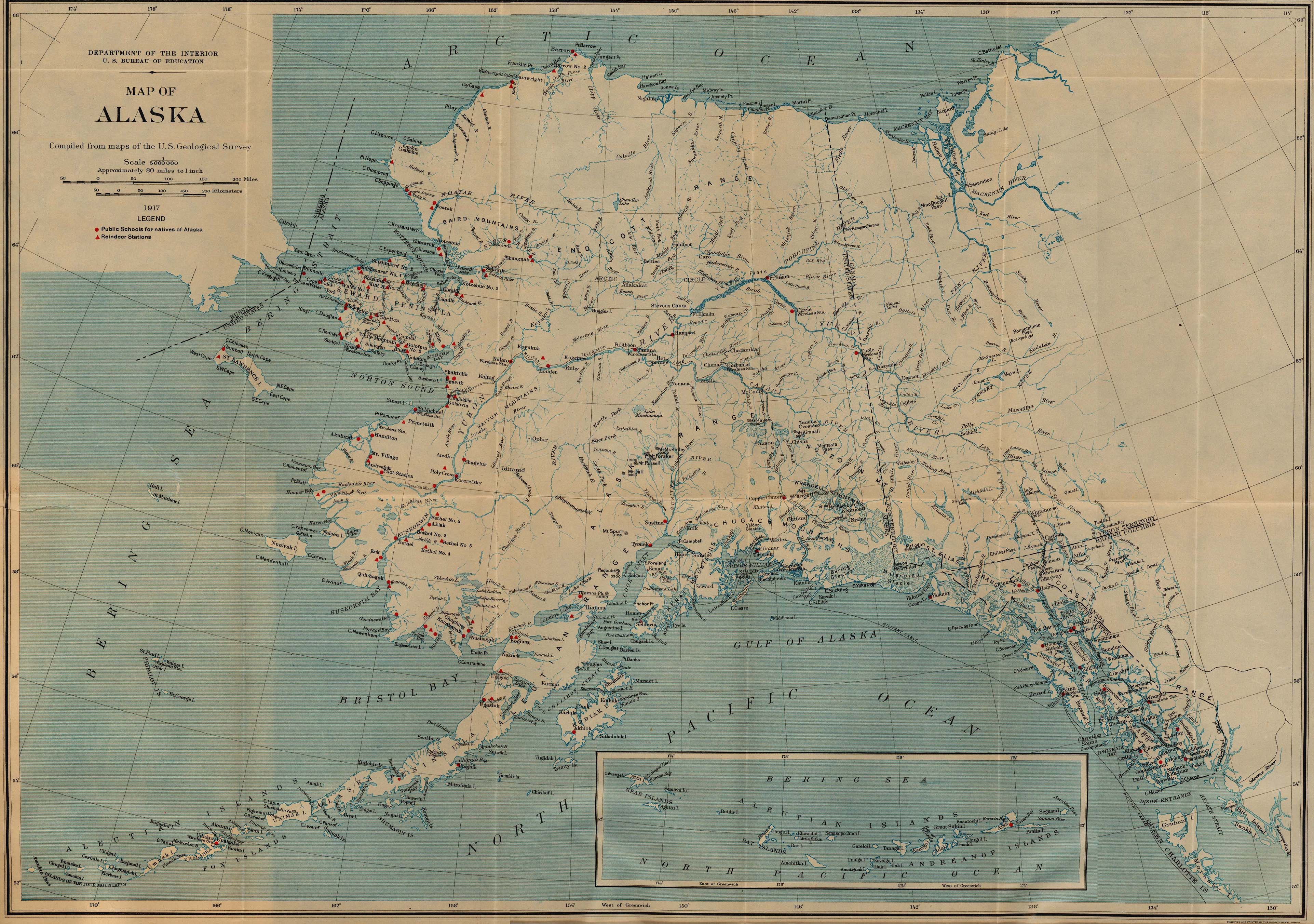
- "Map of Alaska" from Work of the Bureau of Education for the Natives of Alaska, 1916-17, Department of the Interior. U.S. Bureau of Education Bulletin, 1918, No. 5. The map shows locations of public schools for natives of Alaska and reindeer stations.
- "Map of the Territory of Alaska" From General Information Regarding the Territory of Alaska, Department of the Interior, Office of the Secretary. January 1916. The map shows locations of Army, Navy and commercial radio stations, telegraph offices and lines, railroads and post-offices.
Maps of National Parks, Monuments, and Historic Sites
The following maps were produced by the U.S. National Park Service unless otherwise noted.
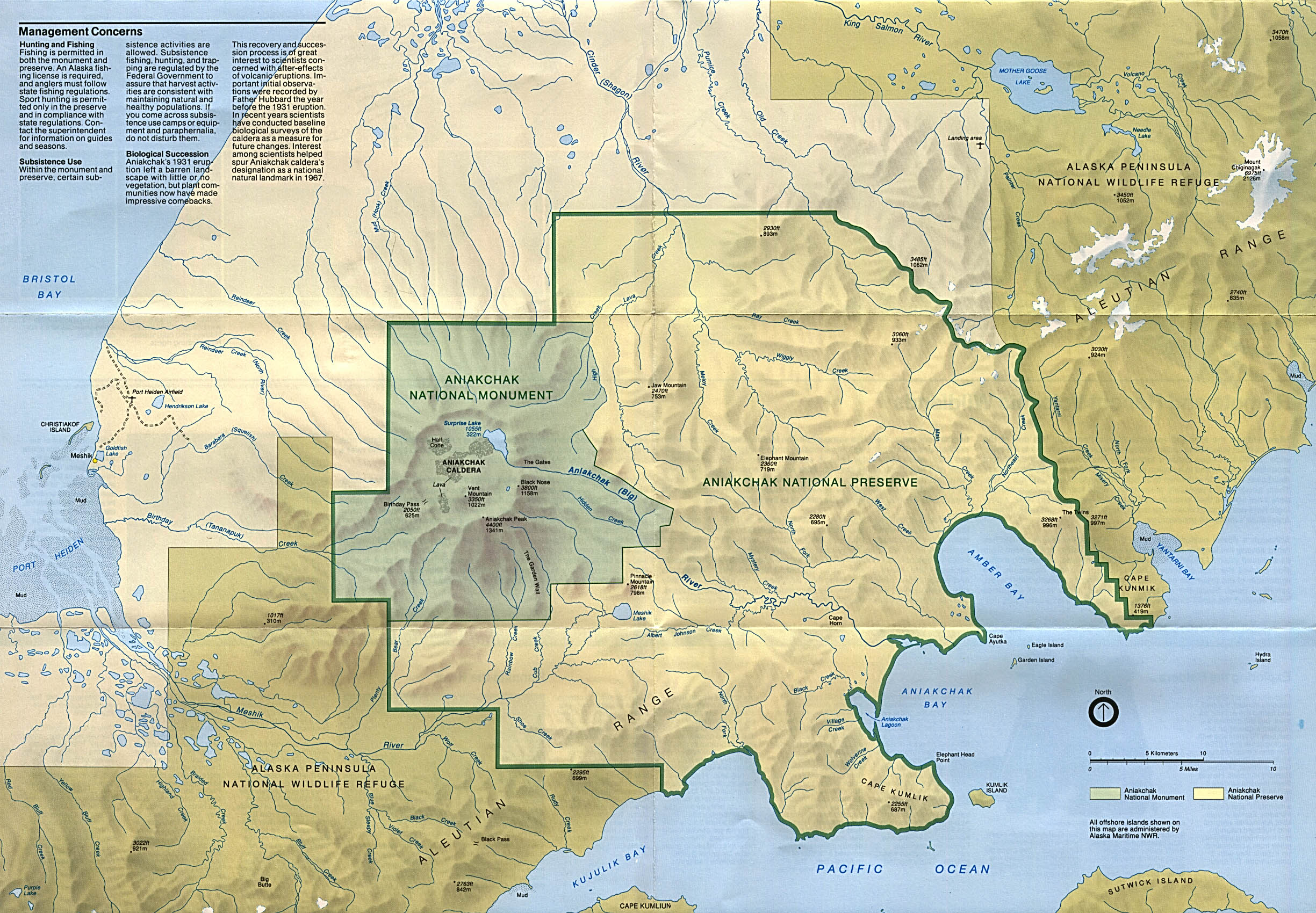
- Aniakchak National Monument and Preserve (Park Map) 1993 (901K)
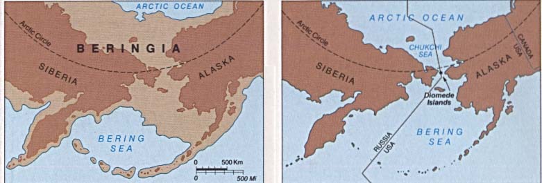
- Bering Land Bridge National Preserve (Park Map) 1995 (854K)
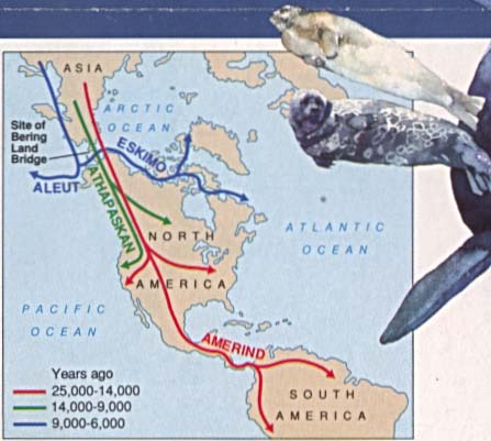
- Bering Land Bridge National Preserve (First Americans: Migration Routes Map) 1995 (31K)
- Bering Land Bridge National Preserve (Beringia: Historical Glaciation Map) 1995 (37K)
- Cape Krusenstern National Monument (Park Map) (1MB)
- Cape Krusenstern National Monument (Location Map) (26KB)
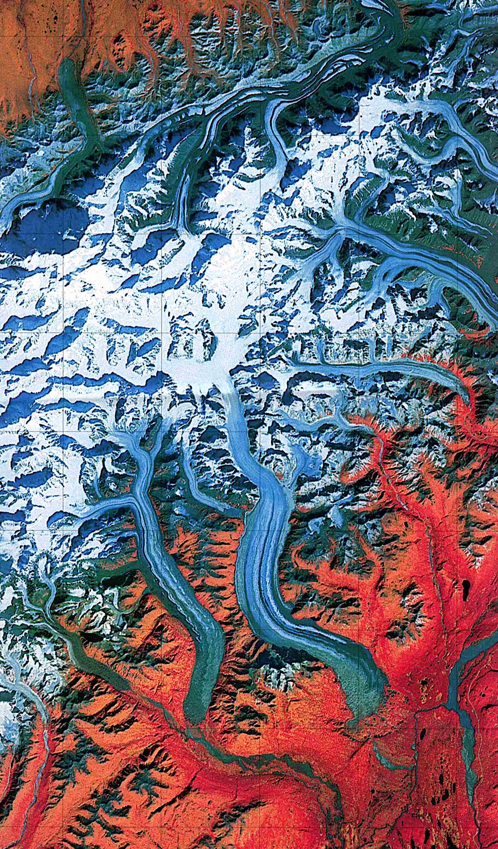
- Denali National Park and Preserve (Landsat Image) 1:250,000 U.S.G.S. 1984 (459K)
- Denali National Park and Preserve (Park Map) 1998 (839K) (PDF Format)
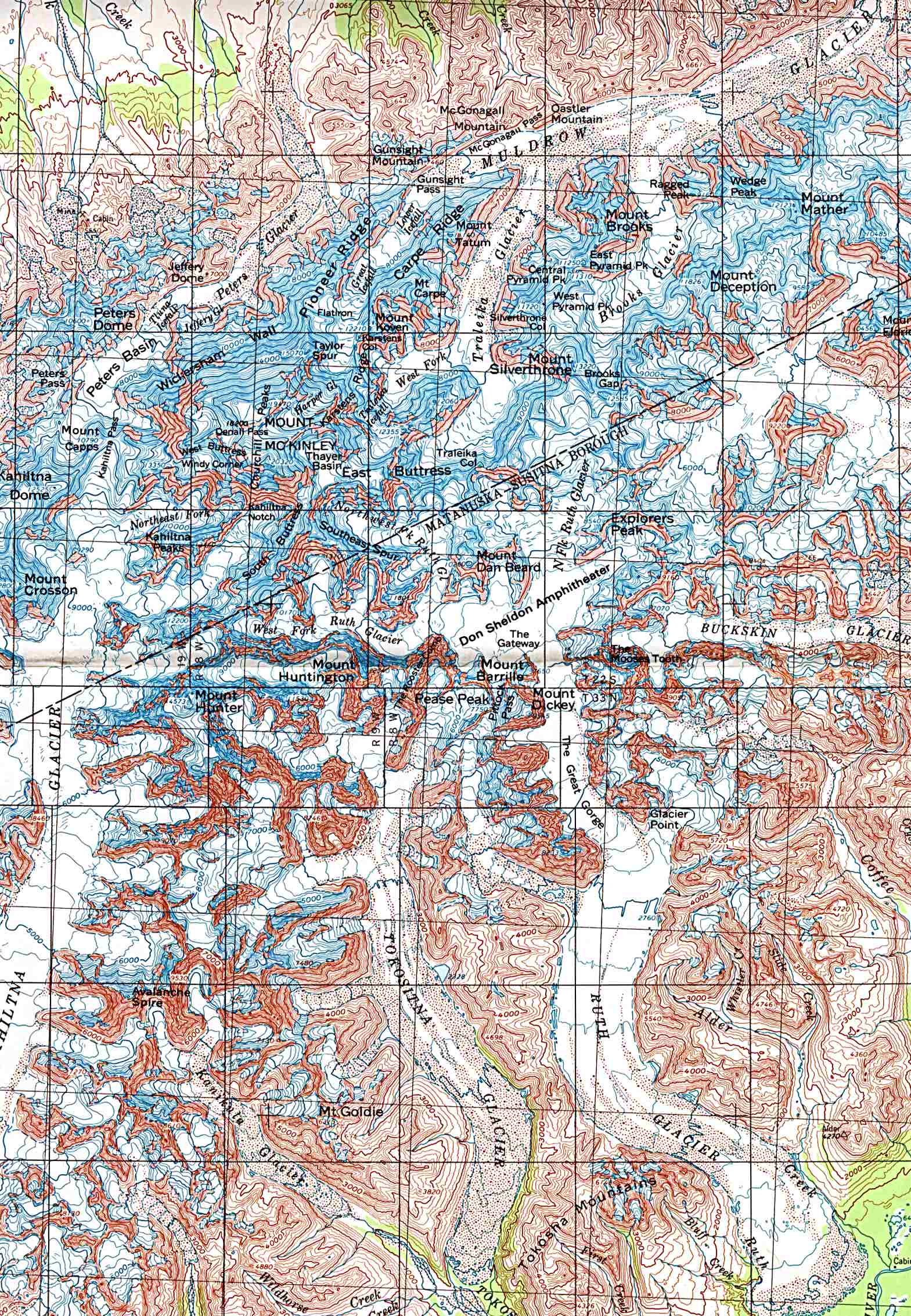
- Denali National Park and Preserve - Mount McKinley (Shaded Relief Map) 1:250,000 U.S.G.S. 1984 (612K)
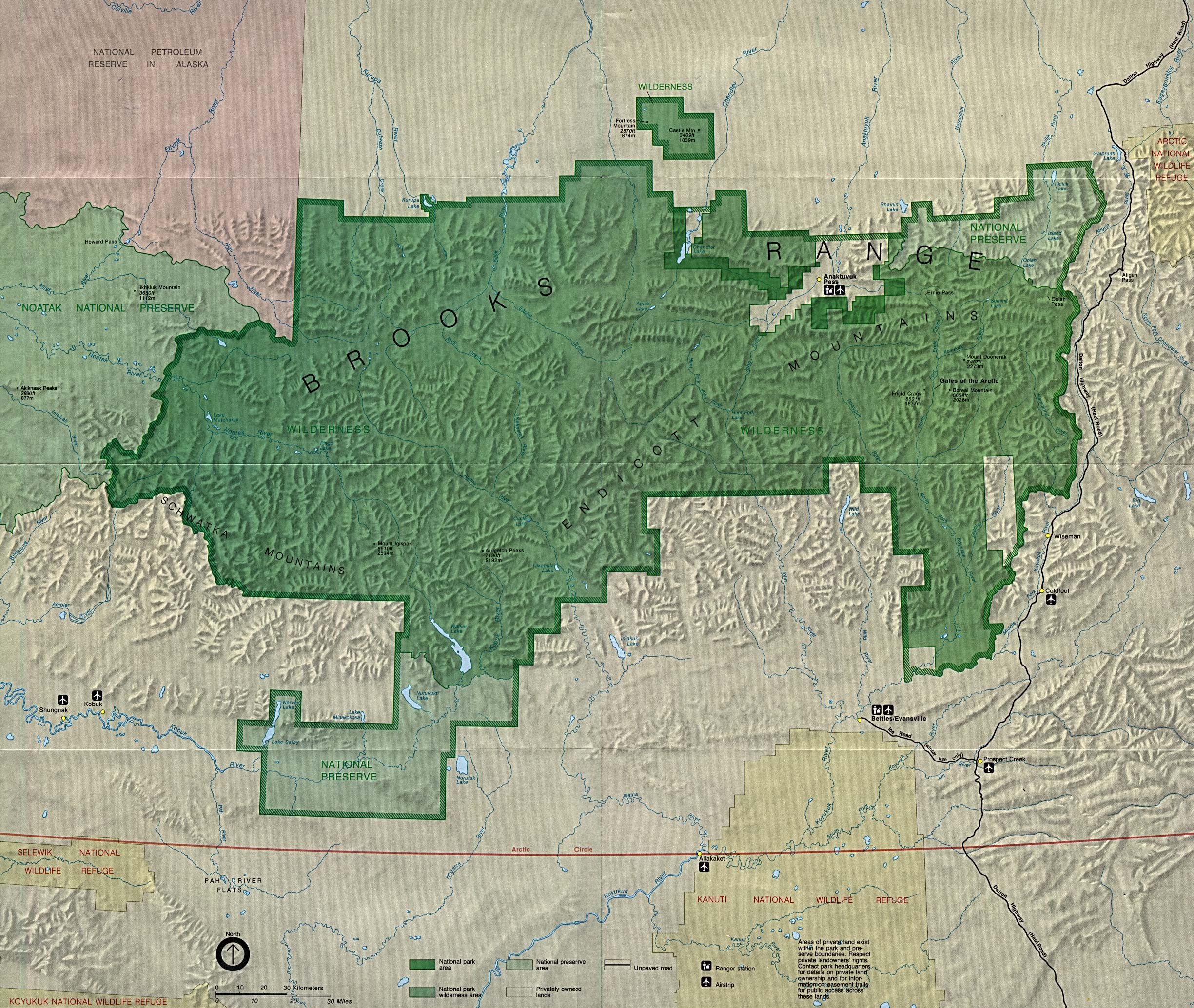
- Gates of the Arctic National Park and Preserve in Brooks Range (Park Map) (323K) (PDF Format)
- Gates of the Arctic National Park and Preserve in Brooks Range - Preserve Area (Detail Map) (1MB)
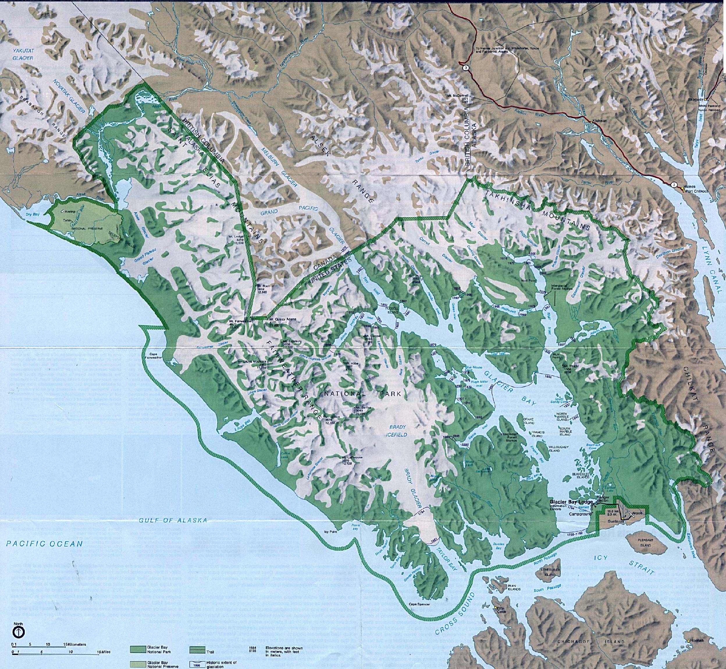
- Glacier Bay National Park (Park Map / Shaded Relief) 1994 (1.1MB)
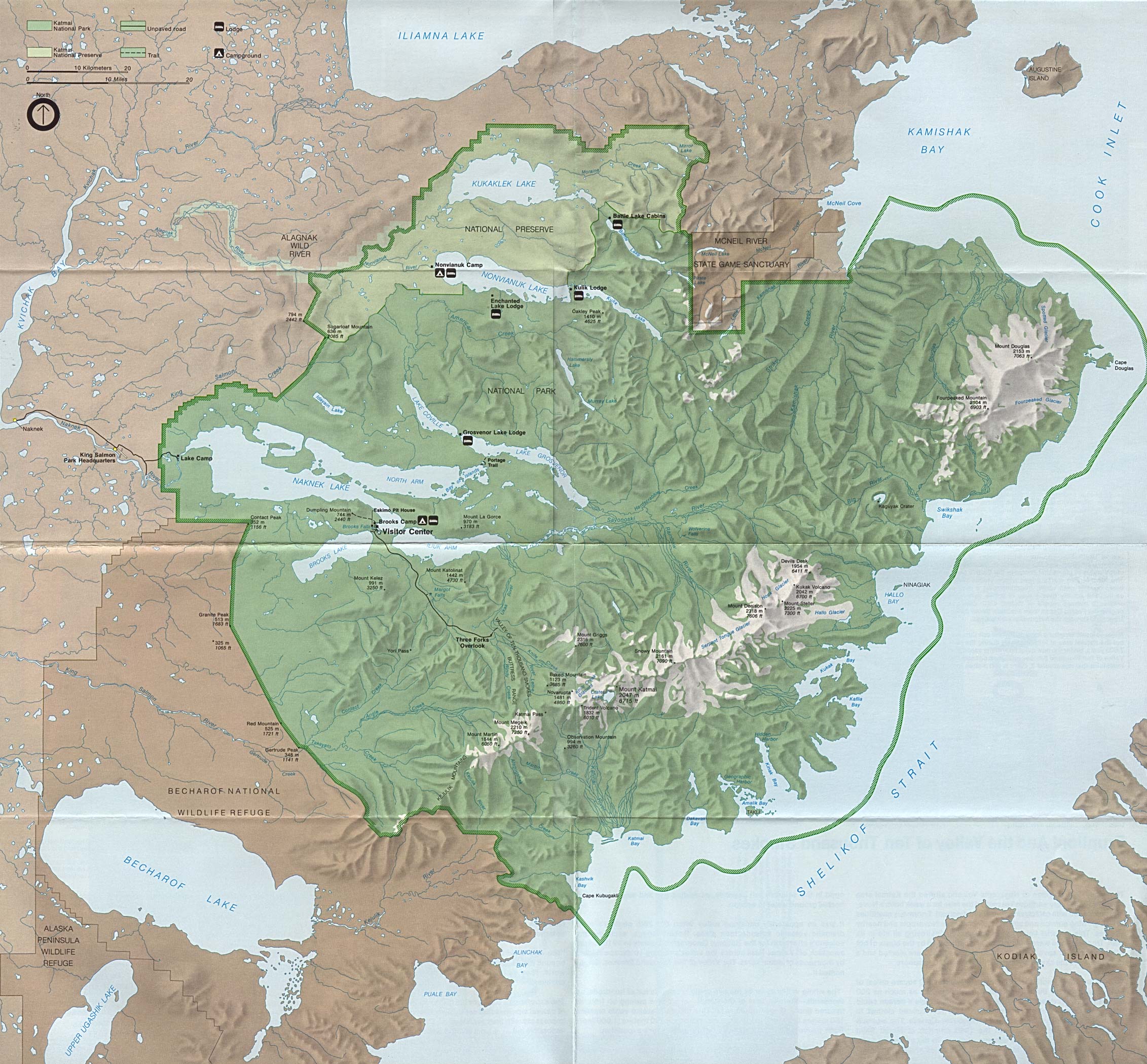
- Katmai National Park and Preserve (Park Map) 1994 (1.2MB)
- Katmai National Park and Preserve (Park Map) 1988 (748K)
- Kenai Fjords National Park (Glacier Map) 1999 (65K) (PDF Format)
- Kenai Fjords National Park (Park Map) 1999 (968K) (PDF Format)
- Klondike Gold Rush National Historical Park (Skagway Map) 1999 (65K) (PDF Format)
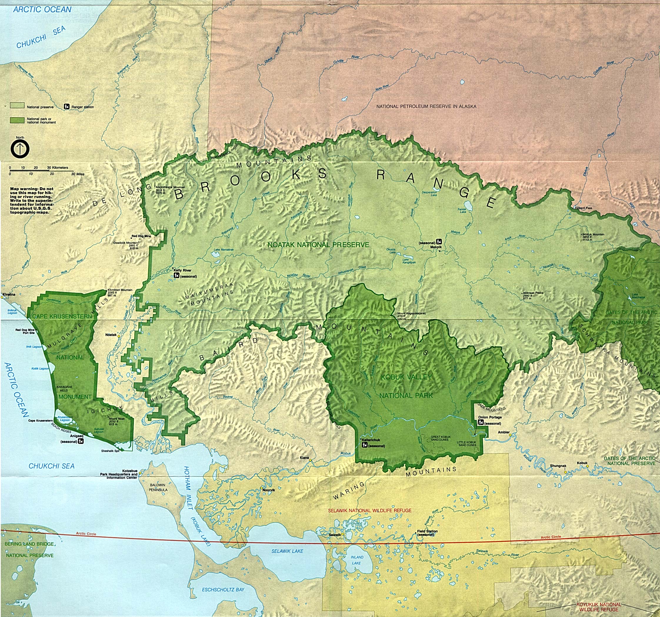
- Kobuk Valley National Park (Park Map) (1MB)
- Kobuk Valley National Park (Location Map) (26KB)
- Noatak National Preserve (Park Map) (1MB)
- Noatak National Preserve (Location Map) (26KB)
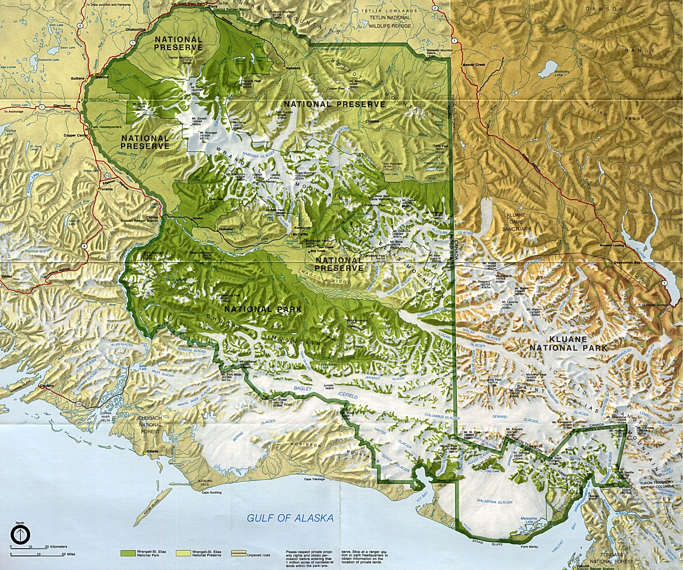
- Wrangell-St. Elias National Park and Preserve (Park Map) (1M)
- Yukon - Charley Rivers National Preserve (Park Map) 1998 (323K) (PDF Format)
Maps on Other Web Sites